Area Overview for NR2 2NQ
Photos of NR2 2NQ

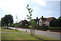
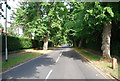
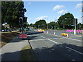
100 photos from this area
Area Information
Key information about the NR2 2NQ including its size, population, and administrative classification.
- Area Type
- Postcode
- Area Size
- 5.2 hectares
- Population
- 1545
- Population Density
- 3063 people/km²
House Prices in NR2 2NQ
30
Properties
£642,881
Average Sold Price
£136,500
Lowest Price
£1,500,000
Highest Price
Showing 30 properties
| Address | Type | Beds | Baths | Last Sale Price | Last Sale Date | |
|---|---|---|---|---|---|---|
| 6 Lime Tree Road, Norwich, NR2 2NQ | Detached | 6 | 4 | £1,500,000 | Mar 2023 | |
| 18 Lime Tree Road, Norwich, NR2 2NQ | house | - | - | £975,000 | May 2022 | |
| 29 Lime Tree Road, Norwich, NR2 2NQ | house | 6 | - | £695,000 | Sep 2015 | |
| 13A Lime Tree Road, Norwich, NR2 2NQ | Detached | - | - | £575,000 | Aug 2015 | |
| 17A Lime Tree Road, Norwich, NR2 2NQ | Terraced | - | - | £620,000 | May 2015 | |
| 26 Lime Tree Road, Norwich, NR2 2NQ | house | - | - | £685,000 | Apr 2014 | |
| 19 Lime Tree Road, Norwich, NR2 2NQ | Detached | 4 | 2 | £707,500 | Feb 2013 | |
| 24 Lime Tree Road, Norwich, NR2 2NQ | house | 4 | - | £535,000 | Jun 2011 | |
| 17 Lime Tree Road, Norwich, NR2 2NQ | house | 4 | - | £535,000 | Jan 2011 | |
| 9 Lime Tree Road, Norwich, NR2 2NQ | Detached | - | - | £475,000 | Mar 2009 |
Page 1 of 3
Energy Efficiency in NR2 2NQ
Amenities
Schools
| Rank | School | Type | Entry gender | Ages |
|---|
Explore more schools in this area
Go to Schools tabDemographics
Household Size
One person
most common
Accommodation Type
Houses
most common
Tenure
49
majority
Ethnic Group
White
most common
Religion
N/A
most common
Household Composition
N/A
most common
Age
47
median
Adults (30-64 years)
most common
Household Deprivation
N/A
with no deprivation
NS-SEC
43
in Lower managerial occupations
Explore more demographic insights in this area
Go to Demographics tabPlanning
Planning Constraints
- Flood RiskPremium
- Ramsar Wetland SitesPremium
- Area of Outstanding Natural BeautyPremium
- Protected Nature ReservePremium
- Protected WoodlandPremium