Area Overview for NR2 2DY
Photos of NR2 2DY

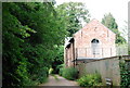
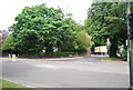
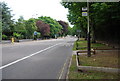
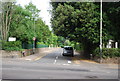
100 photos from this area
Area Information
Key information about the NR2 2DY including its size, population, and administrative classification.
- Area Type
- Postcode
- Area Size
- 5628 m²
- Population
- 1781
- Population Density
- 316434 people/km²
House Prices in NR2 2DY
30
Properties
£203,833
Average Sold Price
£35,000
Lowest Price
£374,000
Highest Price
Showing 30 properties
| Address | Type | Beds | Baths | Last Sale Price | Last Sale Date | |
|---|---|---|---|---|---|---|
| 95 Gloucester Street, Norwich, NR2 2DY | Terraced | 3 | 2 | £371,000 | Jun 2025 | |
| 87 Gloucester Street, Norwich, NR2 2DY | Terraced | 2 | 2 | £300,000 | Aug 2024 | |
| 81 Gloucester Street, Norwich, NR2 2DY | Terraced | 4 | 1 | £300,000 | Jun 2024 | |
| 83 Gloucester Street, Norwich, NR2 2DY | Terraced | 3 | 1 | £290,000 | Apr 2024 | |
| 74 Gloucester Street, Norwich, NR2 2DY | Terraced | 2 | 1 | £216,000 | Apr 2024 | |
| 78 Gloucester Street, Norwich, NR2 2DY | Flat | - | - | £118,000 | Apr 2021 | |
| 85 Gloucester Street, Norwich, NR2 2DY | Terraced | 3 | 1 | £202,500 | Nov 2020 | |
| 93 Gloucester Street, Norwich, NR2 2DY | Terraced | 3 | 1 | £230,000 | Aug 2018 | |
| 105 Gloucester Street, Norwich, NR2 2DY | Terraced | 3 | 2 | £301,000 | Dec 2017 | |
| 99 Gloucester Street, Norwich, NR2 2DY | Terraced | 2 | 1 | £235,000 | Mar 2017 |
Page 1 of 3
Energy Efficiency in NR2 2DY
Amenities
Schools
| Rank | School | Type | Entry gender | Ages |
|---|
Explore more schools in this area
Go to Schools tabDemographics
Household Size
One person
most common
Accommodation Type
Houses
most common
Tenure
46
majority
Ethnic Group
White
most common
Religion
N/A
most common
Household Composition
N/A
most common
Age
47
median
Adults (30-64 years)
most common
Household Deprivation
N/A
with no deprivation
NS-SEC
40
in Lower managerial occupations
Explore more demographic insights in this area
Go to Demographics tabPlanning
Planning Constraints
- Flood RiskPremium
- Ramsar Wetland SitesPremium
- Area of Outstanding Natural BeautyPremium
- Protected Nature ReservePremium
- Protected WoodlandPremium