Area Overview for NR19 2QE
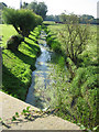
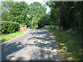
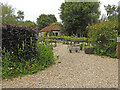
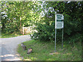
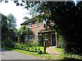
Photos of NR19 2QE
Area Information
NR19 2QE is a specific postcode area covering a small residential cluster of 6.1 hectares within Norfolk. This compact footprint supports a population of 1,711 people, creating a neighbourhood where residents recognise one another quickly. The setting is defined by its manageable scale, which offers a settled feeling without the noise of larger towns. You will find that daily life here revolves around close proximity to local services rather than extensive commutes or urban sprawl. The community feels established and stable, with a demographic profile that suggests a mature population prioritising long-term living. Because the area is small, amenities and transport links are within practical reach for most households. This density fosters a sense of community ownership over the local environment. When considering homes in NR19 2QE, you are entering a space designed for residents who value quiet streets and a predictable neighbourhood atmosphere. The layout supports a car-dependent lifestyle given the rural nature of the site, but the proximity to Dereham mitigates的距离 concerns for those who need regular access to a larger town centre.
- Area Type
- Postcode
- Area Size
- 6.1 hectares
- Population
- 1711
- Population Density
- 148 people/km²
The housing market in NR19 2QE is defined by a strong preference for traditional dwelling types. Accommodation consists primarily of houses, with very few, if any, purpose-built flats or apartments available within this specific postcode. This structural reality makes the area suitable for families requiring space and privacy rather than urban dwellers seeking compact living. With a home ownership rate of 74 per cent, the area is distinctly owner-occupied rather than a rental hub. This statistic signals that the local housing stock is invested in by those who intend to remain long-term. You will find that properties here are likely maintained to a standard expected by owners, not landlords. The small area size of 6.1 hectares further limits the volume of available homes, potentially making desirable plots competitive if you wish to buy. Buyers should approach the market with an eye toward the scarcity of selection relative to the total population of 1,711. Since most residents already own their homes, the turnover rate may be lower than in typical commuter towns. Consequently, opportunities to purchase arise less frequently, so you must act decisively when listings appear. The focus remains on substantial properties catering to the needs of the local adult population.
House Prices in NR19 2QE
Showing 7 properties
| Address | Type | Beds | Baths | Last Sale Price | Last Sale Date | |
|---|---|---|---|---|---|---|
| The Cottage, Old Bridge, Gressenhall, NR19 2QE | Semi-detached | 3 | 2 | £245,000 | May 2021 | |
| Solucki, Old Bridge, Gressenhall, NR19 2QE | house | - | - | £290,000 | Dec 2020 | |
| Herons Bridge, Old Bridge, Gressenhall, NR19 2QE | Bungalow | 2 | - | £228,000 | Sep 2009 | |
| Meadow View, Old Bridge, Gressenhall, NR19 2QE | house | - | - | - | - | |
| The Old Brigg, Old Bridge, Gressenhall, NR19 2QE | Semi-detached | - | - | - | - | |
| Workshop, Old Bridge, Gressenhall, NR19 2QE | Industrial | - | - | - | - | |
| Victoria Place, Old Bridge, Gressenhall, NR19 2QE | Bungalow | - | - | - | - |
Energy Efficiency in NR19 2QE
Your daily lifestyle in NR19 2QE is anchored by a selection of straightforward amenities within practical reach. Retail options include the East of England Co-operative Company, Co-op East, and Iceland East, providing essential provisioning for households. There are five such retail venues identified in the vicinity, ensuring you can purchase groceries and basic goods without travelling long distances. For those needing to visit a town centre, Dereham serves as the nearest metro and transport hub. It is the primary destination for broader shopping, leisure, and administrative services. While the area itself lacks extensive leisure facilities, parks, or diverse dining venues, the proximity to Dereham compensates for this modest local offering. You will manage your social and commercial life by combining local convenience with periodic trips to the town. The lifestyle is quiet and utilitarian rather than vibrant or leisure-focused. This suits those who prefer a home base for rest and routine, using larger towns for entertainment. The presence of these specific shops creates a functional community loop where daily necessities are handled efficiently. You do not need to drive far for essentials, preserving your time for family or leisure activities elsewhere.
Amenities
Schools
Families living in NR19 2QE have access to Scarning Voluntary Controlled Primary School, which serves as the main educational facility for the neighbourhood. The school holds an Ofsted rating of good, a status that reflects reliable educational standards and effective management. This primary option is the only school referenced for the immediate vicinity, meaning families with younger children rely heavily on this institution. There are no secondary schools listed in the immediate critical radius of NR19 2QE, suggesting that older students typically commute to a larger town. The presence of a Voluntary Controlled school indicates a partnership between the Church, the local parish council, and the local authority, often resulting in a deep-rooted commitment to the local community. When you consider schools near NR19 2QE, Scarning is the primary choice for pre-secondary education. The good rating provides assurance regarding the curriculum and learning environment. Parents in this area plan for school transport to accommodate the distance to secondary institutions not listed here. The reliance on a single primary school simplifies school choice for younger families, though it concentrates educational demand in one location.
| Rank | School | Type | Entry gender | Ages |
|---|
Explore more schools in this area
Go to Schools tabDemographics
The community in NR19 2QE reflects a settled demographic with a median age of 47 years. Most residents fall within the adult age range of 30 to 64 years, indicating a household structure focused on stability rather than transient living. Home ownership stands at 74 per cent, meaning three out of four residents own their property outright or with a mortgage. This high rate of ownership aligns with the area's status as a residential zone where accommodation is predominantly house-based rather than purpose-built flats. The predominant ethnic group in the area is White, which is consistent with the broader rural norms of rural Norfolk. You are buying into a community where families have likely settled for generations. This age distribution suggests a lower noise pollution and a slower pace of life compared to areas with younger populations. The lack of significant diversity in age or background does not diminish the quality of life; instead, it reinforces a cohesive social structure. Most neighbours will be peers in terms of life stage, often raising school-aged children or caring for older relatives. This demographic reality supports a stable local economy driven by house ownership and local employment rather than student influxes.
Household Size
Accommodation Type
Tenure
Ethnic Group
Religion
Household Composition
Age
Household Deprivation
NS-SEC
Explore more demographic insights in this area
Go to Demographics tabPlanning
Planning Constraints
- Flood RiskPremium
- Ramsar Wetland SitesPremium
- Area of Outstanding Natural BeautyPremium
- Protected Nature ReservePremium
- Protected WoodlandPremium