Area Overview for NR19 2JT
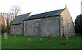
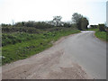
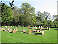
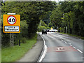
Photos of NR19 2JT


Area Information
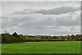
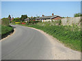
Living in NR19 2JT offers a secluded experience within a distinct residential cluster covering just 11.1 hectares. You will find 1,552 residents spread across this compact footprint, resulting in a population density of 44 people per square kilometre. This low density means streets are quiet and neighbours are likely known by sight but perhaps not by name. The postcode serves as a small, self-contained bubble rather than a bustling town centre or a sprawling suburb of a major city. Daily life here moves at a slower pace, defined by green spaces and the relative isolation of homes. While the area lacks the immediate noise and foot traffic of larger urban districts, its size ensures that setbacks from planning changes or large-scale developments are minimal. For those seeking a home away from the high-density pressure of coastal resorts or provincial capitals, NR19 2JT provides a singular focus on residential tranquility. The character of the neighbourhood is defined entirely by its housing stock and the people who call these modest plots their home. It is a place where space and privacy take precedence over urban convenience or nightlife.
- Area Type
- Postcode
- Area Size
- 11.1 hectares
- Population
- 1552
- Population Density
- 44 people/km²
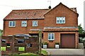
The housing market in NR19 2JT is characterised by a strong tendency toward ownership. With 71% of homes owner-occupied, the area functions primarily as a settlement for buyers rather than a hub for rental investment. Houses make up the bulk of the accommodation type, suggesting a stock comprised of family-style dwellings rather than high-density flats or converted commercial units. This profile means that if you are looking to buy, you are entering a market focused on individual households looking to secure a permanent home. The small size of the postcode, covering only 11.1 hectares, limits the total number of properties available compared to larger neighbourhoods. Consequently, competition for specific homes may be intense, yet the total stock remains manageable. The dominance of houses reflects the preferences of the 30-to-64-year-old demographic who dominate the local population. There is little evidence of student housing or build-to-rent schemes within this specific cluster. For buyers, this translates to a market where price reflects the value of a tangible asset rather than short-term yield expectations.
House Prices in NR19 2JT
Showing 12 properties
| Address | Type | Beds | Baths | Last Sale Price | Last Sale Date | |
|---|---|---|---|---|---|---|
| Mitre Lodge, Crown Lane, Little Fransham, Fransham, NR19 2JT | Detached | 5 | 3 | £587,500 | Sep 2022 | |
| 3 Crown Lane, Little Fransham, Fransham, NR19 2JT | Detached | 3 | - | £194,000 | Aug 2017 | |
| Lansdowne House, Crown Lane, Little Fransham, Fransham, NR19 2JT | Detached | 5 | 2 | £390,000 | Nov 2015 | |
| Maple House, Crown Lane, Little Fransham, Fransham, NR19 2JT | Detached | 3 | - | £326,000 | Jul 2015 | |
| Lyons Cottage, Crown Lane, Little Fransham, Fransham, NR19 2JT | Cottage | 3 | - | £264,000 | Feb 2014 | |
| 2 Crown Lane, Little Fransham, Fransham, NR19 2JT | Bungalow | 3 | 2 | £150,000 | Jul 2009 | |
| 4 Crown Lane, Little Fransham, Fransham, NR19 2JT | Detached | 4 | 2 | - | - | |
| 5 Crown Lane, Little Fransham, Fransham, NR19 2JT | Bungalow | 4 | 2 | - | - | |
| 1 Crown Lane, Little Fransham, Fransham, NR19 2JT | Bungalow | 3 | 2 | - | - | |
| Caravan, Lansdowne House, Crown Lane, Little Fransham, Fransham, NR19 2JT | Mobile Home | - | - | - | - |
Energy Efficiency in NR19 2JT
Residents of NR19 2JT enjoy immediate access to significant retail venues without leaving the county. The area is within practical reach of Asda Necton, where you can find groceries and general merchandise quickly. Nearby, the East of England Co-operative Co provides additional shopping options, offering a choice of two stores in close proximity. These supermarkets are the primary commercial anchors for the neighbourhood, supporting a lifestyle where daily necessities are handled efficiently. There are no independent cafes, bars, or specialty boutiques located directly within the 11.1-heighbourhood cluster itself. The metro station at Dereham serves as the nearest transport hub, linkining the residential area to wider rail networks. While the immediate surroundings of NR19 2JT are defined by housing and open space, the presence of major chains ensures that long commutes for shopping are avoided. This arrangement suits families who value the quiet of a residential street for their evenings but require proximate access to essential goods for their daily routine.
Amenities
Schools
| Rank | School | Type | Entry gender | Ages |
|---|
Explore more schools in this area
Go to Schools tabDemographics
The community in NR19 2JT is firmly anchored by established adults. Data shows that 71% of households are owner-occupied, indicating a neighbourhood where residents have likely put down roots and plan to stay long term. Houses constitute the predominant form of accommodation, aligning with a demographic profile where the most common age range is adults aged 30 to 64 years. The median age for the area sits at 47 years, suggesting a population composed largely of families in stable circumstances or retirees rather than young professionals or students. White residents form the predominant ethnic group, reflecting a relatively homogenous social fabric typical of many smaller, older English localities. This demographic mix creates a stable environment where values tend to align around domestic stability and family life. You will not find a transient population looking for short-term lets or a mix of generations sharing communal spaces in the way seen in student towns. The high ownership rate combined with the age profile indicates a settlement of mature homes owned by people who value quiet surroundings over rapid movement or trend-driven living.
Household Size
Accommodation Type
Tenure
Ethnic Group
Religion
Household Composition
Age
Household Deprivation
NS-SEC
Explore more demographic insights in this area
Go to Demographics tabPlanning
Planning Constraints
- Flood RiskPremium
- Ramsar Wetland SitesPremium
- Area of Outstanding Natural BeautyPremium
- Protected Nature ReservePremium
- Protected WoodlandPremium