Area Overview for NR19 2JL
Photos of NR19 2JL


Area Information
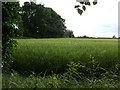
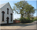
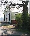
Living in NR19 2JL means residing within a specific residential cluster of 12.1 hectares in Norfolk. This postcode covers a population of 1552 people, creating a neighbourhood that feels quiet but is not entirely isolated. The area sits at very low density, with only 44 people per square kilometre. You will find yourself in a setting where space is plentiful and the residential nature is dominant. This small geographic footprint supports a community where neighbours are often within easy walking or driving distance. The location offers a peaceful retreat while remaining connected to wider surroundings. Your daily routine likely involves short trips to nearby towns for essential services. The area is defined by its exclusivity as a postcode rather than a large town or city district. You are part of a smaller population group where individual households have significant privacy. The environment is characterised by distinct separation from urban hubs, which suits those seeking a calmer domestic life. The scale of the land ensures that development pressure remains low compared to denser coastal towns. Prospective buyers should understand that this is a compact zone with a clear residential identity. The 12.1 hectare limit defines the physical boundaries of your community. You will access local paths and Green spaces directly from your street. The population concentration means you will experience a close-knit social environment without the congestion of larger urban centres. Daily life revolves around the immediate cluster and the nearby market towns like Dereham and Cromer that frame the broader locality.
- Area Type
- Postcode
- Area Size
- 12.1 hectares
- Population
- 1552
- Population Density
- 44 people/km²
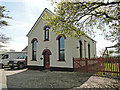
The property market in NR19 2JL is defined by a high concentration of privately owned households. With 71% home ownership, you will find that the majority of stock consists of families who have built equity over many years. This statistic indicates a robust local economy where residents prefer to stay put rather than move frequently. The accommodation type is exclusively houses, meaning you will not encounter converted bedsits or purpose-built flats on the planning horizon. Buyers looking at homes in this postcode should expect a traditional suburban environment dominated by detached or semi-detached structures. The scale of the area, at just 12.1 hectares, limits the total volume of properties available. This scarcity often drives up the value of individual properties within the cluster. The market operates on a steady, low-turnover basis rather than the speculative speed seen near university towns or new waterfront developments. The lack of rental properties is significant for your investment strategy. If you plan to let the property out, the pool of tenants is smaller than in a mixed-use village. Most of your neighbours are homeowners who occupy their own properties. This restricts the supply of rooms available for short-term lets or student hosting. The house-focused stock appeals to buyers seeking garden space and grounds rather than convenience stores on the doorstep. You are buying into a legacy market where values are supported by long-term owner retention.
House Prices in NR19 2JL
Showing 15 properties
| Address | Type | Beds | Baths | Last Sale Price | Last Sale Date | |
|---|---|---|---|---|---|---|
| 19 Lime Tree Crescent, Little Fransham, Fransham, NR19 2JL | Detached | 4 | 1 | £345,000 | Jul 2025 | |
| 3 Lime Tree Crescent, Little Fransham, Fransham, NR19 2JL | Bungalow | 2 | 1 | £259,950 | Sep 2022 | |
| 15 Lime Tree Crescent, Little Fransham, Fransham, NR19 2JL | Detached | 4 | 1 | £280,000 | Jan 2017 | |
| 1 Lime Tree Crescent, Little Fransham, Fransham, NR19 2JL | Bungalow | 3 | - | £165,000 | Nov 2014 | |
| 5 Lime Tree Crescent, Little Fransham, Fransham, NR19 2JL | Detached | - | - | £168,500 | Jul 2007 | |
| 13 Lime Tree Crescent, Little Fransham, Fransham, NR19 2JL | Detached | - | - | £148,500 | Apr 2003 | |
| 9 Lime Tree Crescent, Little Fransham, Fransham, NR19 2JL | Detached | - | - | £132,000 | Mar 2003 | |
| 7 Lime Tree Crescent, Little Fransham, Fransham, NR19 2JL | Detached | - | - | £128,000 | Feb 2003 | |
| 11 Lime Tree Crescent, Little Fransham, Fransham, NR19 2JL | Detached | - | - | £148,000 | Feb 2003 | |
| 17 Lime Tree Crescent, Little Fransham, Fransham, NR19 2JL | Detached | - | - | £65,000 | Sep 1997 |
Energy Efficiency in NR19 2JL
Living in NR19 2JL grants you access to practical retail amenities within a short drive. There are 5 notable retail venues in your immediate reach, ensuring you do not need to travel far for daily essentials. You can visit Asda Necton for supermarket stock, or travel to Waitrose in Swaffham for higher-end provisions. The proximity to Tesco in Swaffham ensures competitive pricing and convenience for shopping trips. These three major chains form the backbone of the local retail landscape without requiring leave the county. Leisure and dining options extend slightly further to the nearest metro station at Dereham. Your weekend activities often revolve around the high street there or nearby coastal towns. The specific venues like Waitrose attract regular customers from the 1552 residents in the postcode. The concentration of supermarkets suggests a household-focused economy where car usage is common for shopping. You will find a variety of product ranges from budget superstores to quality grocers available nearby. Parks and open spaces are integrated into the 12.1 hectare landscape of the area itself. The residential cluster likely contains local green areas perfect for morning walks with dogs. The absence of heavy industry or commercial zones nearby means these spaces remain peaceful and unused. Your lifestyle balances the quiet of the neighbourhood with the utility of the nearby high streets. The distance to larger towns like Cromer adds a day-trip element to your leisure planning.
Amenities
Schools
| Rank | School | Type | Entry gender | Ages |
|---|
Explore more schools in this area
Go to Schools tabDemographics
The community in NR19 2JL is distinctly mature, with a median age of 47 years. The vast majority of residents fall into the adult age range between 30 and 64 years old. This profile suggests a stable neighbourhood where families with older children or down-sized retirees are the norm rather than first-time young buyers. You will find a population that values stability and long-term settlement over rapid turnover of tenants or owners. Home ownership stands at 71%, confirming that this is primarily an owner-occupied sector. Only roughly one-third of households rent, indicating a strong sense of established residency. The accommodation type is overwhelmingly houses, with no significant presence of apartments or flats. This physical layout reinforces the suburban character of the area and limits density. The predominant ethnic group is White, reflecting the traditional demographic makeup of this part of Norfolk. There is no substantial presence of younger children in the immediate demographic data, as the bulk of the population is in the middle life stages. This aligns with the high home ownership rate and the house-focused housing stock. You can expect a quiet evenings where the resident demographic dictates a lack of late-night noise. The community feels established, with few new moves expected each year. The 47-year median age means the voices of families and professionals in their prime earning years dominate the local dynamic.
Household Size
Accommodation Type
Tenure
Ethnic Group
Religion
Household Composition
Age
Household Deprivation
NS-SEC
Explore more demographic insights in this area
Go to Demographics tabPlanning
Planning Constraints
- Flood RiskPremium
- Ramsar Wetland SitesPremium
- Area of Outstanding Natural BeautyPremium
- Protected Nature ReservePremium
- Protected WoodlandPremium