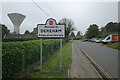
Area Overview for NR19 2HA
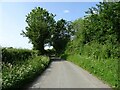
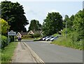
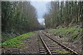
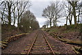
Photos of NR19 2HA
Area Information
Living in NR19 2HA offers a quiet residential experience within a very compact footprint. This postcode defines a small residential cluster covering just 8808 m², which explains the intimate character and close-knit feel of the neighbourhood. The area accommodates a population of 1175 residents, creating a density of 133400 people per km². While the high density figure suggests proximity to neighbours, the building stock is primarily houses rather than high-rise blocks or flats. You will find that daily life here is defined by a mature, settled community atmosphere rather than the bustle of larger towns. The area sits in England and serves as a stable base for those seeking a home with established character. Because the zone is so small, simple walking distances often suffice for local errands, though you may need to travel further for major retail or leisure activities. The layout supports a lifestyle where the immediate surroundings provide direct access to your garden or street, with larger amenities remaining a short drive away in nearby Dereham.
- Area Type
- Postcode
- Area Size
- 8808 m²
- Population
- 1175
- Population Density
- 1336 people/km²
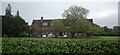
The housing market in NR19 2HA is characterised by a strong focus on owner-occupied families. With 75% of the population owning their homes, this small postcode forms a classic example of a low-mobility housing stock where people stay for the long term. The predominant accommodation type is houses, meaning you are looking at detached or semi-detected properties rather than apartments or flats. This composition appeals strongly to buyers seeking character homes, garden space, and the quiet that often accompanies smaller towns. The area size of only 8808 m² limits the available supply within the exact postcode boundary, but the high ownership rate suggests consistent value for existing properties. Potential buyers should look beyond the immediate postcode to include the immediate surroundings where the housing stock continues. The lack of a significant rental sector implies that trying to rent a home here is unlikely, so purchasing is the primary route to living in this specific cluster. This market stability often results in fair values that reflect the quality of the brickwork, location relative to Dereham, and the desirability of owning a house rather than flat.
House Prices in NR19 2HA
Showing 9 properties
| Address | Type | Beds | Baths | Last Sale Price | Last Sale Date | |
|---|---|---|---|---|---|---|
| 3 Bulwer Road, Dereham, NR19 2HA | Detached | 2 | 1 | £260,000 | Jul 2025 | |
| 5 Bulwer Road, Dereham, NR19 2HA | Bungalow | - | - | £270,000 | Nov 2023 | |
| 10 Bulwer Road, Dereham, NR19 2HA | Bungalow | - | - | £410,000 | Aug 2022 | |
| 8 Bulwer Road, Dereham, NR19 2HA | Bungalow | 3 | - | £163,000 | May 2011 | |
| 2 Bulwer Road, Dereham, NR19 2HA | Bungalow | 3 | - | £133,000 | Oct 2010 | |
| 6 Bulwer Road, Dereham, NR19 2HA | Detached | - | - | £150,000 | Oct 2006 | |
| 7 Bulwer Road, Dereham, NR19 2HA | Bungalow | - | - | - | - | |
| 4 Bulwer Road, Dereham, NR19 2HA | Detached | - | - | - | - | |
| 1 Bulwer Road, Dereham, NR19 2HA | Bungalow | - | - | - | - |
Energy Efficiency in NR19 2HA
Daily life in NR19 2HA benefits from practical access to essential retail and transport hubs located within practical reach. Five key retail outlets serve the local population, including Co-op East, the East of England Co-operative Co, and Iceland East. These venues provide everything from fresh groceries to general household requirements without needing to venture far. You can stock your fridge and shop for daily necessities while still enjoying the quiet of your residential street. For travel, the nearest major transport point is Dereham, which serves as the metro hub for the area. This station likely provides the link to broader regional and national rail networks. The combination of specific supermarkets and a railway station creates a convenient lifestyle where work and shopping are easily balanced. There are no parks, leisure centres, or restaurants listed within the immediate vicinity, so cultural activities remain centred on the nearby town. For a community of 1175, this infrastructure provides all the core requirements for a functional and comfortable home.
Amenities
Schools
Families living in or near NR19 2HA have access to Northgate High School, which serves as the key educational provision for the area. The school operates as a primary institution and also functions as an academy. Ofsted has rated Northgate High School as good, providing reassurance regarding the quality of education available. This single school option simplifies the choices for parents, as they do not need to navigate a complex selection process for different types of institutions within the catchment. The presence of an academy suggests the school receives additional funding and autonomy, which can positively impact facilities and curriculum delivery. While the neighbourhood density is high, the number of schools listed is limited, so families may need to consider catchment boundaries carefully. Living in NR19 2HA notably places you close to this well-regarded facility, ensuring that daily commuting to school is short and manageable. The mixture of primary and academy status under one name highlights a strong local resource dedicated to the education of children in the region.
| Rank | School | Type | Entry gender | Ages |
|---|
Explore more schools in this area
Go to Schools tabDemographics
The community in NR19 2HA is defined by a predominantly adult demographic. The median age stands at 47 years, and the most common age range is adults aged between 30 and 64 years. This indicates a neighbourhood populated by professionals and families who have moved beyond their thirties. You can expect a significant majority of residents to identify as part of the White ethnic group, which shapes the cultural landscape of the area. Home ownership is exceptionally high, with 75% of the population owning their homes outright or with a mortgage. Consequently, the area consists almost entirely of houses, with a negligible rental market compared to urban centres. Such a high ownership rate suggests long-term residents who have planted roots in the locality and are likely to care for their properties well. The stability of the demographic profile means that local businesses and services tend to cater to a settled family and professional base, providing a reliable environment for living in NR19 2HA.
Household Size
Accommodation Type
Tenure
Ethnic Group
Religion
Household Composition
Age
Household Deprivation
NS-SEC
Explore more demographic insights in this area
Go to Demographics tabPlanning
Planning Constraints
- Flood RiskPremium
- Ramsar Wetland SitesPremium
- Area of Outstanding Natural BeautyPremium
- Protected Nature ReservePremium
- Protected WoodlandPremium