Area Overview for NR19 1XP
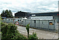
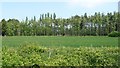
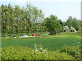
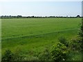
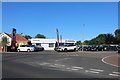
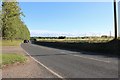
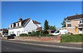
Photos of NR19 1XP
Area Information
Living in NR19 1XP means inhabiting a small, tightly knit residential cluster defined by its specific postcode. This site covers just 4580 square metres, creating a concentrated environment where local interactions are frequent and immediate. The area currently accommodates a population of 2477 residents, resulting in a high density of 1056 people per square kilometre. For those considering homes in this location, the scale indicates a neighbourhood where privacy exists but community life is prominent. You will find yourself surrounded by other occupants who share similar spatial constraints and daily routines. The compact nature of this postcode boundary suggests a village-like feel within a broader urban or suburban framework. Daily life here revolves around proximity, with residents accustomed to navigating a limited footprint while maintaining access to wider city amenities.
- Area Type
- Postcode
- Area Size
- 4580 m²
- Population
- 2477
- Population Density
- 1056 people/km²
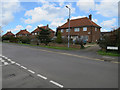
homes in NR19 1XP are predominantly owner-occupied, with a recorded home ownership percentage of 74%. This statistic signals a market shaped by settled families rather than transient renters or students. The accommodation type is almost exclusively houses, which dictates the nature of the properties you might encounter in this postcode. You will likely find detached or semi-detached bungalows and two-storey homes suited to the needs of adults in their 30s to 60s. The high ownership rate implies that many current owners plan to stay for the long term, potentially supporting steady local investment. When viewing properties in this cluster, expect a steady market where sales are driven by life events rather than investment speculation. The housing stock reflects a mature area where condition and location are the primary drivers of value.
House Prices in NR19 1XP
Showing 4 properties
| Address | Type | Beds | Baths | Last Sale Price | Last Sale Date | |
|---|---|---|---|---|---|---|
| 1 Stephen Beaumont Way, Dereham, NR19 1XP | Bungalow | 3 | 2 | £320,000 | Aug 2023 | |
| 4 Stephen Beaumont Way, Dereham, NR19 1XP | Detached | - | - | £182,000 | Dec 2001 | |
| 2 Stephen Beaumont Way, Dereham, NR19 1XP | Detached | - | - | £79,950 | Dec 1996 | |
| 3 Stephen Beaumont Way, Dereham, NR19 1XP | Bungalow | 3 | 2 | £88,000 | Dec 1995 |
Energy Efficiency in NR19 1XP
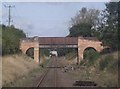
Your daily life in NR19 1XP is supported by a compact range of retail amenities located within the nearby municipality of Dereham. You have access to five key retail venues, including the Aldi Toftwood, Lidl Toftwood, and the larger Tesco Dereham. These supermarkets provide immediate access to food and household essentials, reducing the need for long trips into the city. The designation of Dereham as a metro locality within this radius confirms that a railway station is within reach for those needing to travel further afield. This proximity to national railway services links the residential cluster to wider regional networks. Consequently, you enjoy the convenience of rural-style access to major shopping parks alongside the practicality of inter-city travel via a local station.
Amenities
Schools
Families living in NR19 1XP benefit from a selection of educational institutions within practical reach. Dereham, Toftwood Community Junior School holds a good Ofsted rating, serving children in their final years of primary education. Nearby, Toftwood Infant School also carries a good Ofsted rating, catering to younger pupils. These two establishments form a core part of the local educational landscape, both rated good. Additionally, the area has access to Fred Nicholson School, which functions as a special school, providing support for specific educational needs. This mix ensures that families with infants, juniors, or children requiring specialised care have options close by. The presence of two highly rated community schools suggests a well-supported environment for child development without the need to commute far to main hubs.
| Rank | School | Type | Entry gender | Ages |
|---|
Explore more schools in this area
Go to Schools tabDemographics
The community within NR19 1XP is distinctly established, with a median age of 47 years. The most common age range consists of adults between 30 and 64 years old, reflecting a workforce and family demographic rather than a young professional or retired population. This stability is reinforced by a home ownership rate of 74%, indicating that the majority of residents have settled permanently. Most dwellings are houses, aligning with the preference for private gardens and single-story living arrangements common in this demographic. The predominant ethnic group is White, contributing to a culturally cohesive neighbourhood. This high level of ownership and mature age profile suggests a quiet, predictable environment where long-term residents know their neighbours well. Homebuyers here should expect a population that values stability over rapid change.
Household Size
Accommodation Type
Tenure
Ethnic Group
Religion
Household Composition
Age
Household Deprivation
NS-SEC
Explore more demographic insights in this area
Go to Demographics tabPlanning
Planning Constraints
- Flood RiskPremium
- Ramsar Wetland SitesPremium
- Area of Outstanding Natural BeautyPremium
- Protected Nature ReservePremium
- Protected WoodlandPremium