Area Overview for NR19 1XB
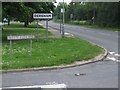
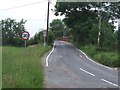
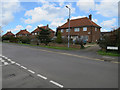
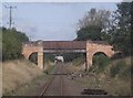
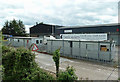
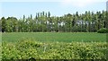
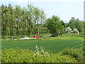
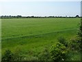
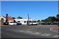
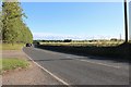
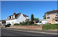
Photos of NR19 1XB
Area Information
NR19 1XB is a specific postcode area covering a small residential cluster in Norfolk, England. The population stands at 2,477 residents, creating a tight-knit environment with a population density of 1056 people per square kilometre. You live in a settled part of the region where daily life is defined by established patterns rather than rapid change. The area functions as a quiet residential zone within the broader network of Dorset and Sudbury. Housing here is predominantly houses, reflecting a tradition of single-family living over terraced or high-rise accommodation. This configuration supports private gardens and self-contained lifestyles. You are located near Dereham, which provides local train services and wider transport links for commuting or holiday travel. The vicinity includes access to supermarkets and essential services, ensuring your day-to-day needs are met without extensive travel. While the cluster is small, the location offers stability and a sense of permanence. Residents enjoy proximity to retail outlets like Aldi and Lidl while remaining in a low-density setting. The area lacks significant planning constraints such as protected woodlands or wetlands, allowing for straightforward property maintenance. Safety assessments confirm low flood risk, ensuring your investment remains secure against environmental hazards. This postcode represents a practical choice for those seeking a stable home outside the busy city centre.
- Area Type
- Postcode
- Area Size
- Not available
- Population
- 2477
- Population Density
- 1056 people/km²
Homes in NR19 1XB are characterised by a stable owner-occupied market. The 74% home ownership rate signals that this postcode is not a primary hub for short-term rentals or student accommodation. Instead, the housing stock consists almost entirely of houses, catering to families or individuals seeking self-contained living. You will find minimal competition from purpose-built blocks, as the accommodation type data confirms a flat-free environment. This structure often appeals to buyers who value privacy and outdoor space over proximity to dense urban centres. The market behaviour reflects a settled population with deep roots in the locality. Property values here are likely influenced by the total floor space and condition of individual houses rather than the prestige of the development site. Buyers looking at this area should expect prices to vary based on the specific house configuration and garden size. The absence of high-density blocks means that resale markets are driven by individual property appeal rather than floor plan ratios typical of flats.
House Prices in NR19 1XB
No properties found in this postcode.
Energy Efficiency in NR19 1XB
Living in NR19 1XB offers convenient access to essential retail and transport hubs within practical reach. The area hosts five notable retail venues that form the local shopping heart. Aldi Toftwood and Lidl Toftwood are the standout supermarkets, providing daily grocery needs without a lengthy drive. East of England Co-operative Co offers another retail option for residents seeking variety or ethical shopping choices. These three stores ensure you have multiple points of access for food, household goods, and general necessities. For rail travel, Dereham station serves as the local metro/transport node, offering connections to the wider rail network. This single transport station facilitates regional travel for holidays or business commitments. The proximity of these amenities means you can shop, commute, or handle administrative tasks efficiently from your doorstep. You do not need to travel far to find what you require, saving valuable time during your week. The layout supports a self-sufficient lifestyle with minimal reliance on long-distance commuting for basics.
Amenities
Schools
Schools near NR19 1XB offer a mix of primary and special education options. Toftwood Infant School is a primary institution with a good Ofsted rating, serving younger children in the local cluster. Dereham, Toftwood Community Junior School also holds a good Ofsted rating, providing secondary education for the same community catchment. These two schools form the core of the local educational infrastructure, ensuring continuity for families staying in the area. Fred Nicholson School provides special education services, representing an additional option for families with specific educational needs. The presence of two primary schools with good ratings suggests a strong focus on early years education quality. You will find that most young families in NR19 1XB send their children to either Toftwood Infant School or Dereham, Toftwood Community Junior School. The proximity of these educational facilities supports the decision to purchase a home in this postcode.
| Rank | School | Type | Entry gender | Ages |
|---|
Explore more schools in this area
Go to Schools tabDemographics
The community in NR19 1XB is defined by stability and maturity. The median age is 47 years, indicating a population with most people falling into the 30 to 64 year adult bracket. This age profile suggests a neighbourhood dominated by established families or mature individuals rather than students or young professionals. Home ownership stands at a solid 74%, meaning the majority of residents have bought their own homes. This high level of ownership typically translates to long-term stability and a community invested in local improvements. Houses form the sole predominant accommodation type in the area, eliminating flats or purpose-built rental blocks from the immediate landscape. The ethnic composition is predominantly White, reflecting the typical demographic makeup of many rural and semi-rural clusters in East Anglia. With a population of 2,477 across a small footprint, the density of 1056 people per square kilometre ensures you know your neighbours without feeling overwhelmed by urban congestion. The community atmosphere is one of quiet independence. You are likely to encounter residents who have lived in the area for decades, contributing to a predictable and reliable social environment. The lack of significant migration or transient populations reinforces this settled character.
Household Size
Accommodation Type
Tenure
Ethnic Group
Religion
Household Composition
Age
Household Deprivation
NS-SEC
Explore more demographic insights in this area
Go to Demographics tabPlanning
Planning Constraints
- Flood RiskPremium
- Ramsar Wetland SitesPremium
- Area of Outstanding Natural BeautyPremium
- Protected Nature ReservePremium
- Protected WoodlandPremium