Area Overview for NR19 1LZ
Photos of NR19 1LZ
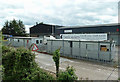
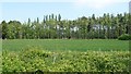
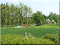
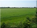
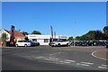
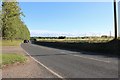
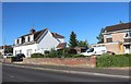
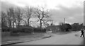
28 photos from this area
Area Information
Key information about the NR19 1LZ including its size, population, and administrative classification.
- Area Type
- Postcode
- Area Size
- 9195 m²
- Population
- 2477
- Population Density
- 1056 people/km²
House Prices in NR19 1LZ
21
Properties
£161,507
Average Sold Price
£71,500
Lowest Price
£275,000
Highest Price
Showing 21 properties
| Address | Type | Beds | Baths | Last Sale Price | Last Sale Date | |
|---|---|---|---|---|---|---|
| 10 Laburnum Crescent, Dereham, NR19 1LZ | Chalet | 3 | 1 | £250,000 | Nov 2025 | |
| 12 Laburnum Crescent, Dereham, NR19 1LZ | Bungalow | 3 | 1 | £275,000 | Aug 2023 | |
| 20 Laburnum Crescent, Dereham, NR19 1LZ | Bungalow | 2 | 1 | £257,500 | Oct 2022 | |
| 18 Laburnum Crescent, Dereham, NR19 1LZ | Bungalow | 2 | 1 | £170,000 | Sep 2016 | |
| 7 Laburnum Crescent, Dereham, NR19 1LZ | house | 3 | - | £165,000 | Jul 2014 | |
| 11 Laburnum Crescent, Dereham, NR19 1LZ | Bungalow | 3 | - | £138,000 | Nov 2013 | |
| 16 Laburnum Crescent, Dereham, NR19 1LZ | Semi-detached | 2 | 1 | £101,895 | Dec 2012 | |
| 3 Laburnum Crescent, Dereham, NR19 1LZ | Flat | 3 | 1 | £82,250 | Jul 2011 | |
| 2 Laburnum Crescent, Dereham, NR19 1LZ | Flat | - | - | £103,000 | Dec 2010 | |
| 13 Laburnum Crescent, Dereham, NR19 1LZ | Semi-detached | - | - | £169,950 | May 2007 |
Page 1 of 3
Energy Efficiency in NR19 1LZ
Amenities
Schools
| Rank | School | Type | Entry gender | Ages |
|---|
Explore more schools in this area
Go to Schools tabDemographics
Household Size
Two person
most common
Accommodation Type
Houses
most common
Tenure
74
majority
Ethnic Group
White
most common
Religion
N/A
most common
Household Composition
N/A
most common
Age
47
median
Adults (30-64 years)
most common
Household Deprivation
N/A
with no deprivation
NS-SEC
25
in Lower managerial occupations
Explore more demographic insights in this area
Go to Demographics tabPlanning
Planning Constraints
- Flood RiskPremium
- Ramsar Wetland SitesPremium
- Area of Outstanding Natural BeautyPremium
- Protected Nature ReservePremium
- Protected WoodlandPremium