Area Overview for NR18 9BP
Photos of NR18 9BP
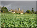
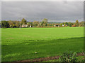
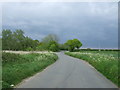
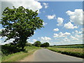
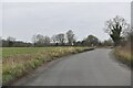
11 photos from this area
Area Information
Key information about the NR18 9BP including its size, population, and administrative classification.
- Area Type
- Postcode
- Area Size
- 24.6 hectares
- Population
- 1603
- Population Density
- 58 people/km²
House Prices in NR18 9BP
34
Properties
£248,545
Average Sold Price
£77,500
Lowest Price
£430,000
Highest Price
Showing 34 properties
| Address | Type | Beds | Baths | Last Sale Price | Last Sale Date | |
|---|---|---|---|---|---|---|
| 74 London Road, Wymondham, NR18 9BP | Semi-detached | 3 | 1 | £340,000 | Dec 2022 | |
| 62 London Road, Wymondham, NR18 9BP | Terraced | 3 | 1 | £253,000 | Aug 2021 | |
| 60 London Road, Wymondham, NR18 9BP | house | - | - | £395,000 | May 2021 | |
| 80 London Road, Wymondham, NR18 9BP | Semi-detached | 2 | 2 | £250,000 | Mar 2021 | |
| 64 London Road, Wymondham, NR18 9BP | house | 3 | - | £270,000 | Jan 2021 | |
| 66 London Road, Wymondham, NR18 9BP | house | 3 | - | £240,000 | Dec 2020 | |
| 42 London Road, Wymondham, NR18 9BP | Semi-detached | 3 | 1 | £355,000 | May 2019 | |
| 9 London Road, Wymondham, NR18 9BP | Detached | 4 | - | £240,400 | Sep 2016 | |
| 17 London Road, Wymondham, NR18 9BP | house | - | - | £235,000 | Jul 2016 | |
| 76 London Road, Wymondham, NR18 9BP | Detached | 4 | 2 | £430,000 | Jul 2014 |
Page 1 of 4
Energy Efficiency in NR18 9BP
Amenities
Schools
| Rank | School | Type | Entry gender | Ages |
|---|
Explore more schools in this area
Go to Schools tabDemographics
Household Size
Family (3-5 people)
most common
Accommodation Type
Houses
most common
Tenure
78
majority
Ethnic Group
White
most common
Religion
N/A
most common
Household Composition
N/A
most common
Age
47
median
Adults (30-64 years)
most common
Household Deprivation
N/A
with no deprivation
NS-SEC
40
in Lower managerial occupations
Explore more demographic insights in this area
Go to Demographics tabPlanning
Planning Constraints
- Flood RiskPremium
- Ramsar Wetland SitesPremium
- Area of Outstanding Natural BeautyPremium
- Protected Nature ReservePremium
- Protected WoodlandPremium