Area Overview for NR18 0SB
Photos of NR18 0SB

Area Information
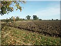
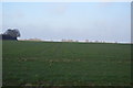
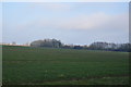
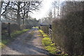
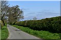
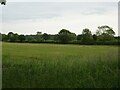
Living in NR18 0SB means residing within a compact residential cluster covering an area of just 1.3 km². This specific postcode serves approximately 1,274 people, creating a tightly knit community with a population density of 178 people per square kilometre. The population profile skews towards adult residents aged between 30 and 64 years, reflecting a mature demographic rather than a younger family centre. You will experience an environment defined by its intimate scale and established character. The high proportion of home ownership at 82% suggests a long-term settlement rather than a transient market. Daily life here revolves around a quiet, residential rhythm where neighbours likely know one another well. The area avoids the noise and congestion of larger urban centres. Instead, you find a focused living space where the physical boundaries are close and the sense of locality is strong. For those seeking peace and stability, the small size of this postcode ensures that amenities and neighbours remain immediately accessible. Stability defines the everyday experience for the majority of residents who have called this small area home for decades.
- Area Type
- Postcode
- Area Size
- 1.3 km²
- Population
- 1274
- Population Density
- 178 people/km²
The property market in NR18 0SB is characterised by a steadfast focus on single-family homes. Houses constitute the primary and almost exclusive form of accommodation within this 1.3 km² postcode area. The extremely high home ownership rate of 82% confirms that the vast majority of residents are owner-occupiers, not tenants. This statistic reflects a market driven by long-term investment and established household roots rather than a influx of rental seekers. If you are looking at homes in NR18 0SB, expect to find a stock of detached, semi-detached, or terraced properties suited to adult families and empty nesters. Flats and apartments are notably absent from the provided data, meaning you will not find high-density living options here. The low population density of 178 people per square kilometre further supports the prevalence of standalone houses over shared estate living. This market structure appeals to buyers seeking privacy and a traditional suburban feel. Transactions in this area likely involve established owners selling to similar demographic profiles. The consistency of the housing stock ensures that the neighbourhood appearance remains uniform and predictable for anyone moving into this specific residential cluster.
House Prices in NR18 0SB
Showing 13 properties
| Address | Type | Beds | Baths | Last Sale Price | Last Sale Date | |
|---|---|---|---|---|---|---|
| 3, Manor Farm Barns, Wramplingham Road, Downham, NR18 0SB | Semi-detached | 3 | 3 | £700,000 | Feb 2025 | |
| The Old Granary, Wramplingham Road, Downham, NR18 0SB | house | 4 | 3 | £940,000 | Jan 2023 | |
| Barnabee Barn, Wramplingham Road, Downham, NR18 0SB | Semi-detached | 5 | 4 | £688,000 | Nov 2020 | |
| Old Beam Barn, Wramplingham Road, Downham, NR18 0SB | Semi-detached | 4 | 4 | £680,000 | Oct 2020 | |
| Flint Barn, Wramplingham Road, Downham, NR18 0SB | Bungalow | 4 | 2 | - | - | |
| Manor Farm, Wramplingham Road, Downham, NR18 0SB | Detached | - | - | - | - | |
| Manor Farm Bungalow, Wramplingham Road, Downham, NR18 0SB | Bungalow | 4 | 1 | - | - | |
| 1, Manor Farm Cottages, Wramplingham Road, Downham, NR18 0SB | Bungalow | 4 | - | - | - | |
| The Cedars, Wramplingham Road, Downham, NR18 0SB | Detached | - | - | - | - | |
| Brittons Farm, Wramplingham Road, Downham, NR18 0SB | house | - | - | - | - |
Energy Efficiency in NR18 0SB
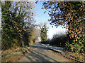
Residents of NR18 0SB benefit from a practical network of amenities located within walking or short driving distance. Five major retail outlets serve the immediate neighbourhood, including the East of England Co-operative Co, Waitrose Wymondham, and Lidl Farrier. These supermarkets provide comprehensive grocery shopping without the need for long journeys. Transport links are well established, offering one metro stop at Wymondham Abbey and two railway stations: Wymondham Railway Station and Spooner Row Railway Station. Beyond shopping and transport, there are five listed metro points in the broader vicinity, with Wymondham Abbey being the most notable landmark for commuters and visitors. The availability of Waitrose suggests access to higher-quality produce, which elevates the daily shopping experience. You will find that essential services are clustered closely around your postcode. This convenience reduces travel time for weekly errands and creates a self-sufficient local economy. The presence of multiple railway stations ensures that accessing other parts of the region requires minimal planning. Your lifestyle in NR18 0SB is defined by close access to necessary goods and efficient transport connections.
Amenities
Schools
Families living in NR18 0SB rely on Robert Kett Primary School for primary education. This institution is the only specific school mentioned in the data for this location. Both entries in the school listing refer to this same establishment, indicating it serves as the central educational hub for the immediate vicinity. Researchers have not provided data on the Ofsted rating for Robert Kett Primary School, so official inspection grades remain unverified in this report. Parents considering schools near NR18 0SB will find that their children likely fall within the catchment area of this single primary institution. The absence of secondary school names in the dataset suggests that older children usually travel further for secondary education. You must look beyond local boundaries to find high schools for students in this postcode. The reliance on one specific primary school highlights the concentrated nature of educational provision in this small 1.3 km² area. If you have young children, securing a place at Robert Kett Primary School will be the most critical step in planning your education strategy for this location.
| Rank | School | Type | Entry gender | Ages |
|---|
Explore more schools in this area
Go to Schools tabDemographics
The community in NR18 0SB is dominated by adults aged 30 to 64 years, with a median age of 47. This age profile indicates a neighbourhood where residents plan for long-term stays rather than short-term moves. A substantial 82% of households own their homes, which contrasts sharply with areas reliant on the rental sector. The predominant accommodation type consists of houses, reinforcing the traditional, family-oriented nature of the area. There is no significant presence of flats or purpose-built apartment blocks within this residential cluster. While specific breakdowns of minority ethnic groups are not detailed in the current statistics, the predominant ethnic group identified is White. Deprivation levels are not quantified in the available figures, yet the high rate of home ownership often correlates with financial stability among residents. The population density of 178 people per square kilometre suggests a spread-out living pattern rather than a crowded high-rise environment. This demographic structure creates a stable society where established families form the core of the local social fabric. You will find an environment where the needs of working-age adults shape the services and community activities available.
Household Size
Accommodation Type
Tenure
Ethnic Group
Religion
Household Composition
Age
Household Deprivation
NS-SEC
Explore more demographic insights in this area
Go to Demographics tabPlanning
Planning Constraints
- Flood RiskPremium
- Ramsar Wetland SitesPremium
- Area of Outstanding Natural BeautyPremium
- Protected Nature ReservePremium
- Protected WoodlandPremium