Area Overview for NR17 2SP
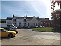
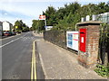
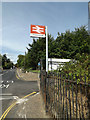
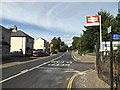
Photos of NR17 2SP
Area Information
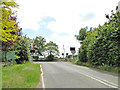
Living in NR17 2SP means residing within a specific postcode cluster that covers just 4,332 square metres. This small residential area is distinct for its concentrated nature, housing a population of 2,480 people who call this spot their home. You are stepping into an environment that prioritises a quiet, settled life rather than the hustle of dense urban centres. The landscape is defined by its scale, which keeps distances short between neighbours and local points of interest. This community stands apart from broader regions because of its high density within such a compact footprint. When you choose homes in NR17 2SP, you are selecting a location where every footstep brings you closer to your local hub. The area functions as a close-knit residential zone, ideal for those who value the simplicity of a managed, small-scale environment. Understanding the layout is key, as the limited square kilometre count ensures a very personal sense of place. You do not need to travel far to experience the rhythm of daily life here. The identity of NR17 2SP is rooted in this balance between low traffic volumes and accessible community resources. It is a straightforward choice for anyone seeking a defined territory with clear borders and a predictable structure. The specific population count of 2,480 residents confirms that this is a neighbourhood designed for living rather than just passing through.
- Area Type
- Postcode
- Area Size
- 4332 m²
- Population
- 2480
- Population Density
- 264 people/km²
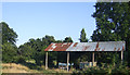
Homes in NR17 2SP are exclusively houses, which sets this small area apart from mixed housing estates found in larger towns. With 84 per cent of the population owning their homes, the market is heavily skewed towards owner-occupiers rather than landlords or renters. This statistic means that when you view properties in NR17 2SP, you will encounter established owners rather than seeking out rental opportunities. The shortage of rental options is a direct result of this high ownership figure. You are looking for a buy-to-live environment where neighbours are likely to stay for many years. The accommodation type is uniform, offering a consistency that many buyers find attractive for planning their future. This lack of variety in housing types means high street accessibility or complex estate planning is less relevant here. The 2,480 residents are spread across this small area, indicating that the stock is sufficient for the local population without feeling overly exclusive or crowded. For someone entering the market, the challenge is finding available stock, but the reward is joining a community of permanent residents. The dominance of houses suggests a preference for private gardens and quieter streets over flats or terraced options.
House Prices in NR17 2SP
Showing 12 properties
| Address | Type | Beds | Baths | Last Sale Price | Last Sale Date | |
|---|---|---|---|---|---|---|
| 1 Balmoral Close, Attleborough, NR17 2SP | Detached | 4 | 2 | £345,000 | Aug 2025 | |
| 11 Balmoral Close, Attleborough, NR17 2SP | Detached | 4 | 2 | £335,000 | Jun 2024 | |
| 4 Balmoral Close, Attleborough, NR17 2SP | Detached | 3 | 2 | £255,000 | Jun 2021 | |
| 8 Balmoral Close, Attleborough, NR17 2SP | house | - | - | £370,000 | Feb 2021 | |
| 7 Balmoral Close, Attleborough, NR17 2SP | Detached | 3 | 2 | £225,000 | Aug 2018 | |
| 5 Balmoral Close, Attleborough, NR17 2SP | Detached | 4 | - | £279,000 | Aug 2017 | |
| 12 Balmoral Close, Attleborough, NR17 2SP | Detached | 4 | - | £212,500 | Dec 2013 | |
| 9 Balmoral Close, Attleborough, NR17 2SP | Detached | 4 | - | £220,000 | Jul 2010 | |
| 2 Balmoral Close, Attleborough, NR17 2SP | house | - | - | £212,000 | Dec 2009 | |
| 6 Balmoral Close, Attleborough, NR17 2SP | Detached | - | - | £191,500 | Sep 2007 |
Energy Efficiency in NR17 2SP
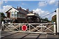
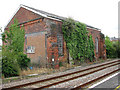
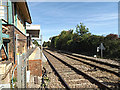
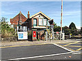
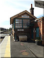
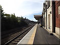
Your daily routine in NR17 2SP is shaped by the range of amenities located within practical reach. There are four railway stations nearby, including Attleborough Railway Station, Spooner Row Railway Station, and Eccles Road Railway Station. These connections allow you to travel to larger towns or connect with national rail networks efficiently. For your weekly grocery shopping, Lidl Attleborough and Sainsburys Attleborough offer convenient retail options. You also have access to M&S Besthorpe BP for basic needs. If leisure or cultural outings are part of your plan, Wymondham Abbey provides a notable destination for visits. These five retail outlets and four rail links form the backbone of the local lifestyle. You can sustain a complete life cycle of shopping, commuting, and occasional outings from this postcode. The presence of these specific venues means you are not isolated from the wider region. Convenience is built into the layout, with key services situated close enough for frequent visits. This mix of transport and shopping ensures that living in NR17 2SP remains practical for families or professionals.
Amenities
Schools
Parents in NR17 2SP rely on a very small selection of school choices immediately nearby. The nearest education provider is Attleborough Primary School, which serves the elementary level. This school currently holds a satisfactory Ofsted rating, confirming that it meets the minimum standards set for educational provision. Because there are no secondary schools listed within the immediate vicinity of NR17 2SP, you must consider the broader transport network for later schooling stages. The primary school option is the first educational step for families living in this postcode. A satisfactory rating indicates that the school is functional and compliant, though it may not offer the high accolades of a top-tier institution. You are responsible for researching further education options beyond this primary level through the local authority or online directories. The proximity to Attleborough Primary School makes living in NR17 2SP practical for early years education, provided your children eventually need access to secondary institutions elsewhere. This limited supply of local schools means that while you have an educational starting point, your child's full schooling journey may take them outside the immediate neighbourhood.
| Rank | School | Type | Entry gender | Ages |
|---|
Explore more schools in this area
Go to Schools tabDemographics
The community within NR17 2SP is defined by stability, with 84 per cent of households owning their homes. This high ownership rate indicates a settled population that is less likely to move frequently. Most residents are adults aged between 30 and 64 years, which suggests a workforce that is either established in their careers or approaching retirement. The median age of 47 years reinforces the idea that this is not an area dominated by young families or transient students. You are looking at an area where the majority of the population has deep roots. The predominant ethnic group is White, reflecting the typical composition of many rural and semi-rural clusters in England. Almost all accommodation consists of houses, offering those looking to live here a single-family dwelling or a property set back from busy roads. There is very little data on deprivation for this specific small postcode, but the high home ownership rate often correlates with financial security and stability. Residents share a common demographic profile that values long-term settlement. This age distribution means the community likely organises around practical life stages, such as retirement planning or supporting adult children. The presence of homeowners means investment in the local street scenes and gardens is more consistent than in rental-heavy areas.
Household Size
Accommodation Type
Tenure
Ethnic Group
Religion
Household Composition
Age
Household Deprivation
NS-SEC
Explore more demographic insights in this area
Go to Demographics tabPlanning
Planning Constraints
- Flood RiskPremium
- Ramsar Wetland SitesPremium
- Area of Outstanding Natural BeautyPremium
- Protected Nature ReservePremium
- Protected WoodlandPremium