Area Overview for NR17 2HQ
Photos of NR17 2HQ
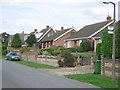
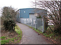
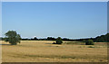
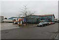
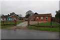
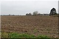
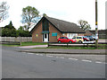
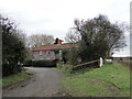
16 photos from this area
Area Information
Key information about the NR17 2HQ including its size, population, and administrative classification.
- Area Type
- Postcode
- Area Size
- 2.4 hectares
- Population
- 2006
- Population Density
- 323 people/km²
House Prices in NR17 2HQ
38
Properties
£237,379
Average Sold Price
£42,500
Lowest Price
£398,000
Highest Price
Showing 38 properties
| Address | Type | Beds | Baths | Last Sale Price | Last Sale Date | |
|---|---|---|---|---|---|---|
| 130A Hargham Road, Attleborough, NR17 2HQ | Bungalow | 4 | 2 | £365,000 | Aug 2023 | |
| 102A Hargham Road, Attleborough, NR17 2HQ | house | - | - | £398,000 | Jul 2023 | |
| 105 Hargham Road, Attleborough, NR17 2HQ | Semi-detached | 4 | 1 | £310,000 | Apr 2023 | |
| 122 Hargham Road, Attleborough, NR17 2HQ | Bungalow | - | - | £237,500 | Feb 2021 | |
| 106 Hargham Road, Attleborough, NR17 2HQ | Bungalow | 4 | - | £375,000 | Jul 2019 | |
| 128 Hargham Road, Attleborough, NR17 2HQ | Semi-detached | 3 | - | £239,000 | Feb 2017 | |
| 104 Hargham Road, Attleborough, NR17 2HQ | Bungalow | 4 | 1 | £383,000 | Dec 2016 | |
| 130 Hargham Road, Attleborough, NR17 2HQ | Bungalow | - | - | £171,000 | May 2016 | |
| 120 Hargham Road, Attleborough, NR17 2HQ | Semi-detached | 3 | - | £178,000 | Aug 2015 | |
| 108 Hargham Road, Attleborough, NR17 2HQ | Bungalow | 3 | - | £345,000 | Jun 2014 |
Page 1 of 4
Energy Efficiency in NR17 2HQ
Amenities
Schools
| Rank | School | Type | Entry gender | Ages |
|---|
Explore more schools in this area
Go to Schools tabDemographics
Household Size
Two person
most common
Accommodation Type
Houses
most common
Tenure
83
majority
Ethnic Group
White
most common
Religion
N/A
most common
Household Composition
N/A
most common
Age
47
median
Adults (30-64 years)
most common
Household Deprivation
N/A
with no deprivation
NS-SEC
30
in Lower managerial occupations
Explore more demographic insights in this area
Go to Demographics tabPlanning
Planning Constraints
- Flood RiskPremium
- Ramsar Wetland SitesPremium
- Area of Outstanding Natural BeautyPremium
- Protected Nature ReservePremium
- Protected WoodlandPremium