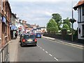
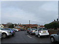
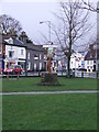
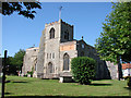
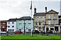
Area Overview for NR17 2BY
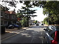
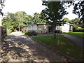
Photos of NR17 2BY


Area Information
Living in NR17 2BY offers a stable residential experience within a specific postcode cluster in Norfolk. The area covers 2,125 square metres and supports a population of 1,869 residents. This small community operates as a tight-knit residential hub rather than a sprawling urban centre. You will find a neighbourhood defined by established homes and long-term residency. The environment sits comfortably away from major planning constraints, avoiding protected sites such as Areas of Outstanding Natural Beauty or Ramsar wetland areas. This status ensures that local development follows standard procedures without significant environmental restrictions. Daily life here revolves around proximity to Attleborough and access to regional transport links. The location provides a quiet setting while remaining connected to wider Norfolk networks. Prospective buyers looking for a settled community will find the population density reflects a mix of single-family dwellings and larger properties common to the region. The area avoids flood zones, providing peace of mind regarding water safety. Residents benefit from a layout that prioritises function over commercial noise. The small size of the postcode means your view of the neighbourhood changes little, offering a predictable and consistent living rhythm.
- Area Type
- Postcode
- Area Size
- 2125 m²
- Population
- 1869
- Population Density
- 3880 people/km²
The housing market in NR17 2BY reflects a mature, owner-occupied landscape. Eighty per cent of properties are owner-occupied, creating a market where residents treat their homes as long-term assets. The accommodation type is almost exclusively houses, making NR17 2BY unsuitable for those seeking the high density of apartment living. This lack of shared ownership or high-rise flats means buyers cannot expect the convenience of concierge services or gyms within the building. Instead, the market offers detached or semi-detached homes, likely with private gardens and off-street parking. Typical offers here focus on exterior space and structural integrity rather than communal amenities. The low count of units in this specific postcode cluster means price competition occurs between a limited number of properties. You are buying into a neighbourhood where sellers often have high equity and lower turnover rates. This dynamic can slow transactions but also maintains value stability. Investment purchases must account for the fact that most neighbours live there permanently. There is little rental pressure visible in the housing mix. Buyers seeking a traditional family home will find the existing stock matches the 80 per cent ownership statistic.
House Prices in NR17 2BY
Showing 7 properties
| Address | Type | Beds | Baths | Last Sale Price | Last Sale Date | |
|---|---|---|---|---|---|---|
| 6, Cherry Row, London Road, Attleborough, NR17 2BY | Terraced | 3 | 1 | £227,500 | May 2025 | |
| 1, Cherry Row, London Road, Attleborough, NR17 2BY | Terraced | 2 | 1 | £245,000 | Aug 2023 | |
| 5, Cherry Row, London Road, Attleborough, NR17 2BY | Terraced | - | - | £110,000 | Feb 2004 | |
| 3, Cherry Row, London Road, Attleborough, NR17 2BY | house | - | - | £68,000 | Jul 2001 | |
| 7, Cherry Row, London Road, Attleborough, NR17 2BY | Terraced | - | - | £67,000 | Feb 1996 | |
| 4, Cherry Row, London Road, Attleborough, NR17 2BY | Terraced | 3 | - | - | - | |
| 2, Cherry Row, London Road, Attleborough, NR17 2BY | Terraced | - | - | - | - |
Energy Efficiency in NR17 2BY
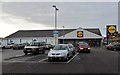
Daily life in NR17 2BY centres on the practical amenities located within easy reach of your front door. Residents have five retail options nearby, including the Sainsburys at Attleborough and the Lidl in Attleborough. These superstores provide comprehensive shopping needs for groceries and household essentials. The M&S Besthorpe BP location adds fuel and convenience options for quick errands. You do not need to travel far for basic necessities, saving the fuel costs of a longer journey. Transport links include five railway stations in the immediate vicinity. Attleborough Railway Station serves as the main departure point for regional travel, while Eccles Road and Spooner Row stations offer local alternatives. Wymondham Abbey provides a specific cultural landmark and leisure spot just one metro station away. This amenity cluster creates a balanced lifestyle where work and play remain accessible. You can combine a quiet morning at home with an afternoon trip to the Abbey or a Sunday grocery run in Attleborough. The availability of five retail points and multiple train links ensures that living in NR17 2BY does not mean isolation. Convenience is built into the layout of the surrounding estates. Car ownership helps maximise access to these specific venues efficiently.
Amenities
Schools
| Rank | School | Type | Entry gender | Ages |
|---|
Explore more schools in this area
Go to Schools tabDemographics
The community residing in NR17 2BY skews towards maturity, with a median age of 47 years. The vast majority of the population falls within the adult age range of 30 to 64 years. This demographic profile suggests a neighbourhood dominated by established families and professionals mid-career. Home ownership stands at 80 per cent of all households, indicating a area where residents have invested in their permanent residences. The remaining 20 per cent of homes are likely rentals, though the high ownership rate points to a stable, owner-occupied stock. Most properties are classified as houses rather than apartments or flats, reinforcing the traditional English suburban feel. The predominant ethnic group is White, aligning with broader regional trends in East Anglia. There are no signs of rapid demographic turnover or transient populations. The age distribution supports a steady demand for single-storey adaptations or larger gardens. Buyers looking for ageing-in-place options will find the median age of 47 supports a community accustomed to long-term settlement patterns. The social fabric is built around local engagement rather than transient student housing or commuter worker clusters.
Household Size
Accommodation Type
Tenure
Ethnic Group
Religion
Household Composition
Age
Household Deprivation
NS-SEC
Explore more demographic insights in this area
Go to Demographics tabPlanning
Planning Constraints
- Flood RiskPremium
- Ramsar Wetland SitesPremium
- Area of Outstanding Natural BeautyPremium
- Protected Nature ReservePremium
- Protected WoodlandPremium