Area Overview for NR17 1JP
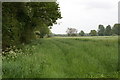
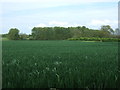
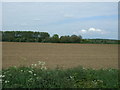
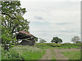
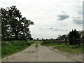
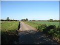
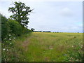
Photos of NR17 1JP


Area Information
NR17 1JP is a specific postcode area covering a small residential cluster in Norfolk, England. This designated zone spans 71.0 hectares and accommodates a population of 1,297 residents. Such a limited footprint means the area maintains an intimate feel where neighbours often know each other by sight. You will find the community is centred around houses rather than apartments, creating a distinctly terraced or semi-detached character common in rural Norfolk postcodes. The low population density of 49 people per square kilometre ensures that despite being part of the larger Norfolk network, this specific location avoids the congestion of larger towns. Daily life here revolves around a quiet, managed pace of living. The area does not offer the sprawling urban experience of city centres but provides a retreat where the focus remains on the immediate residential cluster. For you, living in NR17 1JP means accepting a smaller footprint in exchange for a setting defined by its manageable scale and contained nature. The environment is constructed specifically for residents who value a defined boundary between their homes and the surrounding countryside. This registered postcode serves as a precise identifier for this compact neighbourhood, separating it from adjacent clusters while maintaining clear administrative boundaries within the Harleston district.
- Area Type
- Postcode
- Area Size
- 71.0 hectares
- Population
- 1297
- Population Density
- 49 people/km²
Homes in NR17 1JP are characterised by a market almost entirely defined by ownership. With 77 per cent of residents owning their homes, the area functions as a stable, owner-occupied zone rather than a hub for short-term rentals or student accommodation. The type of accommodation is exclusively houses, meaning you will not find flats or purpose-built estates here. This housing stock likely consists of traditional detached or semi-detached properties typical of the Harleston and Hingham corridor in Norfolk. The low population density of 49 people per square kilometre and the total area size of 71.0 hectares suggest that individual plots are spacious. Buying in NR17 1JP offers you a private residence with significant grounds, far removed from the density concerns of urban developments. The market reflects the needs of established families who prioritise space and permanence over the convenience of apartment complexes. For sellers, the high ownership rate implies a community invested in the long-term value of the neighbourhood. Potential buyers seeking a rental investment may find limited opportunity here, but those seeking a permanent home will find a stock designed for permanence and quiet enjoyment.
House Prices in NR17 1JP
Showing 1 properties
| Address | Type | Beds | Baths | Last Sale Price | Last Sale Date | |
|---|---|---|---|---|---|---|
| Little Ellingham Hall, Barrack Row, Little Ellingham, NR17 1JP | Detached | - | - | - | - |
Energy Efficiency in NR17 1JP
Your lifestyle in NR17 1JP is defined by practical convenience within a rural setting. Daily shopping needs are met by several local supermarkets, including Co-op Hingham, Spar, and Lidl Watton. These three major retailers form the core of local retail, ensuring you can stock your pantry without travelling far. For residents who prefer train travel, two railway stations, Attleborough Railway Station and Spooner Row Railway Station, are within practical reach. These stations serve as gateways for longer journeys, connecting you to Norwich and beyond. The area maintains a low-key character where the nearest amenities are focused on essential goods and transport rather than nightlife or high-end dining. You will find a neighbourhood where the weekly shop is a short drive or train ride away. The absence of listed leisure centres, parks, or cinema venues means culture comes from the surrounding Norfolk countryside or nearby towns. This lifestyle suits those who value a simple routine centred around home, local supermarkets, and rail connections. It is a functional, predictable lifestyle where the essentials are close and the extras are accessible via the railway network.
Amenities
Schools
For families living in NR17 1JP, the educational landscape is anchored by Rocklands Community Primary School. This primary school holds a 'good' Ofsted rating, confirming it meets the required standards for educational provision. The data lists only this single institution as a nearby school, indicating that secondary education requires travel further afield to towns like Attleborough or Great Yarmouth. This configuration is typical for rural villages where a single strong primary feeds into larger saturation catchment areas for comprehensive schools. You will find no academies or private options listed within the immediate vicinity of NR17 1JP. The presence of Rocklands Community Primary School provides a solid foundation for early education within walking or short driving distance. The 'good' rating reassures parents that the curriculum and management are effective. While the lack of secondary schools on record means you must look outside the immediate postcode for high school options, the quality of local primary education remains a distinct advantage. This setup supports a community where school runs are manageable and the local primary institution serves as a central community hub.
| Rank | School | Type | Entry gender | Ages |
|---|
Explore more schools in this area
Go to Schools tabDemographics
The community within NR17 1JP reflects a mature demographic profile where adults between the ages of 30 and 64 years form the most common age group. This dominance suggests an area populated by established families, retired professionals, or those in established careers rather than young professionals seeking entry-level housing. Consequently, the median age stands at 47 years, significantly higher than the national average for major cities. Home ownership is the prevailing arrangement, with 77 per cent of residents owning their homes outright or with a mortgage. This statistic underscores a settlement character built on long-term stability rather than transient renting. Accommodation types are consistently houses, aligning with the older, family-oriented nature of the population. The area is predominantly White, mirroring the general ethnic composition of rural Norfolk. These figures indicate a low-deprivation environment where residents have achieved a high level of financial security. You will find a neighbourhood where wealth and stability are the norm, driven by the high rate of property ownership. This stability supports local businesses like the Co-op Hingham and creates a quiet, orderly atmosphere free from the volatility often seen in student or transient housing markets.
Household Size
Accommodation Type
Tenure
Ethnic Group
Religion
Household Composition
Age
Household Deprivation
NS-SEC
Explore more demographic insights in this area
Go to Demographics tabPlanning
Planning Constraints
- Flood RiskPremium
- Ramsar Wetland SitesPremium
- Area of Outstanding Natural BeautyPremium
- Protected Nature ReservePremium
- Protected WoodlandPremium