Area Overview for NR17 1FF
Photos of NR17 1FF
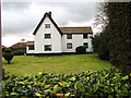
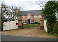

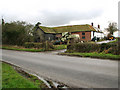
22 photos from this area
Area Information
Key information about the NR17 1FF including its size, population, and administrative classification.
- Area Type
- Postcode
- Area Size
- 2.0 hectares
- Population
- 2006
- Population Density
- 323 people/km²
House Prices in NR17 1FF
48
Properties
£263,541
Average Sold Price
£192,995
Lowest Price
£426,000
Highest Price
Showing 48 properties
| Address | Type | Beds | Baths | Last Sale Price | Last Sale Date | |
|---|---|---|---|---|---|---|
| 9 Waller Drive, Attleborough, NR17 1FF | house | - | - | £426,000 | Nov 2025 | |
| 32 Waller Drive, Attleborough, NR17 1FF | Detached | 3 | 2 | £271,000 | Sep 2024 | |
| 15 Waller Drive, Attleborough, NR17 1FF | Terraced | 2 | 2 | £202,500 | Apr 2024 | |
| 27 Waller Drive, Attleborough, NR17 1FF | house | - | - | £262,000 | Feb 2024 | |
| 11 Waller Drive, Attleborough, NR17 1FF | house | - | - | £360,000 | Aug 2022 | |
| 13 Waller Drive, Attleborough, NR17 1FF | house | - | - | £285,000 | Aug 2022 | |
| 4 Waller Drive, Attleborough, NR17 1FF | Detached | 4 | 2 | £320,000 | Jul 2021 | |
| 1 Waller Drive, Attleborough, NR17 1FF | Retail | 4 | 2 | £350,000 | Jun 2021 | |
| 3 Waller Drive, Attleborough, NR17 1FF | Detached | - | - | £310,000 | Jun 2021 | |
| 10 Waller Drive, Attleborough, NR17 1FF | house | - | - | £265,000 | Feb 2021 |
Page 1 of 5
Energy Efficiency in NR17 1FF
Amenities
Schools
| Rank | School | Type | Entry gender | Ages |
|---|
Explore more schools in this area
Go to Schools tabDemographics
Household Size
Two person
most common
Accommodation Type
Houses
most common
Tenure
83
majority
Ethnic Group
White
most common
Religion
N/A
most common
Household Composition
N/A
most common
Age
47
median
Adults (30-64 years)
most common
Household Deprivation
N/A
with no deprivation
NS-SEC
30
in Lower managerial occupations
Explore more demographic insights in this area
Go to Demographics tabPlanning
Planning Constraints
- Flood RiskPremium
- Ramsar Wetland SitesPremium
- Area of Outstanding Natural BeautyPremium
- Protected Nature ReservePremium
- Protected WoodlandPremium