Area Overview for NR17 1DG
Photos of NR17 1DG
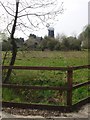
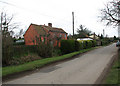
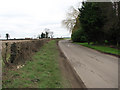
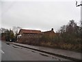
19 photos from this area
Area Information
Key information about the NR17 1DG including its size, population, and administrative classification.
- Area Type
- Postcode
- Area Size
- 71.7 hectares
- Population
- 1297
- Population Density
- 53 people/km²
House Prices in NR17 1DG
43
Properties
£319,500
Average Sold Price
£79,500
Lowest Price
£750,000
Highest Price
Showing 43 properties
| Address | Type | Beds | Baths | Last Sale Price | Last Sale Date | |
|---|---|---|---|---|---|---|
| Ambazac House, Northacre, Caston, NR17 1DG | Detached | 5 | 4 | £750,000 | Aug 2023 | |
| Pine View Cottage, Northacre, Caston, NR17 1DG | Terraced | 2 | 1 | £110,000 | Feb 2023 | |
| Alma House, Northacre, Caston, NR17 1DG | Cottage | 3 | - | £400,000 | Nov 2022 | |
| Abbots Gate Cottage, Northacre, Caston, NR17 1DG | Bungalow | - | - | £263,000 | Oct 2022 | |
| Willow House, Northacre, Caston, NR17 1DG | Detached | 5 | 3 | £481,500 | Dec 2018 | |
| Post Box Bungalow, Northacre, Caston, NR17 1DG | Detached | - | - | £190,000 | Oct 2018 | |
| Clay Cottage, Northacre, Caston, NR17 1DG | Cottage | 5 | 2 | £675,000 | Jan 2018 | |
| Northfields, Northacre, Caston, NR17 1DG | house | - | - | £147,500 | Oct 2017 | |
| Jasmine Barn, Northacre, Caston, NR17 1DG | Semi-detached | 4 | - | £390,000 | Feb 2016 | |
| Foxley, Northacre, Caston, NR17 1DG | Bungalow | 4 | - | £272,500 | May 2015 |
Page 1 of 5
Energy Efficiency in NR17 1DG
Amenities
Schools
| Rank | School | Type | Entry gender | Ages |
|---|
Explore more schools in this area
Go to Schools tabDemographics
Household Size
Two person
most common
Accommodation Type
Houses
most common
Tenure
79
majority
Ethnic Group
White
most common
Religion
N/A
most common
Household Composition
N/A
most common
Age
47
median
Adults (30-64 years)
most common
Household Deprivation
N/A
with no deprivation
NS-SEC
35
in Lower managerial occupations
Explore more demographic insights in this area
Go to Demographics tabPlanning
Planning Constraints
- Flood RiskPremium
- Ramsar Wetland SitesPremium
- Area of Outstanding Natural BeautyPremium
- Protected Nature ReservePremium
- Protected WoodlandPremium