Area Overview for NR17 1AA
Photos of NR17 1AA
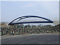

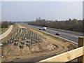
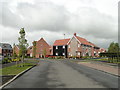
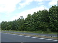


22 photos from this area
Area Information
Key information about the NR17 1AA including its size, population, and administrative classification.
- Area Type
- Postcode
- Area Size
- 6.7 hectares
- Population
- 1869
- Population Density
- 3880 people/km²
House Prices in NR17 1AA
41
Properties
£298,045
Average Sold Price
£105,000
Lowest Price
£680,000
Highest Price
Showing 41 properties
| Address | Type | Beds | Baths | Last Sale Price | Last Sale Date | |
|---|---|---|---|---|---|---|
| Glenross, West Carr Road, Attleborough, NR17 1AA | Bungalow | - | - | £345,000 | Jul 2025 | |
| The Cherries, West Carr Road, Attleborough, NR17 1AA | Detached | 5 | 1 | £400,000 | Dec 2024 | |
| Willowdale, West Carr Road, Attleborough, NR17 1AA | Detached | 6 | 2 | £680,000 | Jun 2024 | |
| Timaru, West Carr Road, Attleborough, NR17 1AA | Bungalow | - | - | £325,000 | Sep 2021 | |
| The Cannons, West Carr Road, Attleborough, NR17 1AA | Bungalow | - | - | £350,000 | May 2021 | |
| Sandown, West Carr Road, Attleborough, NR17 1AA | Bungalow | 3 | - | £390,000 | May 2021 | |
| Westland House, West Carr Road, Attleborough, NR17 1AA | house | - | - | £380,000 | Mar 2021 | |
| Orchard End, West Carr Road, Attleborough, NR17 1AA | Bungalow | 4 | - | £317,000 | Feb 2021 | |
| Honeysuckle Cottage, 3B West Carr Road, Attleborough, NR17 1AA | Terraced | 2 | 1 | £195,000 | Aug 2018 | |
| Day Break, West Carr Road, Attleborough, NR17 1AA | Bungalow | 2 | 2 | £290,000 | Jul 2018 |
Page 1 of 5
Energy Efficiency in NR17 1AA
Amenities
Schools
| Rank | School | Type | Entry gender | Ages |
|---|
Explore more schools in this area
Go to Schools tabDemographics
Household Size
Two person
most common
Accommodation Type
Houses
most common
Tenure
80
majority
Ethnic Group
White
most common
Religion
N/A
most common
Household Composition
N/A
most common
Age
47
median
Adults (30-64 years)
most common
Household Deprivation
N/A
with no deprivation
NS-SEC
33
in Lower managerial occupations
Explore more demographic insights in this area
Go to Demographics tabPlanning
Planning Constraints
- Flood RiskPremium
- Ramsar Wetland SitesPremium
- Area of Outstanding Natural BeautyPremium
- Protected Nature ReservePremium
- Protected WoodlandPremium