Area Overview for NR16 2EP
Photos of NR16 2EP
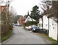
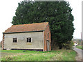
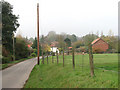
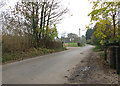
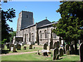
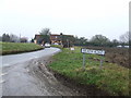
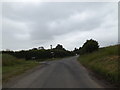
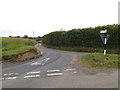
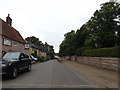
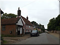
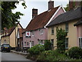
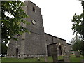
46 photos from this area
Area Information
Key information about the NR16 2EP including its size, population, and administrative classification.
- Area Type
- Postcode
- Area Size
- 44.5 hectares
- Population
- 2394
- Population Density
- 67 people/km²
House Prices in NR16 2EP
77
Properties
£324,903
Average Sold Price
£30,000
Lowest Price
£770,000
Highest Price
Showing 77 properties
| Address | Type | Beds | Baths | Last Sale Price | Last Sale Date | |
|---|---|---|---|---|---|---|
| Woodwell Furlong, East Church Street, Kenninghall, NR16 2EP | Detached | 4 | 3 | £770,000 | Mar 2025 | |
| Ollys Cottage, East Church Street, Kenninghall, NR16 2EP | Cottage | 3 | 2 | £280,000 | May 2024 | |
| Faith Cottage, East Church Street, Kenninghall, NR16 2EP | Semi-detached | 3 | 1 | £440,000 | May 2024 | |
| The Shop House, East Church Street, Kenninghall, NR16 2EP | Cottage | 4 | 3 | £490,000 | Mar 2024 | |
| Avalon, East Church Street, Kenninghall, NR16 2EP | Detached | 3 | 1 | £300,000 | Sep 2023 | |
| Grange Farm, East Church Street, Kenninghall, NR16 2EP | Detached | 5 | 4 | £250,000 | Aug 2023 | |
| The Shielings, East Church Street, Kenninghall, NR16 2EP | Detached | 4 | 2 | £620,000 | Jan 2023 | |
| Shabou Cottage, East Church Street, Kenninghall, NR16 2EP | house | - | - | £596,000 | Aug 2021 | |
| Cleland House, East Church Street, Kenninghall, NR16 2EP | house | - | - | £481,000 | Aug 2021 | |
| White Haven, East Church Street, Kenninghall, NR16 2EP | Detached | 3 | 2 | £425,000 | May 2021 |
Page 1 of 8
Energy Efficiency in NR16 2EP
Amenities
Schools
| Rank | School | Type | Entry gender | Ages |
|---|
Explore more schools in this area
Go to Schools tabDemographics
Household Size
Two person
most common
Accommodation Type
Houses
most common
Tenure
76
majority
Ethnic Group
White
most common
Religion
N/A
most common
Household Composition
N/A
most common
Age
47
median
Adults (30-64 years)
most common
Household Deprivation
N/A
with no deprivation
NS-SEC
37
in Lower managerial occupations
Explore more demographic insights in this area
Go to Demographics tabPlanning
Planning Constraints
- Flood RiskPremium
- Ramsar Wetland SitesPremium
- Area of Outstanding Natural BeautyPremium
- Protected Nature ReservePremium
- Protected WoodlandPremium