Area Overview for NR16 2BZ
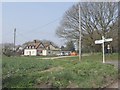
Photos of NR16 2BZ
Area Information
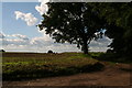
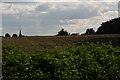
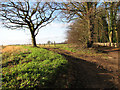
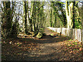
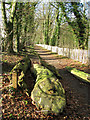
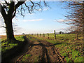
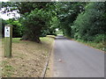
Living in NR16 2BZ means residing within a small, specific residential cluster covering 33.4 hectares. The area accommodates a population of 2,201 people, resulting in a low density of just 46 people per square kilometre. This postcode represents a quiet suburban environment where neighbours are close but individual space is not compromised by overcrowding. You will find a setting that prioritises privacy while remaining connected to the wider rural-urban fringe of Norfolk. The layout fosters a community feel where residents likely know one another from daily encounters in village green spaces or local lanes. Because the footprint is compact, daily errands often require only a short walk or a quick car journey to the wider network of towns surrounding Attleborough. The area functions as a distinct bubble of calm compared to more commercial centres, yet it benefits from excellent proximity to essential services. Your morning commute or evening stroll unfolds across green spaces and tree-lined streets typical of this part of the county. The specific nature of this small settlement creates a sense of place that larger developments often fail to replicate.
- Area Type
- Postcode
- Area Size
- 33.4 hectares
- Population
- 2201
- Population Density
- 46 people/km²
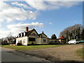
The property market in NR16 2BZ is defined by a heavy weight of owner-occupied housing. With 66% of residents owning their homes, the area is not driven by short-term letting or student rentals. Instead, the housing stock reflects families who have invested in NR16 2BZ as their long-term base. Houses represent the primary accommodation type found across the postcode, meaning you will encounter single-family dwellings rather than high-rise flats or semi-detached rows. This private tenure structure often results in better-maintained gardens and exteriors, as owners have direct incentive to keep their property presentable. The low population density of 46 people per square kilometre further emphasises that this is a household-centric market. Buyers seeking entry into this sector can expect to find more generous plot sizes and traditional building styles. The market dynamics here differ significantly from urban fringes where landlord competition drives turnover. Prospective buyers should look for homes that offer space and perimeter boundaries, which are standard features in this specific cluster. The consistency of tenure types provides a stable backdrop for understanding what you are purchasing.
House Prices in NR16 2BZ
Showing 4 properties
| Address | Type | Beds | Baths | Last Sale Price | Last Sale Date | |
|---|---|---|---|---|---|---|
| 2, Hall Farm Cottage, New Buckenham Road, Banham, NR16 2BZ | Cottage | 3 | 1 | - | - | |
| Banham Hall, New Buckenham Road, Banham, NR16 2BZ | Cottage | 3 | 1 | - | - | |
| 1, Hall Farm Cottage, New Buckenham Road, Banham, NR16 2BZ | house | 3 | 1 | - | - | |
| Hall Farm Cottage, New Buckenham Road, Banham, NR16 2BZ | Semi-detached | - | - | - | - |
Energy Efficiency in NR16 2BZ
Your lifestyle in NR16 2BZ revolved around convenient access to essential retail and transport hubs nearby. Four railway stations are within practical reach, including Eccles Road Railway Station, Attleborough Railway Station, and Spooner Row Railway Station. This rail connectivity allows you to commute to larger towns or connect to London-mainline services with minimal transfer hassle. For shopping requirements, five major retailers serve the local area. Asda Snetterton, Sainsburys Attleborough, and Lidl Attleborough are all accessible within a short drive. These supermarkets provide you with everything from fresh produce to household essentials without lengthy travel times. You do not need to venture far to restock your kitchen or buy weekly groceries. The presence of these large retailers contrasts with the small footprint of the residential cluster, offering a balance between quiet living and commercial convenience. Dining out, leisure activities, and further shopping are available in the surrounding towns linked by these transport routes. Your day-to-day life benefits from this dual access to rural peace and urban utility.
Amenities
Schools
Families living in NR16 2BZ have access to a diverse mix of educational institutions nearby. Banham Community Primary School serves as a local primary option for younger children. Eccles, Hargham and Wilby CofE Primary School offers a church-affiliated education for elementary-aged pupils. Parents requiring specialist support can consider Aurora Eccles School or Banham Marshalls College, both classified as special schools within the immediate vicinity. For those seeking independent education, Church Hill School is located close enough to be a practical choice. This variety ensures that regardless of specific educational needs or philosophical preferences, suitable options exist within your reach. The presence of multiple primary schools indicates a catchment area designed to serve a resident population of roughly 2,200 people. You do not need to travel far to find a classroom that matches your child's requirements. The range from community and church schools to special needs and independent provision creates a comprehensive local offering. When researching schools near NR16 2BZ, you will find sufficient choice to suit different family configurations.
| Rank | School | Type | Entry gender | Ages |
|---|
Explore more schools in this area
Go to Schools tabDemographics
The community in NR16 2BZ is characterised by a mature population with a median age of 47 years. You will find that adults between the ages of 30 and 64 constitute the most common age range within the cluster. This demographic profile suggests a neighbourhood dominated by those with established careers and families, rather than young professionals or empty nesters. Home ownership stands at a high level of 66%, indicating that most residents have purchased their properties and put down roots in the local market. Houses form the predominant accommodation type, reflecting a traditional architectural style suited to a low-density settlement. Data regarding deprivation is not provided in the current assessment, so the focus remains on the clear indicators of stability. The demographic data points to a community where long-term residents value the local schools and amenities. The predominant ethnic group is White, mirroring the broader trends seen in many established Norfolk villages and suburbs. Life here involves a steady pace that aligns with the life stages of middle-aged adults.
Household Size
Accommodation Type
Tenure
Ethnic Group
Religion
Household Composition
Age
Household Deprivation
NS-SEC
Explore more demographic insights in this area
Go to Demographics tabPlanning
Planning Constraints
- Flood RiskPremium
- Ramsar Wetland SitesPremium
- Area of Outstanding Natural BeautyPremium
- Protected Nature ReservePremium
- Protected WoodlandPremium