Area Overview for NR16 1QY
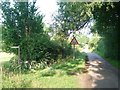
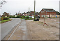
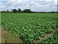
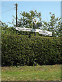
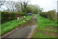
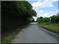
Photos of NR16 1QY

Area Information
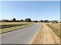
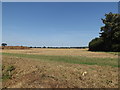
The postcode NR16 1QY represents a compact residential cluster covering 15.8 hectares in Norfolk. This small area houses 1,230 residents, creating a low-density living environment with 106 people per square kilometre. You will find that life here is defined by space and a quiet pace, distinct from the denser urban centres of the east of England. The geography of this specific location prioritises households over high-rise developments, offering an intimate sense of community within a larger county context. As you consider homes in NR16 1QY, recognise that you are entering a setting where every individual's presence is noticeable. The area functions as a stable housing catchment point, balancing accessibility with the privacy that many buyers seek when they research properties in this part of Norfolk. Daily routines involve short commutes and easy access to local facilities, making it a practical base for those prioritising a non-urban lifestyle.
- Area Type
- Postcode
- Area Size
- 15.8 hectares
- Population
- 1230
- Population Density
- 106 people/km²
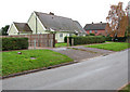
The housing landscape in NR16 1QY is characterised by a strong presence of owner-occupiers. You will observe that 74% of residents hold ownership of their property, indicating a market driven by those who have settled permanently rather than tenants looking for short-term arrangements. Consequently, the accommodation type is almost entirely made up of houses, with no recorded flats or apartments within this specific cluster. This composition means that buyers looking for a garage, a garden, or substantial indoor space will find exactly what they require in this area. The dominance of house ownership also often implies a slower-moving market where sellers are less likely to rush transactions. If you are viewing homes in NR16 1QY, expect to engage with vendors who have deep roots in the locality. The lack of rental stock further confirms that this is a territory for those buying to live in, not for investors seeking high yield from student or young professional lodgers.
House Prices in NR16 1QY
Showing 32 properties
| Address | Type | Beds | Baths | Last Sale Price | Last Sale Date | |
|---|---|---|---|---|---|---|
| 153 Bunwell Street, Bunwell, NR16 1QY | Detached | 5 | 3 | £590,000 | Sep 2024 | |
| The Edge, 155 Bunwell Street, Bunwell, NR16 1QY | house | - | - | £610,000 | Apr 2024 | |
| 145 Bunwell Street, Bunwell, NR16 1QY | house | - | - | £615,000 | Dec 2023 | |
| 149 Bunwell Street, Bunwell, NR16 1QY | house | - | - | £633,488 | Sep 2023 | |
| 147 Bunwell Street, Bunwell, NR16 1QY | house | - | - | £714,000 | Aug 2023 | |
| 151 Bunwell Street, Bunwell, NR16 1QY | house | - | - | £675,000 | Jul 2023 | |
| 131 Bunwell Street, Bunwell, NR16 1QY | house | - | - | £410,000 | Dec 2022 | |
| 154 Bunwell Street, Bunwell, NR16 1QY | Bungalow | - | - | £235,000 | Oct 2022 | |
| 143 Bunwell Street, Bunwell, NR16 1QY | house | - | - | £595,000 | May 2022 | |
| 156 Bunwell Street, Bunwell, NR16 1QY | Semi-detached | 2 | 1 | £185,000 | Jul 2021 |
Energy Efficiency in NR16 1QY
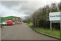
Your daily life in NR16 1QY is supported by a practical network of amenities within walking or driving distance. Three railway stations serve the broader locality, including Spooner Row, Attleborough, and Wymondham, providing straightforward rail links to Norwich and London. For shopping needs, you have five notable retail points, such as the M&S Besthorpe BP, the Co-op MRMF, and the East of England Co-operative. Although the amenity count is modest compared to city centres, these locations cover essential groceries and daily essentials, reducing the need for lengthy car journeys for routine tasks. Wymondham Abbey stands as a single notable point of interest, offering historical engagement and leisure activity close by. This configuration creates a lifestyle where convenience relies on a small selection of high-quality services rather than a sprawling high street. You will find that errands can be completed efficiently, allowing you to return to the peace of your home quickly after visiting shops or attractions.
Amenities
Schools
Families considering NR16 1QY have access to three primary schools within a practical reach. Bunwell Primary School serves as a local option and currently holds a satisfactory Ofsted rating. Approximately half a mile away, you will find Carleton Rode Church of England Voluntary Aided Primary School, which also carries a satisfactory rating from inspectors. Because both schools listed in the immediate vicinity are primary institutions, parents must plan ahead as children typically move to secondary schools outside this specific catchment range. The absence of a secondary school within the immediate area is a crucial factor for anyone evaluating homes in NR16 1QY. The presence of two primary schools with satisfactory grades provides a reliable education base for young children, though you will need to research the secondary options near Attleborough or Wymondham for older pupils. This mix necessitates that you factor transport to secondary education into your total cost of living.
| Rank | School | Type | Entry gender | Ages |
|---|
Explore more schools in this area
Go to Schools tabDemographics
You will discover that the community in NR16 1QY skews towards maturity, with a median age of 47 years. The most common age range consists of adults between 30 and 64 years, confirming that the area attracts established families and professionals rather than young students or transient workers. Ownership is the dominant model here, with 74% of residents owning their homes outright or with a mortgage. This high level of tenure suggests stability and long-term commitment to the neighbourhood. Almost exclusively, the accommodation type consists of houses, meaning you will not find tower blocks or purpose-built flats within this postcode. The predominant ethnic group is White, aligning with the broader demographic profile of rural Norfolk. These figures indicate a traditional, settled neighbourhood where neighbours have often known each other for decades. Such a population structure typically correlates with well-maintained properties and a focus on family-oriented values.
Household Size
Accommodation Type
Tenure
Ethnic Group
Religion
Household Composition
Age
Household Deprivation
NS-SEC
Explore more demographic insights in this area
Go to Demographics tabPlanning
Planning Constraints
- Flood RiskPremium
- Ramsar Wetland SitesPremium
- Area of Outstanding Natural BeautyPremium
- Protected Nature ReservePremium
- Protected WoodlandPremium