Area Overview for NR16 1NA
Photos of NR16 1NA
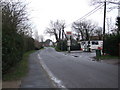
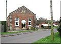
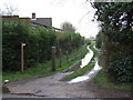
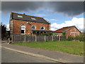
4 photos from this area
Area Information
Key information about the NR16 1NA including its size, population, and administrative classification.
- Area Type
- Postcode
- Area Size
- 54.7 hectares
- Population
- 1230
- Population Density
- 106 people/km²
House Prices in NR16 1NA
57
Properties
£343,938
Average Sold Price
£70,000
Lowest Price
£600,000
Highest Price
Showing 57 properties
| Address | Type | Beds | Baths | Last Sale Price | Last Sale Date | |
|---|---|---|---|---|---|---|
| 64 Bunwell Street, Bunwell, NR16 1NA | Detached | 4 | 2 | £475,000 | Oct 2025 | |
| 40 Bunwell Street, Bunwell, NR16 1NA | Bungalow | 4 | 1 | £525,000 | Jun 2024 | |
| 34 Bunwell Street, Carleton Rode, NR16 1NA | Detached | 3 | 2 | £495,000 | Jun 2022 | |
| 50 Bunwell Street, Bunwell, NR16 1NA | Detached | 4 | 4 | £520,000 | Jan 2022 | |
| 1 Bunwell Street, Bunwell, NR16 1NA | Bungalow | 4 | 3 | £410,000 | Mar 2021 | |
| 35 Bunwell Street, Bunwell, NR16 1NA | Bungalow | 4 | 1 | £420,000 | Aug 2020 | |
| 33 Bunwell Street, Bunwell, NR16 1NA | Detached | - | - | £180,000 | Feb 2020 | |
| 42 Bunwell Street, Bunwell, NR16 1NA | Detached | - | - | £162,500 | Apr 2019 | |
| 23 Bunwell Street, Bunwell, NR16 1NA | Character Property | 4 | 1 | £375,000 | Jun 2018 | |
| 37 Bunwell Street, Bunwell, NR16 1NA | Detached | 4 | 2 | £440,000 | Mar 2018 |
Page 1 of 6
Energy Efficiency in NR16 1NA
Amenities
Schools
| Rank | School | Type | Entry gender | Ages |
|---|
Explore more schools in this area
Go to Schools tabDemographics
Household Size
Two person
most common
Accommodation Type
Houses
most common
Tenure
74
majority
Ethnic Group
White
most common
Religion
N/A
most common
Household Composition
N/A
most common
Age
47
median
Adults (30-64 years)
most common
Household Deprivation
N/A
with no deprivation
NS-SEC
36
in Lower managerial occupations
Explore more demographic insights in this area
Go to Demographics tabPlanning
Planning Constraints
- Flood RiskPremium
- Ramsar Wetland SitesPremium
- Area of Outstanding Natural BeautyPremium
- Protected Nature ReservePremium
- Protected WoodlandPremium