Area Overview for NR15 2UF
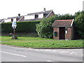
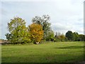
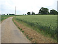
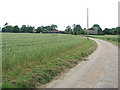
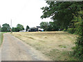
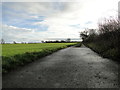
Photos of NR15 2UF
Area Information
Living in NR15 2UF means settling into a compact residential cluster defined by its specific postcode. This area spans 24.1 hectares and hosts a population of 1,727 people. You will find a quiet environment where space is plentiful relative to the number of residents. The population density sits at 128 people per square kilometre, ensuring a low-key atmosphere compared to denser urban centres. Daily life here revolves around a close-knit presence within a clearly defined boundary. The area functions as a self-contained community where residents know their immediate surroundings intimately. You are looking at a neighbourhood that balances isolation with accessibility to wider networks. The physical layout supports a pace of life that does not demand constant engagement with noise or crowds. Prospective buyers visiting NR15 2UF note the simplicity of the local geography. It is a place where the character of the home dominates the experience. You will appreciate the lack of congestion in both the streets and the public spaces. This small footprint allows for strong neighbourly connections without the pressure of high-rise living. The area stands as a distinct option for those seeking stability and a measured approach to suburban life.
- Area Type
- Postcode
- Area Size
- 24.1 hectares
- Population
- 1727
- Population Density
- 128 people/km²
The housing market in NR15 2UF is defined by a dominance of owner-occupied homes. With a home ownership level of 81%, this area serves primarily as a destination for people who have purchased their residences. The accommodation type is exclusively houses, offering a mix of detached and semi-detached properties typical of rural or semi-rural settings. You will find few rental properties or shared living arrangements among the 1,727 residents. This high ownership rate indicates that the local housing stock has been successfully purchased by previous occupants. Buyers considering homes in NR15 2UF should expect properties with gardens and outdoor space. The market favours stability, as owners tend to stay in their neighbourhoods for extended periods. Houses here are geared towards families and individuals seeking a permanent base. The lack of flats aligns with the broader demographic trend of older households and children. When viewing properties, you are looking at real estate built for living rather than short-term lettings. The 81% figure reflects a robust commitment to homeownership within this specific cluster. Potential buyers benefit from an established pricing structure driven by owner turnover. The area remains a stronghold for those seeking to secure a property for themselves.
House Prices in NR15 2UF
Showing 9 properties
| Address | Type | Beds | Baths | Last Sale Price | Last Sale Date | |
|---|---|---|---|---|---|---|
| Wacton Weary, Stratton Road, Wacton, NR15 2UF | Bungalow | - | - | £298,000 | Jul 2016 | |
| Tichwood, Stratton Road, Wacton, NR15 2UF | Bungalow | - | - | £330,000 | Mar 2008 | |
| Beech Cottage, Stratton Road, Wacton, NR15 2UF | Detached | - | - | £205,000 | Aug 2001 | |
| The Cottage Wacton House, Church Road, Wacton, NR15 2UF | Detached | 8 | - | - | - | |
| Flat 2, The Old Rectory, Stratton Road, Wacton, NR15 2UF | Maisonette | 4 | - | - | - | |
| Holly Tree Lodge, Stratton Road, Wacton, NR15 2UF | Detached | - | - | - | - | |
| Dunston Harriers Kennels, Kennels, Stratton Road, Wacton, NR15 2UF | commercial | - | - | - | - | |
| Flat 1, The Old Rectory, Stratton Road, Wacton, NR15 2UF | Flat | - | - | - | - | |
| Achilles, Stratton Road, Wacton, NR15 2UF | Detached | - | - | - | - |
Energy Efficiency in NR15 2UF
Your daily life in NR15 2UF centres on a convenience radius of local retail outlets within practical reach. There are three main retail options available to you, ensuring essential shopping needs are met without long journeys. You can visit the East of England Co-operative Co for groceries, or the Morrisons Daily for a broader range of foods. The Co-op Mulbarton also serves as a convenient stop for household essentials and supplies. These three notable venues form the backbone of local retail activity in the postcode. Residents do not need to travel far to access fresh produce, toiletries, or daily necessities. The layout of these shops caters to the 81% of residents who live in houses and require regular household replenishment. While the area is small, these specific amenities provide sufficient variety for ordinary weekly routines. You will find parking accessible near these locations, adding to the convenience of your visits. The presence of three distinct retailers ensures competition on prices and service quality. This retail mix supports the community feel celebrated by the majority of home owners. Living here means your shopping trips are short, predictable, and integrated into your daily schedule.
Amenities
Schools
| Rank | School | Type | Entry gender | Ages |
|---|
Explore more schools in this area
Go to Schools tabDemographics
The community character of NR15 2UF is shaped by a mature household profile. The median age is 47 years, indicating a demographic skew towards families with school-aged children and older professionals. Most residents fall into the age range of 30 to 64 years, creating a stable social fabric. You will encounter a neighbourhood where long-term residents form the backbone of the social structure. Home ownership stands at an impressive 81%, revealing that the majority of households have purchased their properties outright. This high rate suggests a settled community rather than a transient rental market. Almost all accommodation in this postcode area consists of houses, meaning you will not see flats or purpose-built rental blocks. The predominant ethnic group is White, reflecting the traditional composition of the locality. You can expect a homogenous community where shared cultural values are common. The demographic data points to a family-oriented environment. An 81% ownership rate means most neighbours are invested in improving their local streets. The age distribution ensures a steady presence in local shops and schools throughout the week. Living here offers the benefits of an established community with deep roots.
Household Size
Accommodation Type
Tenure
Ethnic Group
Religion
Household Composition
Age
Household Deprivation
NS-SEC
Explore more demographic insights in this area
Go to Demographics tabPlanning
Planning Constraints
- Flood RiskPremium
- Ramsar Wetland SitesPremium
- Area of Outstanding Natural BeautyPremium
- Protected Nature ReservePremium
- Protected WoodlandPremium