Area Overview for NR15 2PF
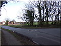
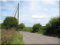
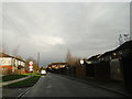
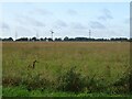
Photos of NR15 2PF


Area Information
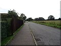
Living in NR15 2PF offers a quiet residential experience within a compact cluster of just 12.3 hectares. This specific postcode covers a small residential area that forms part of the broader NR15 region in England. You will find a settled community of 1,727 people residing across this modest footprint, resulting in a population density of 128 people per square kilometre. The area feels spacious yet connected, typical of established clusters where homes sit comfortably apart from one another. Daily life here revolves around a sense of stability, supported by the fact that the majority of residents are homeowners. While specific street names are not detailed in the current profile, the demographic makeup suggests an environment where long-term residents value their surroundings. You are stepping into a setting where the pace is likely measured, suited to those who prefer a neighbourhood defined by low density rather than high-rise living. The small geographical size means that amenities in the wider NR15 postcode area are often within easy reach without the need for long drives. This specific cluster provides a foundation for a life where the quiet of the countryside meets the convenience of nearby services.
- Area Type
- Postcode
- Area Size
- 12.3 hectares
- Population
- 1727
- Population Density
- 128 people/km²
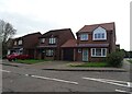
The housing stock in NR15 2PF leans heavily towards permanent residence rather than speculative buying or short-term letting. Eighty-one per cent of properties are owned by their occupants, which clearly establishes this as an owner-occupied market rather than a rental hub. Houses form the primary accommodation type, meaning you can expect terraced, semi-detached, or detached homes designed for long-term dwelling rather than urban flats or purpose-built Lodgers blocks. When you look at homes in NR15 2PF, the high ownership rate suggests that many streets feature families who have lived there for decades. This market dynamic often leads to stable neighbourhood values, as owners typically make maintenance decisions that protect property standards. There is very little evidence of a transient population moving through the area annually. You should approach viewings with an understanding that pricing will reflect owner-only sentiment, often driven by the desire to maintain a home for decades rather than quick flips. Whether you are a local upgrading or an external buyer seeking a family base, the prevalence of houses offers the space and privacy standard for English residential living. This concentration of ownership creates a predictable market where supply comes primarily from individuals staying in the community for the short to medium term.
House Prices in NR15 2PF
Showing 1 properties
| Address | Type | Beds | Baths | Last Sale Price | Last Sale Date | |
|---|---|---|---|---|---|---|
| Unit 12D, Salamanca Road, Tharston, NR15 2PF | office_workshop | - | - | - | - |
Energy Efficiency in NR15 2PF
Residents of NR15 2PF enjoy practical access to essential retail services without needing to travel far. Within practical reach of your home, you will find three main retail outlets to satisfy daily shopping needs. The East of England Co-operative Co offers a local cooperative option often favoured by those seeking community-focused shopping. Morrisons Daily provides convenient quick stops for essentials, while Co-op Mulbarton serves as another reliable point for groceries and household items. These venues are situated close enough that you can manage your weekly shop with a short drive or potentially a support vehicle given the area's nature. This arrangement means you do not need to commute into Norfolk city centres for basic provisions. Your lifestyle revolves around these accessible stores, which function as the commercial heart for this 12.3-hectare zone. While there is no data on parks or leisure centres in the immediate immediate vicinity, the presence of these three retail anchors ensures you can handle all domestic purchasing comfortably. When you plan your week, you can structure your errands around visits to either the Co-operative or the Co-op Mulbarton store efficiently.
Amenities
Schools
| Rank | School | Type | Entry gender | Ages |
|---|
Explore more schools in this area
Go to Schools tabDemographics
The community in NR15 2PF is defined by a mature age profile, with a median age of 47 years. Most residents fall into the adult category spanning 30 to 64 years, indicating a household demographic focused on family stability rather than transient student housing. Eighty-one per cent of homes in this area are owner-occupied, signifying a deeply rooted community where people have settled permanently. The predominant accommodation type consists of houses, which aligns with the higher rate of ownership and the need for space suitable for families or retirees. The predominant ethnic group in this area is White, reflecting the traditional composition of many established English villages and neighbourhoods. You can expect a environment where families and empty-nesters coexist comfortably, rather than relying on a high volume of rental properties. This stability means that when you consider homes in NR15 2PF, you are joining an established circle of neighbours who likely share similar life stages. The lack of significant youth coverage in the most common age range suggests that this is not a student hotspot but a place for settled growth. Every statistical detail points toward a reliable, owner-led society that has prioritised putting down roots over short-term renting arrangements.
Household Size
Accommodation Type
Tenure
Ethnic Group
Religion
Household Composition
Age
Household Deprivation
NS-SEC
Explore more demographic insights in this area
Go to Demographics tabPlanning
Planning Constraints
- Flood RiskPremium
- Ramsar Wetland SitesPremium
- Area of Outstanding Natural BeautyPremium
- Protected Nature ReservePremium
- Protected WoodlandPremium