Area Overview for NR15 1TS
Photos of NR15 1TS

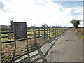
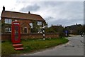
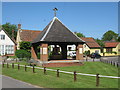
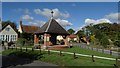
56 photos from this area
Area Information
Key information about the NR15 1TS including its size, population, and administrative classification.
- Area Type
- Postcode
- Area Size
- 47.9 hectares
- Population
- 1239
- Population Density
- 54 people/km²
House Prices in NR15 1TS
23
Properties
£371,542
Average Sold Price
£16,000
Lowest Price
£610,000
Highest Price
Showing 23 properties
| Address | Type | Beds | Baths | Last Sale Price | Last Sale Date | |
|---|---|---|---|---|---|---|
| Bethsalem, Cargate Lane, Saxlingham Nethergate, NR15 1TS | Detached | 4 | 2 | £610,000 | Sep 2020 | |
| Homecroft, Cargate Lane, Saxlingham Nethergate, NR15 1TS | Bungalow | 3 | 2 | £450,000 | Oct 2019 | |
| 1 Cargate Lane, Saxlingham Nethergate, NR15 1TS | Detached | 5 | 2 | £355,000 | Sep 2016 | |
| Greenacres, Cargate Lane, Saxlingham Nethergate, NR15 1TS | house | - | - | £517,505 | Jun 2016 | |
| 4 Cargate Lane, Saxlingham Nethergate, NR15 1TS | Detached | 5 | 2 | £433,000 | Oct 2015 | |
| High Oak House, Cargate Lane, Saxlingham Nethergate, NR15 1TS | Detached | 4 | - | £475,000 | Oct 2014 | |
| 3 Cargate Lane, Saxlingham Nethergate, NR15 1TS | Detached | 4 | - | £362,000 | Aug 2014 | |
| Bluebell Cottage, Cargate Lane, Saxlingham Nethergate, NR15 1TS | Detached | 3 | - | £342,500 | May 2014 | |
| Coraleen, Cargate Lane, Saxlingham Nethergate, NR15 1TS | Semi-detached | 2 | - | £110,000 | May 2013 | |
| Field End House, Cargate Lane, Saxlingham Nethergate, NR15 1TS | house | - | - | £442,500 | Dec 2008 |
Page 1 of 3
Energy Efficiency in NR15 1TS
Amenities
Schools
| Rank | School | Type | Entry gender | Ages |
|---|
Explore more schools in this area
Go to Schools tabDemographics
Household Size
Two person
most common
Accommodation Type
Houses
most common
Tenure
83
majority
Ethnic Group
White
most common
Religion
N/A
most common
Household Composition
N/A
most common
Age
47
median
Adults (30-64 years)
most common
Household Deprivation
N/A
with no deprivation
NS-SEC
47
in Lower managerial occupations
Explore more demographic insights in this area
Go to Demographics tabPlanning
Planning Constraints
- Flood RiskPremium
- Ramsar Wetland SitesPremium
- Area of Outstanding Natural BeautyPremium
- Protected Nature ReservePremium
- Protected WoodlandPremium