Area Overview for NR14 8BU
Photos of NR14 8BU
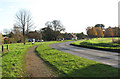
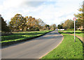
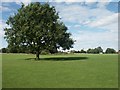
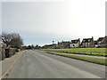
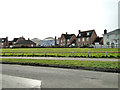
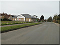
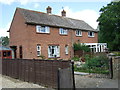
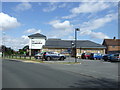
24 photos from this area
Area Information
Key information about the NR14 8BU including its size, population, and administrative classification.
- Area Type
- Postcode
- Area Size
- 3.2 hectares
- Population
- 2048
- Population Density
- 1051 people/km²
House Prices in NR14 8BU
57
Properties
£209,832
Average Sold Price
£70,000
Lowest Price
£375,000
Highest Price
Showing 57 properties
| Address | Type | Beds | Baths | Last Sale Price | Last Sale Date | |
|---|---|---|---|---|---|---|
| 79 Southern Reach, Mulbarton, NR14 8BU | Bungalow | 3 | 2 | £325,000 | Mar 2025 | |
| 73 Southern Reach, Mulbarton, NR14 8BU | Semi-detached | 2 | 1 | £275,000 | Oct 2023 | |
| 9 Southern Reach, Mulbarton, NR14 8BU | Bungalow | 3 | 1 | £375,000 | Apr 2023 | |
| Jentfors, 35 Southern Reach, Mulbarton, NR14 8BU | house | 2 | - | £338,000 | Sep 2021 | |
| 39 Southern Reach, Mulbarton, NR14 8BU | house | - | - | £290,000 | Apr 2021 | |
| 61 Southern Reach, Mulbarton, NR14 8BU | Detached | 2 | 1 | £192,500 | Apr 2021 | |
| 28 Southern Reach, Mulbarton, NR14 8BU | Semi-detached | 3 | 1 | £210,000 | Jul 2020 | |
| 20 Southern Reach, Mulbarton, NR14 8BU | Bungalow | - | - | £347,500 | Jul 2020 | |
| 32 Southern Reach, Mulbarton, NR14 8BU | Bungalow | 2 | 1 | £210,000 | Aug 2019 | |
| 53 Southern Reach, Mulbarton, NR14 8BU | Bungalow | - | - | £225,000 | May 2019 |
Page 1 of 6
Energy Efficiency in NR14 8BU
Amenities
Schools
| Rank | School | Type | Entry gender | Ages |
|---|
Explore more schools in this area
Go to Schools tabDemographics
Household Size
Family (3-5 people)
most common
Accommodation Type
Houses
most common
Tenure
85
majority
Ethnic Group
White
most common
Religion
N/A
most common
Household Composition
N/A
most common
Age
47
median
Adults (30-64 years)
most common
Household Deprivation
N/A
with no deprivation
NS-SEC
44
in Lower managerial occupations
Explore more demographic insights in this area
Go to Demographics tabPlanning
Planning Constraints
- Flood RiskPremium
- Ramsar Wetland SitesPremium
- Area of Outstanding Natural BeautyPremium
- Protected Nature ReservePremium
- Protected WoodlandPremium