Area Overview for NR14 8AG
Photos of NR14 8AG

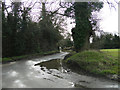
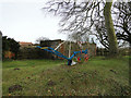
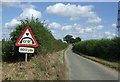
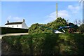
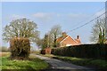

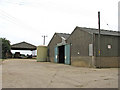
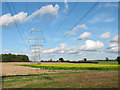
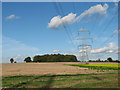
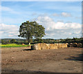
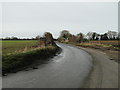
21 photos from this area
Area Information
Key information about the NR14 8AG including its size, population, and administrative classification.
- Area Type
- Postcode
- Area Size
- 80.4 hectares
- Population
- 1953
- Population Density
- 105 people/km²
House Prices in NR14 8AG
37
Properties
£418,833
Average Sold Price
£17,000
Lowest Price
£1,175,000
Highest Price
Showing 37 properties
| Address | Type | Beds | Baths | Last Sale Price | Last Sale Date | |
|---|---|---|---|---|---|---|
| North Barn, 17 Rectory Lane, Mulbarton, NR14 8AG | Semi-detached | 3 | 2 | £625,000 | Feb 2023 | |
| 41 Rectory Lane, Mulbarton, NR14 8AG | Detached | 5 | 3 | £1,175,000 | Nov 2022 | |
| East Cottage, 38 Rectory Lane, Mulbarton, NR14 8AG | Terraced | 3 | - | £300,000 | Apr 2021 | |
| Keshena, 40 Rectory Lane, Mulbarton, NR14 8AG | Detached | 2 | 1 | £275,000 | Sep 2020 | |
| South Barn, 15 Rectory Lane, Mulbarton, NR14 8AG | Semi-detached | 3 | 2 | £369,000 | May 2018 | |
| The Lodge, 43 Rectory Lane, Mulbarton, NR14 8AG | house | 6 | - | £970,000 | Sep 2017 | |
| Beechcroft, 44 Rectory Lane, Mulbarton, NR14 8AG | Detached | 3 | - | £475,000 | Nov 2015 | |
| Walnut Tree Cottage, 28 Rectory Lane, Mulbarton, NR14 8AG | Detached | 4 | 3 | £460,000 | Jun 2015 | |
| 21 Rectory Lane, Mulbarton, NR14 8AG | Cottage | 3 | - | £280,000 | Jun 2013 | |
| 21A Rectory Lane, Mulbarton, NR14 8AG | house | - | - | £392,500 | Mar 2011 |
Page 1 of 4
Energy Efficiency in NR14 8AG
Amenities
Schools
| Rank | School | Type | Entry gender | Ages |
|---|
Explore more schools in this area
Go to Schools tabDemographics
Household Size
Two person
most common
Accommodation Type
Houses
most common
Tenure
83
majority
Ethnic Group
White
most common
Religion
N/A
most common
Household Composition
N/A
most common
Age
47
median
Adults (30-64 years)
most common
Household Deprivation
N/A
with no deprivation
NS-SEC
45
in Lower managerial occupations
Explore more demographic insights in this area
Go to Demographics tabPlanning
Planning Constraints
- Flood RiskPremium
- Ramsar Wetland SitesPremium
- Area of Outstanding Natural BeautyPremium
- Protected Nature ReservePremium
- Protected WoodlandPremium