Area Overview for NR14 7WH
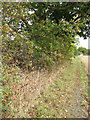
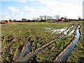
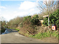
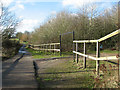
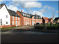
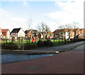
Photos of NR14 7WH


Area Information
Living in NR14 7WH means residing within one of the smallest postcode clusters in England, covering just 4.6 hectares. This compact residential cluster houses a population of 1902 people, creating a tightly knit community where neighbours know each other well. The area sits comfortably in Norfolk, offering a low-density environment that feels distinct from the larger urban centres nearby. You will find a neighbourhood where the size of the footprint allows for quieter streets and a more managed local scene. The demographic makeup skews towards adults, with the majority living within the 30 to 64 year age range. This concentration of working-age adults contributes to a stable community environment without the transient feel of student villages or retirement complexes. Because the area is so small, daily commutes are often shorter than usual, and access to local facilities is immediate. The population density of 406 people per square kilometre suggests a setting that balances suburban openness with local convenience. You can expect a straightforward daily rhythm where local shops and services play a central role in your routine. This specific postcode represents a slice of rural-urban fringe living where the community focus remains high despite its modest size.
- Area Type
- Postcode
- Area Size
- 4.6 hectares
- Population
- 1902
- Population Density
- 406 people/km²
Homes in NR14 7WH present a market dominated by traditional stock, as the accommodation type is strictly houses. With 70% home ownership, this postcode operates as a settled owner-occupied area rather than a volatile rental hub. Buyers looking at this specific cluster should expect properties that have likely been on the market for multiple years, given the low population density and the nature of rural house sales. The absence of flats means options are limited to bungalows, detached homes, or semi-detached pairs common in this Norfolk location. A 4.6 hectare footprint implies a scarcity of edges and gardens, which can limit new developments and maintain price stability. The small population of 1902 means inventory turnover is low, and competition for specific properties might be quiet unless a move is urgently required. You must be prepared to conduct thorough local searches when viewing homes here, as listing data is not always updated in national portals for such small clusters. Selling properties out of this area can take longer due to the niche buyer base. The high ownership percentage suggests that homeowners are generally entrenched in the area, meaning land supply remains fixed and consistent with the total residential area size.
House Prices in NR14 7WH
Showing 31 properties
| Address | Type | Beds | Baths | Last Sale Price | Last Sale Date | |
|---|---|---|---|---|---|---|
| 18 Victory Avenue, Poringland, NR14 7WH | Terraced | 4 | 2 | £350,000 | Oct 2025 | |
| 12 Victory Avenue, Poringland, NR14 7WH | Flat | 1 | 1 | £105,000 | May 2022 | |
| 21 Victory Avenue, Poringland, NR14 7WH | Maisonette | - | - | £195,000 | Jun 2021 | |
| 30 Victory Avenue, Poringland, NR14 7WH | Semi-detached | 4 | 3 | £360,000 | Mar 2021 | |
| 14 Victory Avenue, Poringland, NR14 7WH | Terraced | 1 | 1 | £220,000 | Feb 2021 | |
| 24 Victory Avenue, Poringland, NR14 7WH | Terraced | 3 | 2 | £240,000 | Sep 2019 | |
| 36 Victory Avenue, Poringland, NR14 7WH | Detached | 3 | 2 | £285,000 | Jul 2018 | |
| 5 Victory Avenue, Poringland, NR14 7WH | Detached | 5 | 3 | £445,000 | Feb 2018 | |
| 42 Victory Avenue, Poringland, NR14 7WH | house | - | - | £300,000 | Feb 2018 | |
| 2 Victory Avenue, Poringland, NR14 7WH | Detached | 4 | 3 | £400,000 | Sep 2017 |
Energy Efficiency in NR14 7WH
Daily life in NR14 7WH revolves around a convenient mix of retail and transport options located within practical reach. You have access to five major retail outlets, including Tesco Norwich, Asda Norwich, and Iceland Norwich. These supermarkets provide all daily essentials without the need for extensive travel. For public transport, four railway stations are nearby, including Norwich Railway Station, Brundall Gardens Railway Station, and Brundall Railway Station. This rail connectivity links residents directly to the wider network and London. The area lacks dedicated leisure complexes or parks within the immediate postcode boundary, but the nearby amenities fill this gap effectively. You will not find a cinema or theatre within walking distance, but the retail hubs offer sufficient variety for grocery shopping and household goods. The transport links ensure you can reach larger entertainment venues quickly via train. This arrangement suits families and workers who value accessibility over walking to every amenity. The combination of supermarkets and rail access provides a balanced, functional lifestyle for those living in this small cluster.
Amenities
Schools
| Rank | School | Type | Entry gender | Ages |
|---|
Explore more schools in this area
Go to Schools tabDemographics
The community within NR14 7WH is defined by a mature population profile, with a median age of 47 years. Most residents fall into the adult bracket of 30 to 64 years, reflecting a family-oriented or established professional demographic. Home ownership stands at a robust 70%, indicating that the majority of households have settled deeply into the area rather than renting temporarily. This high ownership rate contrasts with many parts of the country where renting remains dominant. The accommodation type is exclusively houses, confirming that no flats or apartments make up the housing stock in this postcode. You will not find high-rise living or terraced blocks here; the footprint consists solely of detached or semi-detached homes. Diversity data points to a predominantly White ethnic group, which aligns with broader patterns in many parts of rural Norfolk. There is no data on specific deprivation indices for this area, but the high home ownership and stable age profile generally correlate with financial security for local residents. The social fabric is built around long-term residents who own their properties and raise families in a consistent housing environment.
Household Size
Accommodation Type
Tenure
Ethnic Group
Religion
Household Composition
Age
Household Deprivation
NS-SEC
Explore more demographic insights in this area
Go to Demographics tabPlanning
Planning Constraints
- Flood RiskPremium
- Ramsar Wetland SitesPremium
- Area of Outstanding Natural BeautyPremium
- Protected Nature ReservePremium
- Protected WoodlandPremium