Area Overview for NR14 7DA
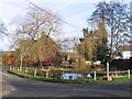
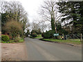
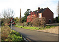
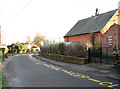
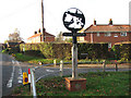
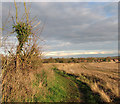
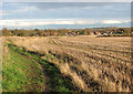
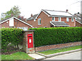
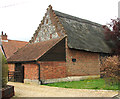
Photos of NR14 7DA


Area Information
NR14 7DA describes a specific residential cluster in Norfolk covering an area of 2.1 hectares. This small grouping holds a population of 1,591 people, creating a close-knit environment where residents know one another. The low population density of 124 people per square kilometre means open space remains a prominent feature of daily life. Living in NR14 7DA offers the quiet of a village without the isolation often found in remote rural locations. You will find this postcode serves as an established homebase rather than a transit hub or commercial centre. The area functions as a stable residential pocket within the wider Broads region.
- Area Type
- Postcode
- Area Size
- 2.1 hectares
- Population
- 1591
- Population Density
- 124 people/km²
Homes in NR14 7DA exist within a market defined by stability and ownership. With 82% of households owning their property, this postcode functions as an owner-occupied zone rather than a rental hotspot. Accommodation type data indicates houses are the standard dwelling, making conversions or maisonettes relatively rare. This structure suits buyers looking to settle permanently rather than those seeking short-term lets or investment properties with high turnover. The mix reflects a traditional rural housing stock rather than a modern build-out. For buyers investigating NR14 7DA, expect to find substantial family homes or cottages that have remained with their original or subsequent owners for generations. This market character reduces the likelihood of aggressive seller financing or speculative developments appearing soon.
House Prices in NR14 7DA
Showing 12 properties
| Address | Type | Beds | Baths | Last Sale Price | Last Sale Date | |
|---|---|---|---|---|---|---|
| 1, Osborne Cottages, Pond Lane, Surlingham, NR14 7DA | Terraced | 3 | - | £210,000 | May 2017 | |
| School Cottage, Pond Lane, Surlingham, NR14 7DA | Cottage | 3 | 2 | £246,000 | Dec 2016 | |
| 2, Osborne Cottages, Pond Lane, Surlingham, NR14 7DA | Terraced | 3 | - | £205,000 | Nov 2014 | |
| 4, Osborne Cottages, Pond Lane, Surlingham, NR14 7DA | Terraced | - | - | £184,950 | Jul 2004 | |
| 14, Southview, Pond Lane, Surlingham, NR14 7DA | house | 3 | 2 | - | - | |
| 5, Acorn Cottage, Osborne Cottages, Pond Lane, Surlingham, NR14 7DA | house | 3 | 2 | - | - | |
| Heimeli, Pond Lane, Surlingham, NR14 7DA | Terraced | - | - | - | - | |
| 3, Osborne Cottages, Pond Lane, Surlingham, NR14 7DA | Terraced | - | - | - | - | |
| 15, Southview, Pond Lane, Surlingham, NR14 7DA | house | - | - | - | - | |
| 13, Southview, Pond Lane, Surlingham, NR14 7DA | house | - | - | - | - |
Energy Efficiency in NR14 7DA
Residents of NR14 7DA rely on nearby amenities for daily shopping and transport needs. Five railway stations lie within practical reach, including Brundall Gardens Railway Station, Brundall Railway Station, and Buckenham Railway Station. These points connect you to wider networks beyond the immediate village. For retail errands, five outlets serve the local community. Co-op 122, Co-op 49-53, and Lidl Poppy are among the notable stores residents visit. Lidl Poppy offers budget groceries, while the Co-op branches provide general merchandise and essentials. While NR14 7DA itself lacks large shopping centres, these distributed facilities ensure you do not need to travel far for daily necessities. The combination of rail access and accessible shops supports a self-sufficient yet connected lifestyle.
Amenities
Schools
Families living near NR14 7DA have access to several primary schools with verified quality ratings. Rockland St Mary Primary School operates in the area and holds a Ofsted rating of good. Surlingham Community Primary School also serves local children with a Ofsted rating of good. Surlingham Primary School is another option nearby, also carrying a good Ofsted rating. These institutions cater exclusively to younger children, as the data lists only primary options. Residents will likely enrol their offspring in one of these state-funded primary establishments before transferring to secondary schools elsewhere. The presence of multiple primary schools with good ratings indicates a supportive local education framework for early childhood through lower secondary years.
| Rank | School | Type | Entry gender | Ages |
|---|
Explore more schools in this area
Go to Schools tabDemographics
The community in NR14 7DA reflects a mature profile with a median age of 47 years. The resident population falls predominantly into the 30 to 64 years age bracket, indicating families and older adults seeking stability rather than rapid urban migration. This demographic skew suggests a neighbourhood built around long-term settlement. Home ownership stands at 82%, confirming that the majority of households have purchased rather than rented their properties. Houses dominate the accommodation landscape, consistent with the older age profile and high ownership rate. The predominant ethnic group is White, aligning with the broader demographic trends of rural Norfolk. An area with such a high home ownership percentage typically implies lower tenancy turnover and more established community roots compared to new estate developments.
Household Size
Accommodation Type
Tenure
Ethnic Group
Religion
Household Composition
Age
Household Deprivation
NS-SEC
Explore more demographic insights in this area
Go to Demographics tabPlanning
Planning Constraints
- Flood RiskPremium
- Ramsar Wetland SitesPremium
- Area of Outstanding Natural BeautyPremium
- Protected Nature ReservePremium
- Protected WoodlandPremium