Area Overview for NR14 6RN
Photos of NR14 6RN
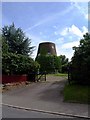
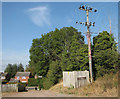
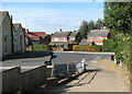
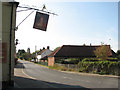
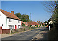
100 photos from this area
Area Information
Key information about the NR14 6RN including its size, population, and administrative classification.
- Area Type
- Postcode
- Area Size
- 12.6 hectares
- Population
- 1254
- Population Density
- 67 people/km²
House Prices in NR14 6RN
27
Properties
£235,143
Average Sold Price
£150,000
Lowest Price
£526,000
Highest Price
Showing 27 properties
| Address | Type | Beds | Baths | Last Sale Price | Last Sale Date | |
|---|---|---|---|---|---|---|
| Brantwood, Church Road, Thurlton, NR14 6RN | house | - | - | £526,000 | Mar 2022 | |
| Greenwood, Church Road, Thurlton, NR14 6RN | Bungalow | 2 | 1 | £220,000 | Oct 2018 | |
| 17 Church Road, Thurlton, NR14 6RN | Bungalow | 3 | 1 | £160,000 | Oct 2015 | |
| 15 Church Road, Thurlton, NR14 6RN | Bungalow | 3 | - | £150,000 | Apr 2015 | |
| Badgers Holt, Church Road, Thurlton, NR14 6RN | Semi-detached | - | - | £245,000 | May 2004 | |
| 21 Church Road, Thurlton, NR14 6RN | Bungalow | - | - | £165,000 | Jun 2003 | |
| Nutwood, Church Road, Thurlton, NR14 6RN | Semi-detached | - | - | £180,000 | Apr 2003 | |
| Sweetbriar, Church Road, Thurlton, NR14 6RN | Bungalow | 3 | 1 | - | - | |
| 19 Church Road, Thurlton, NR14 6RN | Bungalow | 3 | 2 | - | - | |
| Highland, Church Road, Thurlton, NR14 6RN | Bungalow | 3 | 1 | - | - |
Page 1 of 3
Energy Efficiency in NR14 6RN
Amenities
Schools
| Rank | School | Type | Entry gender | Ages |
|---|
Explore more schools in this area
Go to Schools tabDemographics
Household Size
Two person
most common
Accommodation Type
Houses
most common
Tenure
83
majority
Ethnic Group
White
most common
Religion
N/A
most common
Household Composition
N/A
most common
Age
47
median
Adults (30-64 years)
most common
Household Deprivation
N/A
with no deprivation
NS-SEC
35
in Lower managerial occupations
Explore more demographic insights in this area
Go to Demographics tabPlanning
Planning Constraints
- Flood RiskPremium
- Ramsar Wetland SitesPremium
- Area of Outstanding Natural BeautyPremium
- Protected Nature ReservePremium
- Protected WoodlandPremium