Area Overview for NR13 6TB
Photos of NR13 6TB
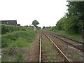
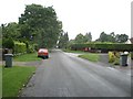
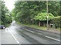
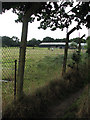
26 photos from this area
Area Information
Key information about the NR13 6TB including its size, population, and administrative classification.
- Area Type
- Postcode
- Area Size
- 2.0 hectares
- Population
- 2147
- Population Density
- 286 people/km²
House Prices in NR13 6TB
46
Properties
£279,571
Average Sold Price
£77,000
Lowest Price
£425,000
Highest Price
Showing 46 properties
| Address | Type | Beds | Baths | Last Sale Price | Last Sale Date | |
|---|---|---|---|---|---|---|
| 46 Sam Smith Way, Rackheath, NR13 6TB | Terraced | 2 | 1 | £108,000 | Dec 2025 | |
| 30 Sam Smith Way, Rackheath, NR13 6TB | Detached | 4 | 2 | £365,000 | Nov 2024 | |
| 52 Sam Smith Way, Rackheath, NR13 6TB | Terraced | 3 | 2 | £290,000 | Aug 2024 | |
| 10 Sam Smith Way, Rackheath, NR13 6TB | Terraced | 3 | 2 | £282,000 | Feb 2024 | |
| 34 Sam Smith Way, Rackheath, NR13 6TB | Terraced | 3 | 1 | £112,000 | Jan 2024 | |
| 32 Sam Smith Way, Rackheath, NR13 6TB | Terraced | 3 | 1 | £150,000 | Nov 2023 | |
| 8 Sam Smith Way, Rackheath, NR13 6TB | Retail | 3 | 2 | £330,000 | Jun 2022 | |
| 36 Sam Smith Way, Rackheath, NR13 6TB | house | - | - | £96,000 | Apr 2022 | |
| 66 Sam Smith Way, Rackheath, NR13 6TB | house | - | - | £320,000 | Feb 2022 | |
| 14 Sam Smith Way, Rackheath, NR13 6TB | house | - | - | £285,000 | Jan 2022 |
Page 1 of 5
Energy Efficiency in NR13 6TB
Amenities
Schools
| Rank | School | Type | Entry gender | Ages |
|---|
Explore more schools in this area
Go to Schools tabDemographics
Household Size
Family (3-5 people)
most common
Accommodation Type
Houses
most common
Tenure
78
majority
Ethnic Group
White
most common
Religion
N/A
most common
Household Composition
N/A
most common
Age
47
median
Adults (30-64 years)
most common
Household Deprivation
N/A
with no deprivation
NS-SEC
33
in Lower managerial occupations
Explore more demographic insights in this area
Go to Demographics tabPlanning
Planning Constraints
- Flood RiskPremium
- Ramsar Wetland SitesPremium
- Area of Outstanding Natural BeautyPremium
- Protected Nature ReservePremium
- Protected WoodlandPremium