Area Overview for NR13 6PW
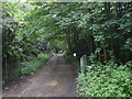
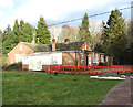
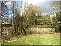
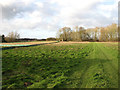
Photos of NR13 6PW
Area Information
NR13 6PW defines a specific postcode covering a small residential cluster of just 1.0 hectares. You will find 2,147 people living within this compact space, resulting in a population density of 286 people per square kilometre. This tight-knit environment creates a straightforward living situation where neighbours are naturally close. The area is entirely residential, offering a quiet alternative to larger urban districts while remaining connected to the wider region. Living in this postcode means you navigate a defined neighbourhood where daily routines are shaped by proximity rather than expansiveness. You can access essential services and local community hubs quickly, as the small footprint eliminates the need for long commutes to immediate necessities. The setting is established and focused, appealing to those who value a settled routine over a sprawling landscape. Your experience here is anchored by the fact that every aspect of daily life operates on a human scale. There is no ambiguity about the size of the community or the nature of the postcode, which simplifies the process of choosing a home in such a specific location.
- Area Type
- Postcode
- Area Size
- 1.0 hectares
- Population
- 2147
- Population Density
- 286 people/km²
The property market in NR13 6PW is characterised by a near-total absence of rental housing, as a staggering 78 per cent of residents own their homes outright or with a mortgage. You will find that the accommodation type consists entirely of houses, meaning there are no flats to consider in this postcode. This structure makes the area distinctly suitable for owner-occupiers rather than private landlords or first-time buyers in the rental sector. Because the stock is exclusive to houses, the construction style likely varies between detached, semi-detached, or terraced properties, though specific unit counts are not detailed. The low density, calculated at 286 people per square kilometre, further confirms that this is not a high-rise or council estate environment. When looking at homes in this postcode, you are entering a territory where sellers typically have a long-term attachment to the property. The market dynamics will therefore favour those seeking to buy and stay, rather than investors looking for rental yield.
House Prices in NR13 6PW
Showing 5 properties
| Address | Type | Beds | Baths | Last Sale Price | Last Sale Date | |
|---|---|---|---|---|---|---|
| 2 Longs Crescent, Rackheath, NR13 6PW | Semi-detached | 2 | - | £236,000 | Jun 2022 | |
| 8 Longs Crescent, Rackheath, NR13 6PW | Bungalow | - | - | - | - | |
| 10 Longs Crescent, Rackheath, NR13 6PW | Bungalow | - | - | - | - | |
| 4 Longs Crescent, Rackheath, NR13 6PW | Bungalow | - | - | - | - | |
| 6 Longs Crescent, Rackheath, NR13 6PW | Bungalow | - | - | - | - |
Energy Efficiency in NR13 6PW
Residents of NR13 6PW benefit from a practical arrangement of amenities within practical reach. For rail travel, you can access Salhouse Railway Station, Brundall Gardens Railway Station, or Norwich Railway Station, all noted as notable local nodes. Retail needs are met by Lidl Sprowston and two instances of Tesco Norwich, providing ample opportunity for grocery shopping and daily errands. Norwich International Airport is just one notable venue away, facilitating travel abroad or to other UK cities. Additionally, Wroxham offers metro services, suggesting a link to broader regional transport networks. This configuration means you do not need to sacrifice convenience for the quiet of a residential cluster. You can run to a supermarket at Lidl Sprowston and catch a train at Salhouse without a significant journey. The presence of these specific venues ensures that daily life involves easy access to food, transport, and travel connections.
Amenities
Schools
Families relying on education in NR13 6PW have one primary school option within easy reach: Rackheath Primary School. This institution holds an outstanding Ofsted rating, marking it as a top-tier choice for primary education. The data lists no secondary schools, so families with older children must look beyond the immediate neighbourhood for their needs. The presence of a single highly-rated primary school suggests a focus on quality early education, but it also implies a need to commute for secondary stages. For a family considering living in this area, the proximity to Rackheath Primary School is a significant advantage for those with children of primary school age. If you have teenagers, you will need to research schools outside the direct vicinity, as none appear linked to this specific postcode. The educational landscape is therefore selective, offering an excellent start but requiring a broader search for later years.
| Rank | School | Type | Entry gender | Ages |
|---|
Explore more schools in this area
Go to Schools tabDemographics
The community profile for NR13 6PW reflects a mature and established population. The median age stands at 47 years, with adults aged between 30 and 64 years forming the most common age range. This demographic prevalence suggests the area attracts residents who have settled down, prioritising stability over transient lifestyles. Almost three-quarters of households, or 78 per cent, are owner-occupied, indicating a strong sense of permanence among residents. The accommodation type is exclusively houses, creating an environment defined by detached or semi-detached living rather than high-density flats. Ethnic diversity is minimal, with White residents forming the predominant group in this specific cluster. You are not competing against high demand for units here, as the housing stock is fixed and the population is largely local-born or long-term settled. The absence of rental properties or younger professional clusters means the social fabric revolves around family life and established neighbourhood bonds rather than the shifting demographics typical of city centres.
Household Size
Accommodation Type
Tenure
Ethnic Group
Religion
Household Composition
Age
Household Deprivation
NS-SEC
Explore more demographic insights in this area
Go to Demographics tabPlanning
Planning Constraints
- Flood RiskPremium
- Ramsar Wetland SitesPremium
- Area of Outstanding Natural BeautyPremium
- Protected Nature ReservePremium
- Protected WoodlandPremium