Area Overview for NR13 6JF
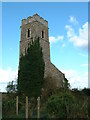
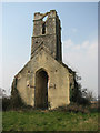
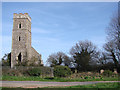
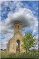
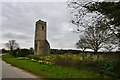
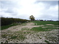
Photos of NR13 6JF
Area Information
Living in NR13 6JF means residing within a small residential cluster of just 13.5 hectares. This compact area serves a population of 1,475 people, creating a setting that feels close-knit yet structured. The density averages 43 people per square kilometre, which suggests a quiet environment without the pressure of high-rise urban centres. Because this postcode covers such a specific and small stretch of land, daily life revolves around the immediate vicinity and the wider Wroxham district. You will find that the area functions as a distinct residential node rather than a sprawling town centre. The limited physical space means that neighbours are often near to one another, fostering an environment where community interactions are frequent but not forced. For anyone considering homes in NR13 6JF, the scale offers a degree of shelter and simplicity that larger towns lack. The area is defined by its residential focus, avoiding industrial noise or heavy commercial traffic. This makes it suitable for households prioritising a contained lifestyle where the environment remains consistent year-round. The small size also simplifies navigation, as you do not need extensive maps to understand the layout of your new home.
- Area Type
- Postcode
- Area Size
- 13.5 hectares
- Population
- 1475
- Population Density
- 43 people/km²
The property market in NR13 6JF is defined by a strong presence of owner-occupied homes. With 75 per cent of residents owning their properties, the housing stock is built around settled families rather than short-term tenants. This high ownership figure indicates that the market consists largely of people who have purchased homes to live in long-term, rather than investors or nomads. Houses are the predominant accommodation type, meaning you will mostly encounter detached or semi-detached dwellings rather than flats or buildings. This configuration suits those seeking more space and private outdoor areas, which is a standard expectation for the median age of 47 in this locality. Because the total population is only 1,475 within 13.5 hectares, the supply of individual properties is inherently limited compared to larger towns. Buyers looking at homes in NR13 6JF should be aware that options are concentrated within a very small geographical footprint. The 75 per cent ownership rate suggests a robust local market where property turnover is driven by life events such as retirement or upscaling, rather than corporate housing blocks. This stability often leads to consistent neighbourhood standards, as owners tend to maintain their homes to protect community values. When searching for properties, focus on house types that align with this high ownership baseline.
House Prices in NR13 6JF
Showing 8 properties
| Address | Type | Beds | Baths | Last Sale Price | Last Sale Date | |
|---|---|---|---|---|---|---|
| Scotts Corner House, Scotts Corner, Panxworth, NR13 6JF | Detached | 5 | 2 | £415,000 | Oct 2019 | |
| Cobweb Cottage, Scotts Corner, Panxworth, NR13 6JF | Cottage | 3 | 1 | £350,000 | Mar 2017 | |
| Oak Lodge, Scotts Corner, Panxworth, NR13 6JF | Detached | 4 | - | £250,000 | May 2006 | |
| Caravan, 1 Scotts Corner, Panxworth, NR13 6JF | Mobile Home | - | - | - | - | |
| 2 Scotts Corner, Panxworth, NR13 6JF | house | - | - | - | - | |
| 4 Scotts Corner, Panxworth, NR13 6JF | Semi-detached | - | - | - | - | |
| 3 Scotts Corner, Panxworth, NR13 6JF | Semi-detached | - | - | - | - | |
| 1 Scotts Corner, Panxworth, NR13 6JF | Semi-detached | - | - | - | - |
Energy Efficiency in NR13 6JF
Daily life in NR13 6JF revolves around a selection of amenities reachable within a practical driving distance. The area has access to five notable retail and food outlets, including a Co-op at 49-53, another Co-op at 122, and a Spar. These three stores provide essential shopping for groceries and daily necessities without requiring a trip into a major city. For rail travel, there are five stations in the wider catchment, with Lingwood, Salhouse, and Brundall Railway Stations being the key points for train access. This network of five stations supports both local commutes and weekend getaways to broader Norfolk destinations. One metro station is located at Wroxham, serving as a central transport hub for the region. While public transport distances are not specified in the data, the presence of these five railheads suggests reasonable connectivity to Norwich and London. Residents will find that essential services are fully covered by the nearby Co-op and Spar branches. The combination of three well-known retailers and five railway stations creates a functional lifestyle foundation. You do not need to live in a town centre to access daily shops and trains, as these five instances of amenities are distributed to serve the residential cluster. This arrangement supports a self-sufficient routine where most errands can be completed locally before catching a train from the nearby stations.
Amenities
Schools
Families considering NR13 6JF have access to Fairhaven Church of England Voluntary Aided Primary School. This primary school holds an Ofsted rating of Good, confirming a standard of education that meets national expectations for curriculum and behaviour. As a voluntary aided institution, the school operates with significant involvement from the local church community, which often influences the ethos and extracurricular activities available to children. There are no secondary schools or other primary institutions listed within the immediate recorded data for this specific postcode cluster, meaning all children will likely commute for older school years or rely on this single primary option. The presence of a single school with a Good rating suggests a consistent educational environment for young children in the village. Parents often appreciate the stability of a long-standing school that serves a local catchment area. While Fairhaven is the only school explicitly named in the data for this area, the strong Ofsted rating provides reassurance for those prioritising early education. Families with older children may need to look further afield, but the primary stage is well covered by this recognised institution. The performance data indicates a functional and approved educational framework for the residents.
| Rank | School | Type | Entry gender | Ages |
|---|
Explore more schools in this area
Go to Schools tabDemographics
The community within NR13 6JF reflects a mature household profile with a median age of 47 years. Most residents fall into the 30 to 64 year age range, indicating that this area attracts families and established professionals rather than young singles or retirees. This age distribution suggests a stable population with deep roots in the locality. Home ownership stands at 75 per cent, showing that the majority of residents own their properties outright or through a mortgage. This high ownership rate contrasts sharply with the prevalence of private rentals found in many city locations. The dominant accommodation type is houses, which aligns with the preference of the older, owner-occupying demographic for more space and traditional living arrangements. The predominant ethnic group is White, mirroring a demographic common across many historic English counties. This homogeneity often correlates with established neighbourhood patterns where values and lifestyles share common ground. With such a high percentage of owners, the area lacks the transient feel of student towns or short-let hubs. Residents likely value long-term stability and are less inclined to move frequently. The demographic picture paints a scene of a quiet, established settlement where community ties have had time to develop over decades.
Household Size
Accommodation Type
Tenure
Ethnic Group
Religion
Household Composition
Age
Household Deprivation
NS-SEC
Explore more demographic insights in this area
Go to Demographics tabPlanning
Planning Constraints
- Flood RiskPremium
- Ramsar Wetland SitesPremium
- Area of Outstanding Natural BeautyPremium
- Protected Nature ReservePremium
- Protected WoodlandPremium