Area Overview for NR13 6HH
Photos of NR13 6HH
Area Information
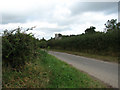
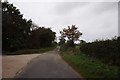
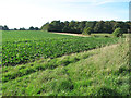
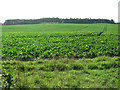
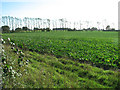
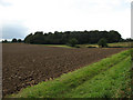
Living in NR13 6HH means settling into a small, quiet residential cluster defined by a specific postcode managed within the wider NR13 region. This particular area covers 54.4 hectares, accommodating approximately 1,475 residents. With a population density of just 43 people per square kilometre, the environment feels spacious and uncrowded compared to more urban Norwich neighbourhoods. The layout supports a low-density lifestyle where neighbours are close enough to know one another yet physically distant enough to ensure privacy. This cluster serves as a calm pocket within Norfolk, largely removed from the immediate chaos of the city centre but still accessible to wider transport networks. You will find the streets are predominantly tree-lined and quiet, suited to those who value stillness over the frenetic energy of the city. The ambiguity of being a small postcode area means there is little development pressure within these specific boundaries, preserving the local character for the foreseeable future. Whether you are seeking a retreat after a busy day or a home for raising children, NR13 6HH offers a contained environment where the focus remains on the immediate surrounding greenery and residential streets rather than commercial noise.
- Area Type
- Postcode
- Area Size
- 54.4 hectares
- Population
- 1475
- Population Density
- 43 people/km²
Homes in NR13 6HH are characterised by a market heavily weighted towards owner-occupiers, with 75 per cent of the population owning their properties outright or with a mortgage. This statistic defines the housing stock, meaning you will encounter very few purpose-built rental units within this specific postcode boundary. The accommodation type is exclusively houses, so you will not find flats or conversions typical of newer market houses in Norwich. Buyers looking at this area should expect to compete with other owners, which can sometimes make transactions slower than in investment-heavy zones. The small footprint of 54.4 hectares means the number of available homes is limited, creating a niche market for those specifically wanting this location. Families and mature couples dominate the sales market, reflecting the median age and homeownership figures. When considering this postcode, you are entering a sphere where property values are likely tied to the stability of the local community rather than speculative development potential. There are no apartments for sale here, only detached or semi-detached homes that suit families or individuals seeking maximum space. The lack of mixed-use properties further isolates this market, making it distinct from areas where shops or student accommodation might influence pricing.
House Prices in NR13 6HH
Showing 22 properties
| Address | Type | Beds | Baths | Last Sale Price | Last Sale Date | |
|---|---|---|---|---|---|---|
| 28 The Green, Woodbastwick, NR13 6HH | Cottage | 3 | 1 | £210,000 | Jan 2020 | |
| Greenwood Cottage, The Green, Woodbastwick, NR13 6HH | Cottage | 5 | 2 | £464,740 | Nov 2004 | |
| 16 The Green, Woodbastwick, NR13 6HH | Bungalow | - | - | - | - | |
| 15 The Green, Woodbastwick, NR13 6HH | house | - | - | - | - | |
| 3 The Green, Woodbastwick, NR13 6HH | house | - | - | - | - | |
| 18 The Green, Woodbastwick, NR13 6HH | house | - | - | - | - | |
| 5 The Green, Woodbastwick, NR13 6HH | house | - | - | - | - | |
| The Green 1, Hall Drive, Pit Road, Woodbastwick, NR13 6HH | Detached | - | - | - | - | |
| Hall Drive, Pit Road, Woodbastwick, NR13 6HH | Detached | - | - | - | - | |
| The Old Vicarage, The Green, Woodbastwick, NR13 6HH | house | - | - | - | - |
Energy Efficiency in NR13 6HH
Daily life in NR13 6HH is supported by a reliable network of amenities within practical reach, ensuring essential needs are met without requiring a long commute into town. For groceries, residents can visit Co-op 122, Co-op 49-53, or Makro Norwich, all of which are noted as notable retail locations nearby. These stores provide a range of dietary options from daily essentials to bulk supermarket shopping. Transport links are anchored by five railway stations, including Salhouse Railway Station, Hoveton & Wroxham Railway Station, Brundall Gardens Railway Station, plus the metro access point at Wroxham. This network facilitates easy travel to Norwich and other regional hubs. You will find that the nearest rail connections cluster around Salhouse and Hoveton, making them key junction points for daily trips. The presence of these transport nodes means you do not need a heavy reliance on a private vehicle for every journey, although the low density of the area itself suggests that a car remains necessary for local errands. Your week will revolve around trips to these retail and transport hubs, balanced by the quiet days spent within the 54.4 hectares of your residential zone.
Amenities
Schools
Families considering NR13 6HH have access to Fairhaven Church of England Voluntary Aided Primary School, which sits nearby and holds an Ofsted rating of good. This single primary option serves as the main educational hub for the immediate cluster, catering to the young children within this mature demographic. While the data does not list secondary schools or alternative educational institutions in the immediate vicinity, this primary school offers a solid foundation for the area's youngest residents. The good rating suggests a school that meets national standards and provides a supportive environment for early learning. With a median age of 47 years, you might find that this primary school is more popular with second-time parents than with those who have younger families, as many older adults in the area will have already left the school system. The concentration of only one named primary school indicates that families may need to consider catchment areas beyond NR13 6HH itself if they have a larger extended family requirement. The presence of a voluntary aided faith school also adds a specific character to the local education system, appealing to families who align with the Church of England ethos.
| Rank | School | Type | Entry gender | Ages |
|---|
Explore more schools in this area
Go to Schools tabDemographics
The community of NR13 6HH is established and stable, largely dominated by adults between the ages of 30 and 64 years. The median age of 47 years indicates a mature population, suggesting that many families have moved away from the area as their children grew up or that retirees have settled here permanently. Seventy-five per cent of residents own their homes, creating a community with deep local roots rather than transient occupiers. This high ownership rate contrasts sharply with rental-heavy city centres, meaning neighbours have invested in their homes and are less likely to move seasonally. Houses form the primary accommodation type, reflecting a preference for traditional single-family living over flats or terraced housing. The demographic profile is predominantly White, aligning with the broader patterns seen across Norfolk's rural and semi-rural districts. You will not find the diversity typical of major university towns here; instead, the social fabric is woven from long-standing families who have stayed put through various economic cycles. This demographic stability contributes to a predictable neighbourhood dynamic where local schools, shops, and community groups operate with a high degree of consistency. The low population density further reinforces this dominant adult culture, resulting in fewer daytime social interactions compared to denser urban clusters.
Household Size
Accommodation Type
Tenure
Ethnic Group
Religion
Household Composition
Age
Household Deprivation
NS-SEC
Explore more demographic insights in this area
Go to Demographics tabPlanning
Planning Constraints
- Flood RiskPremium
- Ramsar Wetland SitesPremium
- Area of Outstanding Natural BeautyPremium
- Protected Nature ReservePremium
- Protected WoodlandPremium