Area Overview for NR13 6AA
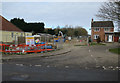
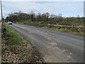
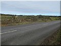
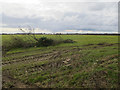
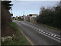
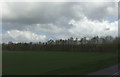
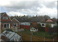
Photos of NR13 6AA

Area Information
Living in NR13 6AA offers a quiet residential experience within a small cluster covering just 2.8 hectares. This specific postcode serves 2,147 people, creating a close-knit environment with a population density of 286 people per square kilometre. The area stands out for its concentration of detached and semi-detached housing rather than flats or apartments. Most residents are adults between 30 and 64 years old, meaning the neighbourhood lacks a significant student population or large numbers of young families with very young children. Daily life revolves around a stable community where long-term residents have established roots. You will find a settlement that prioritises domestic comfort over urban convenience. While the physical footprint is small, the location provides practical access to larger towns for shopping and employment. The housing stock reflects generations of ownership, with fewer new builds or rental conversions typical of dense city centres. If you value privacy and a suburban pace of life, this area delivers exactly that. The lack of high-density accommodation ensures streets remain residential rather than commercial.
- Area Type
- Postcode
- Area Size
- 2.8 hectares
- Population
- 2147
- Population Density
- 286 people/km²
The property market in NR13 6AA is characterised by a strong inclination towards home ownership. With 78% of residents owning their homes, the area functions primarily as an owner-occupied zone rather than a student rental hub. The accommodation type is exclusively houses, which limits the supply of flats and apartments in this specific postcode. Buyers looking for NR13 6AA should expect to find Victorian or semi-detached family homes rather than purpose-built blocks. This concentration of house ownership suggests the building stock is likely older, with gardens and established landscaping. The low population density of 286 people per square kilometre supports the availability of larger plots and private outdoor space. Because most people own their properties, you may face a quieter market with fewer quick-sale opportunities compared to high-demand rental areas. However, the stability of the market protects against the volatility seen in student accommodation zones. If you are a seller, the high ownership rate means motivated buyers who value permanence. The market reflects a traditional English suburb where families stay put.
House Prices in NR13 6AA
Showing 23 properties
| Address | Type | Beds | Baths | Last Sale Price | Last Sale Date | |
|---|---|---|---|---|---|---|
| 78A Salhouse Road, Rackheath, NR13 6AA | Bungalow | 4 | 3 | £390,000 | Aug 2024 | |
| 68 Salhouse Road, Rackheath, NR13 6AA | Detached | - | - | £150,000 | Jun 2023 | |
| Roseacre, 78 Salhouse Road, Rackheath, NR13 6AA | Detached | 4 | 3 | £650,000 | Nov 2022 | |
| 72 Salhouse Road, Rackheath, NR13 6AA | Detached | 3 | 2 | £363,000 | Apr 2022 | |
| 56 Salhouse Road, Rackheath, NR13 6AA | Chalet | 5 | 2 | £520,000 | Dec 2021 | |
| Willows End, 82 Salhouse Road, Rackheath, NR13 6AA | house | - | - | £355,000 | Sep 2021 | |
| 54 Salhouse Road, Rackheath, NR13 6AA | Bungalow | 2 | 1 | £345,000 | May 2019 | |
| 76A Salhouse Road, Rackheath, NR13 6AA | Detached | 4 | - | £450,000 | Aug 2016 | |
| 62A Salhouse Road, Rackheath, NR13 6AA | Detached | 4 | 2 | £324,000 | Oct 2014 | |
| 58 Salhouse Road, Rackheath, NR13 6AA | Bungalow | - | - | £235,000 | Mar 2011 |
Energy Efficiency in NR13 6AA
Access to amenities in NR13 6AA is practical, with several key venues within reach. Five railway stations are nearby, including Salhouse, Brundall Gardens, and Hoveton & Wroxham, offering direct rail access to Norwich. Retail outlets include Lidl Sprowston, Tesco Norwich, and Makro Norwich, ensuring you have access to essential groceries and bulk shopping. The data confirms one metro area in Wroxham and Norwich International Airport as the nearest aviation hub. This mix of transport and retail means you do not need an extensive car collection for daily tasks. You can combine train travel with supermarket runs in a single day. The availability of five retail and five railway options nearby provides a solid foundation for a car-lite lifestyle. Specific venues like Tesco and Lidl cater to different shopping preferences. Living here places you steps or short drives from major high streets. The integration of rail and retail creates a convenient routine without requiring long commutes to city centres.
Amenities
Schools
Families relying on local education have one primary option nearby. Rackheath Primary School serves the local population and holds an outstanding Ofsted rating. This is a significant advantage for parents prioritising educational quality without needing to commute far. The school designation as primary means it educates children from early years up to age 11. Residents will need to consider secondary education separately, as no secondary schools are listed in the immediate vicinity of NR13 6AA. The outstanding rating of Rackheath Primary School is a key selling point for the property. You can rest assured that your children will have access to a top-tier primary institution. The mix of school types is limited, as the data only confirms one primary provider. This singular option for primary schooling reduces the risk of choice fatigue for families moving in. The proximity of this high-rated school increases the desirability of homes in the postcode.
| Rank | School | Type | Entry gender | Ages |
|---|
Explore more schools in this area
Go to Schools tabDemographics
The community in NR13 6AA is defined by stability and maturity. A median age of 47 indicates an older demographic compared to national averages for student-heavy towns. Three-quarters of the residents, representing 78% of households, own their homes outright or with a mortgage. This high ownership rate implies a settled population unlikely to look for accommodation frequently. The prevailing accommodation type is houses, which aligns with the area's function as a residential zone rather than a rental market. Ethnic diversity is low, as the predominant group is White, reflecting a homogenous community structure. The most common age range falls between 30 and 64 years, suggesting working-age adults and retirees are the primary demographic. There is no significant concentration of students or transient workers. This profile creates a predictable environment where neighbours have likely known each other for many years. You are buying into a mature society where property changes hands less frequently than in booming rental hubs. The demographic data confirms a place built for permanent living rather than short-term stays.
Household Size
Accommodation Type
Tenure
Ethnic Group
Religion
Household Composition
Age
Household Deprivation
NS-SEC
Explore more demographic insights in this area
Go to Demographics tabPlanning
Planning Constraints
- Flood RiskPremium
- Ramsar Wetland SitesPremium
- Area of Outstanding Natural BeautyPremium
- Protected Nature ReservePremium
- Protected WoodlandPremium