Area Overview for NR13 5SD
Photos of NR13 5SD
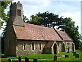
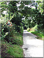
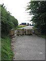
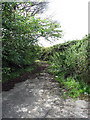
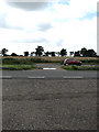
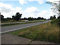
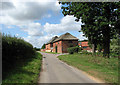
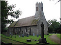
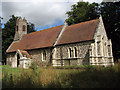
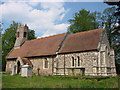
72 photos from this area
Area Information
Key information about the NR13 5SD including its size, population, and administrative classification.
- Area Type
- Postcode
- Area Size
- 3.2 hectares
- Population
- 1923
- Population Density
- 202 people/km²
House Prices in NR13 5SD
52
Properties
£261,626
Average Sold Price
£153,950
Lowest Price
£442,500
Highest Price
Showing 52 properties
| Address | Type | Beds | Baths | Last Sale Price | Last Sale Date | |
|---|---|---|---|---|---|---|
| 1 Maurecourt Drive, Brundall, NR13 5SD | Detached | 4 | 2 | £442,500 | Aug 2025 | |
| 15 Maurecourt Drive, Brundall, NR13 5SD | Terraced | 2 | 2 | £235,000 | Aug 2024 | |
| 7 Maurecourt Drive, Brundall, NR13 5SD | Semi-detached | 4 | 2 | £270,000 | Apr 2024 | |
| 97 Maurecourt Drive, Brundall, NR13 5SD | Semi-detached | 3 | 2 | £270,000 | Apr 2023 | |
| 41 Maurecourt Drive, Brundall, NR13 5SD | house | - | - | £285,000 | Sep 2022 | |
| 35 Maurecourt Drive, Brundall, NR13 5SD | Semi-detached | 3 | 2 | £273,000 | Sep 2022 | |
| 101 Maurecourt Drive, Brundall, NR13 5SD | Detached | 4 | 2 | £418,000 | Aug 2022 | |
| 37 Maurecourt Drive, Brundall, NR13 5SD | Semi-detached | 3 | 2 | £282,000 | Jun 2022 | |
| 45 Maurecourt Drive, Brundall, NR13 5SD | house | - | - | £246,250 | Jun 2021 | |
| 63 Maurecourt Drive, Brundall, NR13 5SD | Detached | 4 | 2 | £325,000 | Jun 2021 |
Page 1 of 6
Energy Efficiency in NR13 5SD
Amenities
Schools
| Rank | School | Type | Entry gender | Ages |
|---|
Explore more schools in this area
Go to Schools tabDemographics
Household Size
Two person
most common
Accommodation Type
Houses
most common
Tenure
84
majority
Ethnic Group
White
most common
Religion
N/A
most common
Household Composition
N/A
most common
Age
47
median
Adults (30-64 years)
most common
Household Deprivation
N/A
with no deprivation
NS-SEC
45
in Lower managerial occupations
Explore more demographic insights in this area
Go to Demographics tabPlanning
Planning Constraints
- Flood RiskPremium
- Ramsar Wetland SitesPremium
- Area of Outstanding Natural BeautyPremium
- Protected Nature ReservePremium
- Protected WoodlandPremium