Area Overview for NR13 5PA
Photos of NR13 5PA
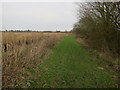
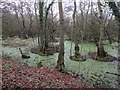
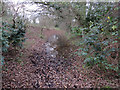
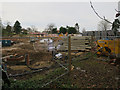
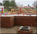
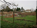
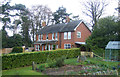
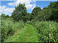
52 photos from this area
Area Information
Key information about the NR13 5PA including its size, population, and administrative classification.
- Area Type
- Postcode
- Area Size
- 6.0 hectares
- Population
- 1759
- Population Density
- 330 people/km²
House Prices in NR13 5PA
45
Properties
£460,411
Average Sold Price
£139,950
Lowest Price
£1,100,000
Highest Price
Showing 45 properties
| Address | Type | Beds | Baths | Last Sale Price | Last Sale Date | |
|---|---|---|---|---|---|---|
| 18 Strumpshaw Road, Brundall, NR13 5PA | Detached | 5 | 3 | £600,000 | Jun 2025 | |
| 18A Strumpshaw Road, Brundall, NR13 5PA | Detached | 4 | 2 | £460,000 | Mar 2024 | |
| Rose Glen, 33 Strumpshaw Road, Brundall, NR13 5PA | Detached | 5 | 3 | £695,000 | Jul 2022 | |
| Chapel Cottages, 28 Strumpshaw Road, Brundall, NR13 5PA | Terraced | 2 | 1 | £235,000 | Aug 2021 | |
| 26 Strumpshaw Road, Brundall, NR13 5PA | house | - | - | £202,000 | Apr 2021 | |
| Riverdale, 20 Strumpshaw Road, Brundall, NR13 5PA | Detached | 5 | 3 | £1,100,000 | Dec 2020 | |
| Loke House, 34A Strumpshaw Road, Brundall, NR13 5PA | Detached | 6 | 1 | £620,000 | Nov 2020 | |
| Breckland, 12 Strumpshaw Road, Brundall, NR13 5PA | Bungalow | 6 | 6 | £530,000 | Oct 2020 | |
| Nether House, 7 Strumpshaw Road, Brundall, NR13 5PA | house | 4 | - | £792,500 | Sep 2018 | |
| Hillside Cottage, 15 Strumpshaw Road, Brundall, NR13 5PA | Detached | 5 | 3 | £595,000 | Jul 2016 |
Page 1 of 5
Energy Efficiency in NR13 5PA
Amenities
Schools
| Rank | School | Type | Entry gender | Ages |
|---|
Explore more schools in this area
Go to Schools tabDemographics
Household Size
Two person
most common
Accommodation Type
Houses
most common
Tenure
85
majority
Ethnic Group
White
most common
Religion
N/A
most common
Household Composition
N/A
most common
Age
47
median
Adults (30-64 years)
most common
Household Deprivation
N/A
with no deprivation
NS-SEC
42
in Lower managerial occupations
Explore more demographic insights in this area
Go to Demographics tabPlanning
Planning Constraints
- Flood RiskPremium
- Ramsar Wetland SitesPremium
- Area of Outstanding Natural BeautyPremium
- Protected Nature ReservePremium
- Protected WoodlandPremium