Area Overview for NR13 5JB
Photos of NR13 5JB
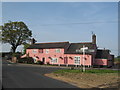
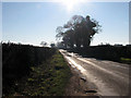
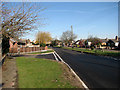

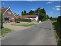
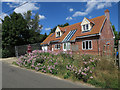
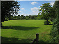
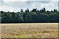
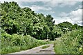
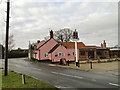
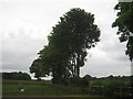
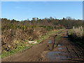
22 photos from this area
Area Information
Key information about the NR13 5JB including its size, population, and administrative classification.
- Area Type
- Postcode
- Area Size
- 4.0 hectares
- Population
- 2160
- Population Density
- 379 people/km²
House Prices in NR13 5JB
31
Properties
£253,625
Average Sold Price
£57,500
Lowest Price
£505,000
Highest Price
Showing 31 properties
| Address | Type | Beds | Baths | Last Sale Price | Last Sale Date | |
|---|---|---|---|---|---|---|
| The Field House, 11 Crowes Loke, Little Plumstead, NR13 5JB | Detached | 3 | 1 | £395,000 | Oct 2025 | |
| Badgers Rest, 6 Crowes Loke, Little Plumstead, NR13 5JB | Detached | 4 | 4 | £505,000 | Jul 2024 | |
| The Old Orchard, 8 Crowes Loke, Little Plumstead, NR13 5JB | Bungalow | 3 | 2 | £400,000 | Jan 2024 | |
| 1 Crowes Loke, Little Plumstead, NR13 5JB | house | - | - | £278,000 | Mar 2021 | |
| Metpol Boy, 15 Crowes Loke, Little Plumstead, NR13 5JB | house | - | - | £215,000 | Jun 2020 | |
| Oakhurst, 4 Crowes Loke, Little Plumstead, NR13 5JB | Bungalow | 3 | 1 | £300,000 | Jun 2019 | |
| The Studio, 20 Crowes Loke, Little Plumstead, NR13 5JB | house | - | - | £318,000 | Apr 2019 | |
| 7 Crowes Loke, Little Plumstead, NR13 5JB | Bungalow | 3 | 2 | £250,000 | Dec 2016 | |
| Caernarvon, 16 Crowes Loke, Little Plumstead, NR13 5JB | Bungalow | 2 | - | £230,000 | Jul 2015 | |
| 5 Crowes Loke, Little Plumstead, NR13 5JB | Bungalow | 2 | - | £210,000 | Apr 2014 |
Page 1 of 4
Energy Efficiency in NR13 5JB
Amenities
Schools
| Rank | School | Type | Entry gender | Ages |
|---|
Explore more schools in this area
Go to Schools tabDemographics
Household Size
Family (3-5 people)
most common
Accommodation Type
Houses
most common
Tenure
78
majority
Ethnic Group
White
most common
Religion
N/A
most common
Household Composition
N/A
most common
Age
47
median
Adults (30-64 years)
most common
Household Deprivation
N/A
with no deprivation
NS-SEC
39
in Lower managerial occupations
Explore more demographic insights in this area
Go to Demographics tabPlanning
Planning Constraints
- Flood RiskPremium
- Ramsar Wetland SitesPremium
- Area of Outstanding Natural BeautyPremium
- Protected Nature ReservePremium
- Protected WoodlandPremium