Area Overview for NR13 5DL
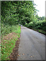
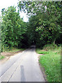
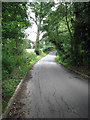
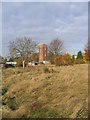
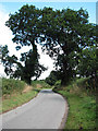
Photos of NR13 5DL

Area Information
You are moving to a specific residential cluster defined by the postcode NR13 5DL, which occupies just 8,623 square metres in Norfolk. This small footprint suggests a concentrated community rather than a sprawling town centre, creating an intimate setting for those who live here. The population stands at 2,160 people, resulting in a density of 379 people per square kilometre. This metric indicates a moderately populated area where neighbours are within close proximity, yet the limited size prevents overcrowding. Living in this precise location offers the advantage of known boundaries and a tightly knit ensemble of households. The environment is entirely residential, focusing on the needs of its permanent residents rather than transient commercial activity. Daily life revolves around the immediate vicinity of the street, with activities often occurring within a short walk. The area represents a static environment where the community impact of any single family is amplified due to the reduced physical space. You should appreciate the distinctness of this cluster, where the lack of geographical sprawl fosters a direct connection between homes and local amenities. Understanding the scale of NR13 5DL is essential for grasping the immediacy of your surroundings in this East Anglian postcode.
- Area Type
- Postcode
- Area Size
- 8623 m²
- Population
- 2160
- Population Density
- 379 people/km²
The housing stock in NR13 5DL is defined by its composition and the high rate of tenure held by residents. With 78% of properties owner-occupied, the market dynamics differ significantly from urban centres reliant on rental investing. This high proportion of owners suggests that houses in this area are approached as long-term assets rather than investment vehicles for flipping or short-term lets. The predominant accommodation type is houses, meaning the streetscape will consist of detached, semi-detached, or terrace homes rather than apartments. This structure appeals to buyers seeking traditional architecture and potentially more space than available in nearby flat markets. Your search for homes in NR13 5DL will focus exclusively on detached or semi-detached properties. The limited total population of 2,160 restricts the volume of listings available at any one time, making each property distinct. There is no indication of student housing blocks or high-density developments within this specific post code. Potential buyers should view this location as a stable enclave where property values are likely influenced by the certainty of homeownership rather than rental yields. The market here reflects enduring local demand for standalone residences over shared ownership models or communal living arrangements.
House Prices in NR13 5DL
Showing 10 properties
| Address | Type | Beds | Baths | Last Sale Price | Last Sale Date | |
|---|---|---|---|---|---|---|
| 10 Witton Lane, Little Plumstead, NR13 5DL | house | - | - | £277,000 | Sep 2021 | |
| 18 Witton Lane, Little Plumstead, NR13 5DL | Semi-detached | 4 | 1 | £256,000 | Oct 2020 | |
| 2 Witton Lane, Little Plumstead, NR13 5DL | Semi-detached | 4 | 2 | £275,000 | Feb 2020 | |
| 20 Witton Lane, Little Plumstead, NR13 5DL | Semi-detached | 3 | 1 | £265,000 | Nov 2019 | |
| 12 Witton Lane, Little Plumstead, NR13 5DL | Semi-detached | - | - | £129,000 | Jul 2009 | |
| 8 Witton Lane, Little Plumstead, NR13 5DL | Semi-detached | - | - | £236,000 | Oct 2007 | |
| 4 Witton Lane, Little Plumstead, NR13 5DL | Semi-detached | - | - | £57,500 | Feb 1999 | |
| 16 Witton Lane, Little Plumstead, NR13 5DL | house | - | - | - | - | |
| 6 Witton Lane, Little Plumstead, NR13 5DL | Semi-detached | - | - | - | - | |
| 14 Witton Lane, Little Plumstead, NR13 5DL | house | - | - | - | - |
Energy Efficiency in NR13 5DL
Your lifestyle within NR13 5DL revolves around a practical network of amenities located within a short reach of your home. Retail needs are met by five nearby locations, specifically Co-op 122, Co-op 49-53, and Lidl Poppy. These grocery stores provide essential daily shopping without requiring a journey into the main town centre. For those requiring rail travel, five stations sit within practical reach, including Brundall Gardens Railway Station, Brundall Railway Station, and Salhouse Railway Station. If you prefer to avoid trains, Wroxham offers one metro option, and Norwich International Airport provides international connectivity for travel needs. This combination of local shops and transport links ensures that daily errands and occasional longer trips are manageable from the house. Amenities in this area prioritise essential commerce over high-end leisure or dining districts. You will drive or walk to these specific venues rather than navigating a complex commercial hub directly adjacent to your doorstep. The presence of multiple Co-ops and a Lidl indicates a focus on value and convenience for families. While the area lacks a vibrant night life or major leisure complexes, it delivers reliable functionality for those prioritising home ownership and stability.
Amenities
Schools
Families living in NR13 5DL have access to education through Little Plumstead Church of England Primary School and Little Plumstead Church of England Primary Academy. Both institutions serve as the nearest schools to this residential cluster and cater to younger children in the area. As primary institutions, these schools focus on the early years of education, providing a foundational environment for children before they transfer to secondary education elsewhere. The presence of two separate primary establishments indicates a structured entry point for families moving into this neighbourhood. You should note that the data lists only primary options, meaning secondary school requirements would depend on the catchment areas of these primary schools and subsequent transfer protocols. The religious designation of both schools offers a specific ethos for families who prioritise a Church of England curriculum. Living in NR13 5DL ensures that young children are fed into this local educational system without needing to cross significant geographical boundaries for primary instruction. The proximity of these facilities supports the community's demographic profile of adults aged 30 to 64 who typically require schooling for their offspring. Schools near NR13 5DL provide a consistent local option for the ages most critical to early development.
| Rank | School | Type | Entry gender | Ages |
|---|
Explore more schools in this area
Go to Schools tabDemographics
The community in NR13 5DL reflects a mature household profile, with a median age of 47 years. Adults between the ages of 30 and 64 form the most common age range, signalling a resident base established in the area for some time. Home ownership stands at 78%, a figure far above the national average and indicative of a stable, settled population. This high ownership rate implies that most homes in this cluster serve long-term families rather than short-term tenants looking for flexibility. The predominant ethnic group is White, which aligns with the established demographic patterns of the wider region. Accommodation types are exclusively houses, confirming that you will not find flats or maisonettes within NR13 5DL. This construction style caters specifically to families and individuals seeking traditional living spaces with private grounds. The absence of rental acceleration and flat conversions points to a local market driven by purchase intent. You can expect a quiet atmosphere rather than the transient energy found in student hubs or high-rise developments. The demographic data supports the view that this postcode is a retirement-friendly or family-retention zone where people prioritize stability over market drift.
Household Size
Accommodation Type
Tenure
Ethnic Group
Religion
Household Composition
Age
Household Deprivation
NS-SEC
Explore more demographic insights in this area
Go to Demographics tabPlanning
Planning Constraints
- Flood RiskPremium
- Ramsar Wetland SitesPremium
- Area of Outstanding Natural BeautyPremium
- Protected Nature ReservePremium
- Protected WoodlandPremium