Area Overview for NR13 5BU
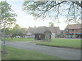
Photos of NR13 5BU


Area Information
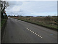
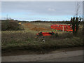
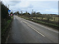
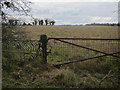
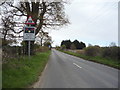
NR13 5BU represents a specific residential cluster located within Norfolk, covering an area of 7.1 hectares. This small postcode serves a population of 1,441 people, resulting in a living density of 270 people per square kilometre. The location functions as a compact community where residents enjoy close proximity to one another while maintaining a suburban feel. Living in this postcode means accessing a contained environment where daily life revolves around local streets and neighbourly interactions. The housing stock is almost entirely comprised of houses, reflecting a traditional residential character typical of this region of England. You will find that the area lacks major planning constraints such as protected woodlands or nature reserves, allowing for straightforward living without significant environmental restrictions. The population here indicates a settled community rather than a rapidly developing zone. Homes in NR13 5BU offer a quiet lifestyle situated in the Norfolk countryside, away from the high-density pressures of urban centres. This specific cluster provides a stable home for families and individuals seeking a slice of rural life with practical access to nearby towns. The area stands as a functional node within the wider NR13 postcode region, offering housing for those who prefer a smaller, managed community setting.
- Area Type
- Postcode
- Area Size
- 7.1 hectares
- Population
- 1441
- Population Density
- 270 people/km²
The property market in NR13 5BU is dominated by private homeownership rather than the private rental sector. Data confirms that 90% of homes in this postcode are owner-occupied, which fundamentally shapes the local housing dynamics. This statistic suggests a market where sellers often own their properties outright or have significant equity, rather than flipping houses quickly for profit. The accommodation type is exclusively houses, meaning you should expect detached, semi-detached, or terraced homes in every direction. You will not encounter flats or luxury high-rise apartments here, as no such accommodation types exist within the data for this area. This configuration appeals to families who value gardens and single-storey living spaces. The small size of the cluster, spanning only 7.1 hectares, limits the total number of properties available for purchase or sale. This scarcity reinforces the high ownership rate, as residents are unlikely to move frequently once established. Buying a home in NR13 5BU means entering a neighbourhood where the majority of neighbours have a permanent interest in the local character. The market does not include student accommodation or short-term rentals typical of university towns. Instead, it functions as a standard residential market driven by local demand and occasional regional movements. The high sustainability of the housing stock suggests that properties here are viewed as long-term assets.
House Prices in NR13 5BU
Showing 15 properties
| Address | Type | Beds | Baths | Last Sale Price | Last Sale Date | |
|---|---|---|---|---|---|---|
| Carmel House, 38 Plumstead Road, Thorpe End, NR13 5BU | Detached | 4 | 2 | £518,500 | Aug 2024 | |
| Shrubberies, 91 Plumstead Road, Thorpe End, NR13 5BU | Bungalow | - | - | £410,000 | May 2021 | |
| 48 Plumstead Road, Thorpe End, NR13 5BU | Detached | 4 | 2 | £485,000 | Jan 2019 | |
| Thorpe Lodge, 40 Plumstead Road, Thorpe End, NR13 5BU | Detached | 4 | 5 | £335,000 | Nov 2018 | |
| Bramcote, 42 Plumstead Road, Thorpe End, NR13 5BU | Detached | 6 | 4 | £600,000 | Nov 2017 | |
| St Margarets, 46 Plumstead Road, Thorpe End, NR13 5BU | Detached | 4 | 2 | £269,000 | Nov 2009 | |
| Longfield, 50 Plumstead Road, Thorpe End, NR13 5BU | Detached | 4 | 1 | £362,500 | Aug 2009 | |
| Marley House, 89 Plumstead Road, Thorpe End, NR13 5BU | Detached | 2 | - | £249,950 | Jan 2006 | |
| Dial House, 79 Plumstead Road, Thorpe End, NR13 5BU | Detached | - | - | £355,000 | Aug 2003 | |
| Little Gables, 83 Plumstead Road, Thorpe End, NR13 5BU | Detached | - | - | £119,000 | Apr 1997 |
Energy Efficiency in NR13 5BU
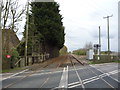
Living in NR13 5BU offers immediate access to essential retail and transport links within practical reach. You can find five notable retail outlets nearby, including Makro Norwich, Lidl Poppy, and Sainsburys Pound. These supermarkets provide you with food and household necessities without the need to travel far. For rail connections, there are five stations listed within easy distance, specifically Salhouse Railway Station, Brundall Gardens Railway Station, and Norwich Railway Station. This variety gives you flexibility in your commute options depending on your destination or working hours. Norwich Railway Station likely provides the most extensive connections to London and other major cities in the South East. If private travel is your preference, Norwich International Airport is just one station away from your daily routine, allowing for domestic and international flights. Nearby leisure options include Wroxham, which often serves as a popular destination for boating and lakeside activities. The proximity of these amenities means you can manage daily shopping, commuting, and leisure without relying on lengthy car journeys. The area functions as a quiet base from which the benefits of a larger town or city are easily accessible. Shopping trips become short errands, and weekend getaways start with a quick train ride.
Amenities
Schools
| Rank | School | Type | Entry gender | Ages |
|---|
Explore more schools in this area
Go to Schools tabDemographics
The community in NR13 5BU has a defined character driven by its age profile and ownership patterns. The median age stands at 47 years, which places the most common age range squarely within adults between 30 and 64 years. You are looking at a mature neighbourhood where the residents are likely established homeowners with significant financial stability. Home ownership reaches an impressive 90% level, indicating that the vast majority of households have bought their property outright or through a mortgage rather than renting. This high ownership rate creates a stable environment where neighbours often share long-term connections. The predominant ethnic group is White, reflecting the demographic makeup of much of East Anglia. Accommodation types are exclusively houses, meaning you will not find apartments or flats within this specific cluster. The population density of 270 people per square kilometre suggests a spread-out living arrangement rather than city-style block living. There is no mixed-use development pressing against the residential zones. This demographic stability means that schools near NR13 5BU likely cater to long-term families rather than transient students. The community feels settled because the residents have the means and the desire to put down roots. With such a high proportion of owners, the area maintains a consistent character over time without the volatility of a rental-dominated street.
Household Size
Accommodation Type
Tenure
Ethnic Group
Religion
Household Composition
Age
Household Deprivation
NS-SEC
Explore more demographic insights in this area
Go to Demographics tabPlanning
Planning Constraints
- Flood RiskPremium
- Ramsar Wetland SitesPremium
- Area of Outstanding Natural BeautyPremium
- Protected Nature ReservePremium
- Protected WoodlandPremium