Area Overview for NR13 4NE
Photos of NR13 4NE
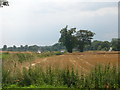
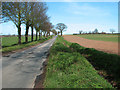
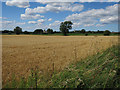
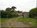
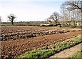
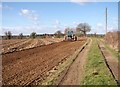
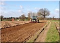
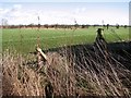
46 photos from this area
Area Information
Key information about the NR13 4NE including its size, population, and administrative classification.
- Area Type
- Postcode
- Area Size
- 30.1 hectares
- Population
- 1759
- Population Density
- 330 people/km²
House Prices in NR13 4NE
12
Properties
£529,000
Average Sold Price
£225,000
Lowest Price
£710,000
Highest Price
Showing 12 properties
| Address | Type | Beds | Baths | Last Sale Price | Last Sale Date | |
|---|---|---|---|---|---|---|
| Broadview, Hemblington Road, Strumpshaw, NR13 4NE | Detached | 4 | 3 | £710,000 | Jul 2022 | |
| The Old Forge, Hemblington Road, Strumpshaw, NR13 4NE | Detached | 4 | 2 | £530,000 | Jan 2020 | |
| Brandon House, Hemblington Road, Strumpshaw, NR13 4NE | house | - | - | £640,000 | May 2019 | |
| Newhaven, Hemblington Road, Strumpshaw, NR13 4NE | Detached | 6 | 3 | £540,000 | Apr 2015 | |
| The Willows, Hemblington Road, Strumpshaw, NR13 4NE | Cottage | 1 | - | £225,000 | Aug 2013 | |
| Old Forge Barn, Hemblington Road, Strumpshaw, NR13 4NE | Bungalow | 1 | - | - | - | |
| Ironwood, Hemblington Road, Strumpshaw, NR13 4NE | house | - | - | - | - | |
| Annexe At, Old Forge Barn, Hemblington Road, Strumpshaw, NR13 4NE | Detached | - | - | - | - | |
| Chapter Ii, Hemblington Road, Strumpshaw, NR13 4NE | Detached | - | - | - | - | |
| The Cedars, Hemblington Road, Strumpshaw, NR13 4NE | Detached | - | - | - | - |
Page 1 of 2
Energy Efficiency in NR13 4NE
Amenities
Schools
| Rank | School | Type | Entry gender | Ages |
|---|
Explore more schools in this area
Go to Schools tabDemographics
Household Size
Two person
most common
Accommodation Type
Houses
most common
Tenure
85
majority
Ethnic Group
White
most common
Religion
N/A
most common
Household Composition
N/A
most common
Age
47
median
Adults (30-64 years)
most common
Household Deprivation
N/A
with no deprivation
NS-SEC
42
in Lower managerial occupations
Explore more demographic insights in this area
Go to Demographics tabPlanning
Planning Constraints
- Flood RiskPremium
- Ramsar Wetland SitesPremium
- Area of Outstanding Natural BeautyPremium
- Protected Nature ReservePremium
- Protected WoodlandPremium