Area Overview for NR13 4NA
Photos of NR13 4NA
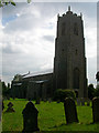
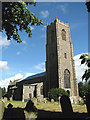
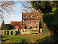

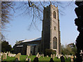
69 photos from this area
Area Information
Key information about the NR13 4NA including its size, population, and administrative classification.
- Area Type
- Postcode
- Area Size
- 15.4 hectares
- Population
- 1431
- Population Density
- 1527 people/km²
House Prices in NR13 4NA
36
Properties
£353,821
Average Sold Price
£48,600
Lowest Price
£1,300,000
Highest Price
Showing 36 properties
| Address | Type | Beds | Baths | Last Sale Price | Last Sale Date | |
|---|---|---|---|---|---|---|
| 17 Church Road, Blofield, NR13 4NA | Chalet | 4 | 2 | £400,000 | Oct 2025 | |
| Woods End, 9 Church Road, Blofield, NR13 4NA | Detached | 5 | 5 | £1,300,000 | Apr 2023 | |
| Oakdene, 3 Church Road, Blofield, NR13 4NA | Bungalow | 5 | 4 | £905,000 | Jun 2021 | |
| Enfin, 26 Church Road, Blofield, NR13 4NA | Semi-detached | 3 | - | £280,000 | Jan 2019 | |
| 24 Church Road, Blofield, NR13 4NA | Semi-detached | 3 | 1 | £240,000 | Dec 2018 | |
| Rose Bungalow, 15 Church Road, Blofield, NR13 4NA | Bungalow | 4 | 2 | £392,500 | Nov 2014 | |
| Thatched Cottage, 27 Church Road, Blofield, NR13 4NA | Cottage | 2 | 1 | £191,000 | Oct 2014 | |
| Beech House, 7 Church Road, Blofield, NR13 4NA | Detached | 5 | - | £639,995 | Jul 2014 | |
| Field View, 18 Church Road, Blofield, NR13 4NA | house | - | - | £200,000 | Apr 2012 | |
| 18 Church Road, Blofield, NR13 4NA | undefined | - | - | £200,000 | Apr 2012 |
Page 1 of 4
Energy Efficiency in NR13 4NA
Amenities
Schools
| Rank | School | Type | Entry gender | Ages |
|---|
Explore more schools in this area
Go to Schools tabDemographics
Household Size
Two person
most common
Accommodation Type
Houses
most common
Tenure
84
majority
Ethnic Group
White
most common
Religion
N/A
most common
Household Composition
N/A
most common
Age
47
median
Adults (30-64 years)
most common
Household Deprivation
N/A
with no deprivation
NS-SEC
40
in Lower managerial occupations
Explore more demographic insights in this area
Go to Demographics tabPlanning
Planning Constraints
- Flood RiskPremium
- Ramsar Wetland SitesPremium
- Area of Outstanding Natural BeautyPremium
- Protected Nature ReservePremium
- Protected WoodlandPremium