Area Overview for NR13 4AZ
Photos of NR13 4AZ
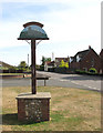
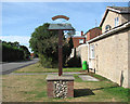
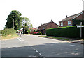
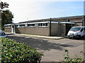
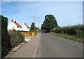
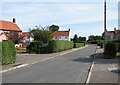
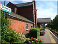

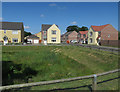
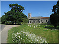
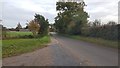
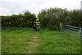
60 photos from this area
Area Information
Key information about the NR13 4AZ including its size, population, and administrative classification.
- Area Type
- Postcode
- Area Size
- 25.6 hectares
- Population
- 1410
- Population Density
- 1349 people/km²
House Prices in NR13 4AZ
37
Properties
£206,006
Average Sold Price
£57,995
Lowest Price
£290,000
Highest Price
Showing 37 properties
| Address | Type | Beds | Baths | Last Sale Price | Last Sale Date | |
|---|---|---|---|---|---|---|
| 32 Station Road, Lingwood, NR13 4AZ | Detached | 3 | 1 | £263,000 | Sep 2025 | |
| 23 Station Road, Lingwood, NR13 4AZ | Semi-detached | 3 | 2 | £290,000 | Jun 2025 | |
| 52 Station Road, Lingwood, NR13 4AZ | Bungalow | 3 | 1 | £260,000 | Apr 2024 | |
| 48 Station Road, Lingwood, NR13 4AZ | Bungalow | 3 | 1 | £280,000 | Aug 2023 | |
| 30 Station Road, Lingwood, NR13 4AZ | Bungalow | 2 | 2 | £275,000 | Jul 2022 | |
| 40 Station Road, Lingwood, NR13 4AZ | Bungalow | 2 | 1 | £247,500 | Oct 2017 | |
| 72 Station Road, Lingwood, NR13 4AZ | Detached | 5 | 2 | £287,950 | Dec 2015 | |
| 70 Station Road, Lingwood, NR13 4AZ | house | - | - | £282,000 | Nov 2015 | |
| 66 Station Road, Lingwood, NR13 4AZ | house | 3 | 1 | £156,000 | Nov 2015 | |
| 74 Station Road, Lingwood, NR13 4AZ | house | - | - | £214,950 | Feb 2015 |
Page 1 of 4
Energy Efficiency in NR13 4AZ
Amenities
Schools
| Rank | School | Type | Entry gender | Ages |
|---|
Explore more schools in this area
Go to Schools tabDemographics
Household Size
Two person
most common
Accommodation Type
Houses
most common
Tenure
83
majority
Ethnic Group
White
most common
Religion
N/A
most common
Household Composition
N/A
most common
Age
47
median
Adults (30-64 years)
most common
Household Deprivation
N/A
with no deprivation
NS-SEC
33
in Lower managerial occupations
Explore more demographic insights in this area
Go to Demographics tabPlanning
Planning Constraints
- Flood RiskPremium
- Ramsar Wetland SitesPremium
- Area of Outstanding Natural BeautyPremium
- Protected Nature ReservePremium
- Protected WoodlandPremium