Area Overview for NR13 3SH
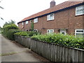
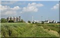
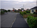
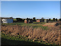
Photos of NR13 3SH
Area Information
Living in NR13 3SH defines a specific lifestyle within a small residential cluster located in England. This postcode covers an area of 1.2 km², which is relatively compact for those establishing a daily routine. You will find 1176 residents distributed across this space, resulting in a population density of 54 people per square kilometre. This low density ensures a quiet environment where noise levels remain generally low. The area functions primarily as a residential community rather than a commercial hub. You encounter very few high-rise buildings or large apartment complexes here. Instead, the landscape supports a more grounded way of living. The character of NR13 3SH is defined by its proximity to natural features and its position within the broader Norfolk region. Everyday life involves navigating a neighbourhood where the pace is moderated by the land surrounding the homes. When you visit NR13 3SH, you notice the distinct separation between private and public spaces. The layout encourages exploration of the immediate surroundings on foot or cycle. The area serves as a stable base for families who prefer a slower rhythm compared to larger urban centres. You find that the residential cluster offers a sense of containment, keeping essential services within a manageable radius. This makes NR13 3SH suitable for individuals prioritising space and quiet over immediate access to major city centres. The 1.2 km² footprint means your daily commute distances are often short, provided you are accessing nearby amenities or transport links.
- Area Type
- Postcode
- Area Size
- 1.2 km²
- Population
- 1176
- Population Density
- 54 people/km²
The property market in NR13 3SH is defined by a lack of rental turnover and a heavy focus on owner occupation. You will find that 78 per cent of properties are owned by their occupants. This figure leaves only a small fraction of the housing stock available for rental purposes. Consequently, most transactions in this area involve one homebuyer replacing another or a family moving into a property they intend to keep long-term. Houses constitute the primary accommodation type for residents of this postcode. You encounter very few flats, apartments, or purpose-built rental blocks. When you look at homes in NR13 3SH, you are typically viewing detached or semi-detached properties. These homes usually come with land and gardens, matching the larger lot sizes found in similar parts of England. The limited size of the area contributes to a constrained market for buyers. NR13 3SH covers only 1.2 km², so the total volume of available properties is low. This scarcity can drive up prices relative to other similar zones, or it may simply mean fewer options to choose from. If you are looking for a rental, your search yield will be significantly lower than in a town with higher rental stock. Most vendors here are selling because they have upgraded or need to move, not because they require immediate rental income. Buyers should expect to compete with other owner-occupiers rather than landlord investors. The market stability provided by high ownership rates means prices tend to reflect long-term value rather than short-term yield expectations.
House Prices in NR13 3SH
Showing 21 properties
| Address | Type | Beds | Baths | Last Sale Price | Last Sale Date | |
|---|---|---|---|---|---|---|
| Sunnyside, Station Road, Cantley, NR13 3SH | Semi-detached | 3 | 1 | £222,500 | Apr 2021 | |
| Garden Cottage, Station Road, Cantley, NR13 3SH | Bungalow | 3 | 2 | £353,000 | Jul 2018 | |
| The Dell, Station Road, Cantley, NR13 3SH | Bungalow | 3 | 1 | £173,000 | Dec 2017 | |
| Wayside, Station Road, Cantley, NR13 3SH | Cottage | 3 | 2 | £140,000 | May 2016 | |
| Four Gables, Station Road, Cantley, NR13 3SH | Detached | - | - | £221,000 | Jun 2004 | |
| Riverview, Station Road, Cantley, NR13 3SH | Detached | 3 | 2 | £194,000 | Apr 2003 | |
| Rosarium, Station Road, Cantley, NR13 3SH | Detached | 4 | - | £75,000 | Aug 1999 | |
| 2, Marsh Farm Cottages, Station Road, Cantley, NR13 3SH | Semi-detached | 3 | - | - | - | |
| Cantley Village Shop, Station Road, Cantley, NR13 3SH | shop | - | - | - | - | |
| Swiftway, 5 Station Road, Cantley, NR13 3SH | Detached | - | - | - | - |
Energy Efficiency in NR13 3SH
Amenities
Schools
Education provision for families living in NR13 3SH starts with Cantley Primary School. This institution serves as the nearest educational facility to your new home. Cantley Primary School holds an Ofsted rating of good, which provides assurance of its standards for pupils entering the system. Schools near NR13 3SH are primarily primary institutions. The data does not list secondary schools or specific academies within the immediate vicinity. This means families often send children to secondary education in a wider catchment area. You will find that the local school landscape relies on this one primary outlet for its youngest students. The good rating at Cantley Primary School is a key factor for those considering homes in NR13 3SH. It suggests that educational quality is recognised for children attending this specific establishment. Families with young children will appreciate the proximity to a school with a positive official evaluation. However, the absence of listed nearby secondary options indicates that you will look beyond local boundaries for broader education. The primary focus of the community surrounds the early years of schooling provided by Cantley Primary School. This setup is typical for rural postcodes where the nearest town or large village holds larger educational facilities. When evaluating NR13 3SH, you must consider the drive time to secondary schools outside the specific data list.
| Rank | School | Type | Entry gender | Ages |
|---|
Explore more schools in this area
Go to Schools tabDemographics
The community in NR13 3SH reflects a settled population with distinct demographic characteristics. You will find that 78 per cent of households consist of owners rather than tenants. This high rate of home ownership indicates stability within the neighbourhood of NR13 3SH. The median age of residents is 47 years, which suggests a mature demographic driving the local housing market. Most children and young adults fall within the 30 to 64 years age range, the most common group here. Accommodation in this area is predominantly composed of houses, meaning you find very few flats or high-density blocks. This structure supports a family-friendly environment where private gardens and larger plots are standard. The predominant ethnic group is White, reflecting the traditional makeup of the region. Living in NR13 3SH, you interact with a community that has remained fairly consistent over recent years. There are very few young families or empty-nesters moving through the neighbourhood frequently. The demographic profile often correlates with the property types available. Households in NR13 3SH tend to be established and long-term residents. This stability can create a strong sense of local history and neighbourly familiarity. You benefit from a community where people know each other and the area itself has witnessed decades of this specific age profile. The high ownership ratio means investment, rather than rental turnover, drives the social fabric of this postcode.
Household Size
Accommodation Type
Tenure
Ethnic Group
Religion
Household Composition
Age
Household Deprivation
NS-SEC
Explore more demographic insights in this area
Go to Demographics tabPlanning
Planning Constraints
- Flood RiskPremium
- Ramsar Wetland SitesPremium
- Area of Outstanding Natural BeautyPremium
- Protected Nature ReservePremium
- Protected WoodlandPremium