Area Overview for NR13 3RH
Photos of NR13 3RH
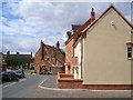
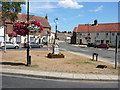
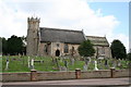

100 photos from this area
Area Information
Key information about the NR13 3RH including its size, population, and administrative classification.
- Area Type
- Postcode
- Area Size
- 1.1 hectares
- Population
- 1462
- Population Density
- 542 people/km²
House Prices in NR13 3RH
24
Properties
£179,634
Average Sold Price
£67,000
Lowest Price
£305,000
Highest Price
Showing 24 properties
| Address | Type | Beds | Baths | Last Sale Price | Last Sale Date | |
|---|---|---|---|---|---|---|
| Debbage House, 16 Fletcher Way, Acle, NR13 3RH | Detached | 3 | 1 | £305,000 | Jun 2025 | |
| 26 Fletcher Way, Acle, NR13 3RH | Semi-detached | 3 | 1 | £245,000 | Jul 2024 | |
| 44 Fletcher Way, Acle, NR13 3RH | Semi-detached | 3 | 2 | £277,000 | Jan 2024 | |
| 32 Fletcher Way, Acle, NR13 3RH | Semi-detached | 3 | 2 | £281,500 | Jul 2023 | |
| 46 Fletcher Way, Acle, NR13 3RH | Detached | 3 | 2 | £260,000 | Jul 2023 | |
| 20 Fletcher Way, Acle, NR13 3RH | Terraced | 2 | 1 | £170,000 | Mar 2019 | |
| 18 Fletcher Way, Acle, NR13 3RH | Terraced | 2 | 1 | £156,000 | Jan 2016 | |
| 22 Fletcher Way, Acle, NR13 3RH | house | 2 | 1 | £155,000 | Mar 2015 | |
| 14 Fletcher Way, Acle, NR13 3RH | Bungalow | 4 | 2 | £250,000 | Aug 2014 | |
| 38 Fletcher Way, Acle, NR13 3RH | Detached | 3 | 1 | £184,000 | Mar 2013 |
Page 1 of 3
Energy Efficiency in NR13 3RH
Amenities
Schools
| Rank | School | Type | Entry gender | Ages |
|---|
Explore more schools in this area
Go to Schools tabDemographics
Household Size
Two person
most common
Accommodation Type
Houses
most common
Tenure
75
majority
Ethnic Group
White
most common
Religion
N/A
most common
Household Composition
N/A
most common
Age
47
median
Adults (30-64 years)
most common
Household Deprivation
N/A
with no deprivation
NS-SEC
31
in Lower managerial occupations
Explore more demographic insights in this area
Go to Demographics tabPlanning
Planning Constraints
- Flood RiskPremium
- Ramsar Wetland SitesPremium
- Area of Outstanding Natural BeautyPremium
- Protected Nature ReservePremium
- Protected WoodlandPremium