Area Overview for NR13 3FY
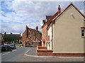
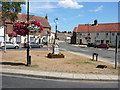
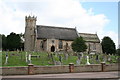
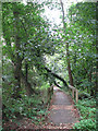
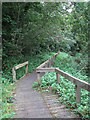
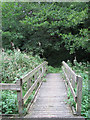
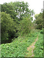
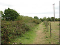
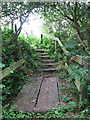
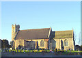
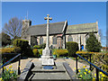
Photos of NR13 3FY

Area Information
Living in NR13 3FY places you within a specific residential cluster located in the countryside of rural Norfolk. This postcode covers a small population of 1,462 people, creating a quiet environment distinct from larger towns. The area sits within a specific postcode boundary that defines a tight-knit community rather than a sprawling neighbourhood. You will find yourself surrounded by England's countryside, where daily life revolves around close proximity to local villages and agricultural landscapes. The population density stands at 542 people per square kilometre, indicating a spread-out living arrangement with ample space. This setting offers a retreat from urban noise while maintaining practical access to nearby services. Residents here experience a lifestyle that balances isolation with accessibility, finding their daily needs met through a combination of local provisions and short travel distances to larger hubs. The area represents a stable, established part of the Norwich postcode district where history and modern convenience meet.
- Area Type
- Postcode
- Area Size
- Not available
- Population
- 1462
- Population Density
- 542 people/km²
Homes in NR13 3FY reflect a market dominated by private ownership rather than the rental sector. With a home ownership rate of 75%, the area functions primarily as an owner-occupied community where buyers look to establish long-term residences. The accommodation type listed as houses confirms that you will typically encounter detached or semi-detached properties suitable for families. This contrasts with urban areas where flats or apartments might dominate the skyline. The purchasing landscape here means that many properties have stayed within the same hands for generations or decades. If you are looking at NR13 3FY as a target, the market is likely driven by people seeking permanent立足 rather than short-term tenancy. The scarcity of rental stock suggests that investment potential lies in the ownership model. You should prepare for a market where sellers are generally motivated to keep their homes in the family legacy rather than quickly liquidating assets for capital gains.
House Prices in NR13 3FY
Showing 4 properties
| Address | Type | Beds | Baths | Last Sale Price | Last Sale Date | |
|---|---|---|---|---|---|---|
| Meadow View, 3 Cecils Meadow, Acle, NR13 3FY | Detached | 5 | 3 | - | - | |
| River House, 2 Cecils Meadow, Acle, NR13 3FY | Detached | 5 | 3 | - | - | |
| Mulberry House, 4 Cecils Meadow, Acle, NR13 3FY | Detached | 5 | 3 | - | - | |
| Woodland View, 1 Cecils Meadow, Acle, NR13 3FY | house | - | - | - | - |
Energy Efficiency in NR13 3FY
Residents of NR13 3FY enjoy convenient access to essential amenities within a practical drive from their homes. Retail needs are met by five nearby shops, including Mamp;S Acle BP, East of England Co-operative Co, and Spar stores that offer groceries and daily essentials. For those needing to travel further, five railway stations serve the region, with Acle Railway Station being the closest direct link to the national rail network. Lingwood Railway Station and Buckenham Railway Station provide additional transport options if you plan trips beyond the immediate vicinity. Reedham Ferry North offers a single ferry crossing opportunity, connecting residents to the opposite bank of the river for local leisure or specific transport needs. This combination of retail outlets and rail hubs means you do not need a car for every single errand, though you will likely need one for weekend outings or visiting family elsewhere. The convenience of these nearby venues supports a balanced lifestyle that blends countryside quiet with moderate access to services.
Amenities
Schools
Families considering NR13 3FY will find two primary schools within practical reach, offering state-educated options for younger children. Acle St Edmund Voluntary Controlled Primary School operates as a state primary institution, providing standard curriculum education to local intake. Nearby, Acle Church of England Primary Academy offers an academically and religiously oriented primary education experience. Both schools serve the village of Acle, which sits immediately adjacent to this specific postcode. While there are no secondary schools listed in the immediate vicinity of NR13 3FY, these primary institutions provide a head start for children starting their education journey. The mix of voluntary controlled and Church of England academies indicates a blend of secular and faith-based educational philosophies in the local area. Parents travelling to these schools will navigate short distances, likely walking or driving briefly from NR13 3FY to the Acre village entrance where these facilities are located.
| Rank | School | Type | Entry gender | Ages |
|---|
Explore more schools in this area
Go to Schools tabDemographics
The community in NR13 3FY is defined by a mature resident base with a median age of 47 years. Most families and individuals fall into the 30 to 64 years age range, suggesting a household structure built around established careers and raising children or supporting older family members. Home ownership is the norm, with 75% of households having secured their properties through purchase rather than renting. This high ownership rate reflects stability and long-term settlement within the area. The accommodation type is predominantly houses, meaning you will find detached or semi-detached dwellings rather than apartment blocks or flats. The predominant ethnic group is White, mirroring the broader demographic trends of the surrounding Norfolk countryside. These statistics paint a picture of a settled, family-oriented community where residents have deep roots. The high home ownership percentage typically correlates with lower turnover, fostering neighbourly familiarity and a consistent local presence year after year.
Household Size
Accommodation Type
Tenure
Ethnic Group
Religion
Household Composition
Age
Household Deprivation
NS-SEC
Explore more demographic insights in this area
Go to Demographics tabPlanning
Planning Constraints
- Flood RiskPremium
- Ramsar Wetland SitesPremium
- Area of Outstanding Natural BeautyPremium
- Protected Nature ReservePremium
- Protected WoodlandPremium