Area Overview for NR13 3EH
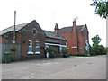
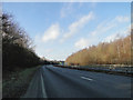
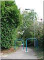
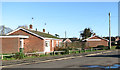
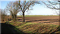
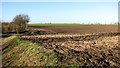
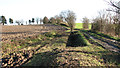
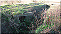
Photos of NR13 3EH
Area Information
Postcode area NR13 3EH defines a specific residential cluster covering just 2.5 hectares. This small footprint supports a population of 1,462 people, creating a tightly knit environment where neighbours are often well acquainted. The density sits at 542 people per square kilometre, which fosters a quiet, village-like atmosphere rather than a sprawling suburban feel. Living in NR13 3EH means you are part of a contained community where local matters remain central to daily life. The area lacks the anonymity of larger towns, yet it offers the space and peace many families seek. You will find homes arranged in close proximity, reinforcing a strong sense of locality. This postcode acts as a distinct residential zone, separate from the wider surrounding development. Your immediate surroundings are defined by this compactness, ensuring that no one is far from a primary service or another resident. The area remains a focused cluster, ideal for those who prefer a settled, predictable neighbourhood over open expanse.
- Area Type
- Postcode
- Area Size
- 2.5 hectares
- Population
- 1462
- Population Density
- 542 people/km²
Homes in NR13 3EH are characterised by high tenure stability. With 75% of residents owning their properties, the local housing stock is not driven by a transient rental market. This statistic reveals an area where occupants stay put, fostering a consistent community vibe. The accommodation type is limited to houses, meaning you will not find flats or apartments within this specific postcode boundary. This homogeneity creates a uniform residential streetscape typical of established villages or small settlements. Buyers looking at NR13 3EH should expect to purchase a standalone dwelling rather than a unit in a multi-unit building. The small total area of 2.5 hectares limits the volume of current properties available within the immediate bounds. Consequently, the local market reflects a scarcity of stock combined with high retention rates. If you are considering moving here, you face a competitive environment where owners rarely depart quickly. The market dynamics favour long-term security over rapid turnover, aligning well with buyers seeking permanence.
House Prices in NR13 3EH
Showing 51 properties
| Address | Type | Beds | Baths | Last Sale Price | Last Sale Date | |
|---|---|---|---|---|---|---|
| 36 Nursery Close, Acle, NR13 3EH | Semi-detached | 3 | 1 | £260,000 | Jun 2025 | |
| 34 Nursery Close, Acle, NR13 3EH | house | 3 | 1 | £250,000 | Dec 2024 | |
| 30 Nursery Close, Acle, NR13 3EH | Detached | 3 | 1 | £262,500 | Aug 2023 | |
| 56 Nursery Close, Acle, NR13 3EH | Detached | 3 | 1 | £300,000 | Jul 2023 | |
| 16 Nursery Close, Acle, NR13 3EH | Bungalow | - | - | £350,000 | Dec 2022 | |
| 48 Nursery Close, Acle, NR13 3EH | house | - | - | £260,000 | May 2022 | |
| 13 Nursery Close, Acle, NR13 3EH | Semi-detached | 3 | 1 | £297,000 | Apr 2022 | |
| 28 Nursery Close, Acle, NR13 3EH | Detached | 3 | 1 | £249,000 | Dec 2021 | |
| 12 Nursery Close, Acle, NR13 3EH | house | - | - | £340,000 | Jul 2021 | |
| 1 Nursery Close, Acle, NR13 3EH | Bungalow | 3 | 1 | £285,000 | Jan 2020 |
Energy Efficiency in NR13 3EH
Amenities
Schools
Families considering NR13 3EH have two primary options for primary education within easy reach. Acle St Edmund Voluntary Controlled Primary School serves as a key institution for younger children in the vicinity. Additionally, Acle Church of England Primary Academy offers another local route for primary schooling. Both schools are located nearby, eliminating the need for long commutes to larger towns. The presence of two primary options indicates a dedicated network for early childhood education in the local area. No secondary schools are listed in the immediate data for this specific cluster, suggesting those pupils likely travel beyond the immediate neighbourhood for further education. The mix of school types is restricted to voluntary controlled and church of England academies, reflecting the village's traditional educational history. Parents can choose between these two local paths for their children without crossing significant boundaries. Schools near NR13 3EH are concentrated in the Acle vicinity, ensuring accessibility for all families residing in this postcode.
| Rank | School | Type | Entry gender | Ages |
|---|
Explore more schools in this area
Go to Schools tabDemographics
The community within NR13 3EH is heavily weighted towards established adults. The median age stands at 47 years, indicating a population dominated by those aged between 30 and 64. This age profile suggests a stable environment where many residents have long-term roots rather than transient tenants. House ownership is highly prevalent at 75%, confirming that the majority of households are owner-occupied. This high level of tenure implies residents are likely invested in improving their properties and maintaining the local character. Accommodation types are almost exclusively houses, providing a consistent architectural style across the cluster. The predominant ethnic group is White, reflecting the traditional demographic makeup of this approach to the east coast. There is no significant deprivation data provided to suggest economic hardship, though the specific figures are not included in the current records. The social fabric appears stable, built around long-term ownership and a mature age group. You can expect a quiet society where families and retirees coexist within the same housing framework.
Household Size
Accommodation Type
Tenure
Ethnic Group
Religion
Household Composition
Age
Household Deprivation
NS-SEC
Explore more demographic insights in this area
Go to Demographics tabPlanning
Planning Constraints
- Flood RiskPremium
- Ramsar Wetland SitesPremium
- Area of Outstanding Natural BeautyPremium
- Protected Nature ReservePremium
- Protected WoodlandPremium