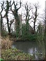
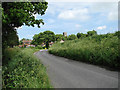
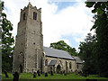
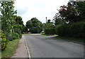
Area Overview for NR13 3AJ
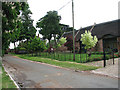
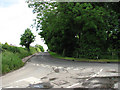
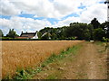
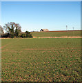
Photos of NR13 3AJ
Area Information
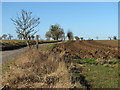
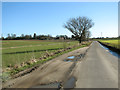
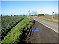
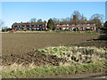
NR13 3AJ is a compact residential postcode covering 2.8 hectares near Acle, Norfolk. It holds a population of 1,631 residents, creating a close-knit community with a density of 49 people per square kilometre. This specific cluster offers a quiet countryside setting rather than an urban environment. The area sits within a small residential zone where daily life revolves around local connections and the surrounding Norfolk landscape. Living in NR13 3AJ means accepting a small footprint with the benefits of low population density. You find yourself in a settled neighbourhood where the pace of life moves steadily. The location provides a direct link to the wider Acle area while maintaining a distinct sense of place. This postcode represents a specific slice of rural Norfolk living where families and long-term residents have established their homes. The small size ensures that the community remains intimate, yet it provides easy access to the amenities found a short distance away in nearby towns.
- Area Type
- Postcode
- Area Size
- 2.8 hectares
- Population
- 1631
- Population Density
- 49 people/km²
The housing market in NR13 3AJ is defined by its nature as an owner-occupied area rather than a rental hub. Eighty-two per cent of homes are owned by their occupants, creating a stable market environment. Houses dominate the accommodation type, confirming that the stock consists of detached or semi-detected family homes rather than flats or high-rises. This profile appeals to buyers seeking a traditional country property with space and garden access. The fact that such a high percentage of residents own their homes indicates strong local attachment to the locality. If you are looking at homes in NR13 3AJ, expect to find properties suited to family life with established gardens and driveways. The market is not driven by speculative investment or student rentals but by genuine householders staying in places for the long term. This stability often leads to higher price transparency compared to fluctuating rental markets. You will find that the transaction history here reflects long-term residents selling to other families looking for similar surroundings.
House Prices in NR13 3AJ
Showing 27 properties
| Address | Type | Beds | Baths | Last Sale Price | Last Sale Date | |
|---|---|---|---|---|---|---|
| 2, Victoria Cottages, The Street, Halvergate, NR13 3AJ | house | - | - | £180,000 | May 2024 | |
| Gretna Cottage, The Street, Halvergate, NR13 3AJ | Bungalow | 2 | - | £245,000 | Apr 2021 | |
| Robin's Nest, The Street, Halvergate, NR13 3AJ | Bungalow | 3 | - | £256,000 | Nov 2020 | |
| The Manor House, The Street, Halvergate, NR13 3AJ | house | - | - | £605,000 | Jun 2020 | |
| 1, Hall Cottages, The Street, Halvergate, NR13 3AJ | Terraced | 3 | 2 | £250,000 | Feb 2020 | |
| 2, Hall Cottages, The Street, Halvergate, NR13 3AJ | Terraced | 2 | 1 | £190,000 | Mar 2019 | |
| Bay Tree House, The Street, Halvergate, NR13 3AJ | house | - | - | £272,500 | Dec 2017 | |
| Horseshoe Barn, The Street, Halvergate, NR13 3AJ | Semi-detached | 4 | 3 | £408,000 | Jul 2017 | |
| Chestnut Meadow Barn, The Street, Halvergate, NR13 3AJ | Semi-detached | 4 | - | £395,000 | Dec 2016 | |
| The Bungalow, The Street, Halvergate, NR13 3AJ | Bungalow | 2 | 1 | £173,000 | Dec 2015 |
Energy Efficiency in NR13 3AJ
Daily life in NR13 3AJ relies on a short commute to nearby towns for extensive amenities. Retail options include the M&S Acle BP, allowing you to purchase groceries and general goods without travelling far. The East of England Co-operative Co and a Spar outlet provide further convenience for everyday shopping needs. You can grab essentials locally before completing larger purchases in the larger villages. Rail access is available through five nearby stations including Acle Railway Station, Berney Arms Railway Station, and Reedham Railway Station. These stations offer connections to Norwich and King's Lynn, though you will need to combine trains with road travel to reach the final destination in many cases. A Reedham Ferry North service provides one ferry crossing option within practical reach, adding variety to your journey planning. While NR13 3AJ itself lacks major leisure facilities, the surrounding area supports a functional lifestyle. You can run errands, manage paperwork, and access financial services at the nearby shops. The focus remains on rural living with town amenities within a manageable distance.
Amenities
Schools
| Rank | School | Type | Entry gender | Ages |
|---|
Explore more schools in this area
Go to Schools tabDemographics
The community in NR13 3AJ reflects a settled population with a median age of 47 years. Adults between 30 and 64 years old form the most common age range, indicating a stage of life focused on family stability and established careers. Home ownership stands at 82 per cent, which shows that the majority of residents live in properties they own outright or have a significant mortgage. This high level of ownership suggests a population with deep roots in the area rather than transient tenants. Houses are the primary form of accommodation, fitting the architectural style typical of the region. The predominant ethnic group is White, aligning with the broader demographic trends of rural Norfolk. You are looking at a demographic profile typical of small East Anglian villages. Most families here will have children or be raising grandchildren, contributing to a stable local environment. The age structure supports a calm neighbourhood atmosphere where neighbours know one another by name.
Household Size
Accommodation Type
Tenure
Ethnic Group
Religion
Household Composition
Age
Household Deprivation
NS-SEC
Explore more demographic insights in this area
Go to Demographics tabPlanning
Planning Constraints
- Flood RiskPremium
- Ramsar Wetland SitesPremium
- Area of Outstanding Natural BeautyPremium
- Protected Nature ReservePremium
- Protected WoodlandPremium