Area Overview for NR12 9QJ
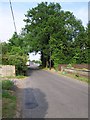
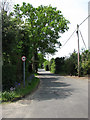
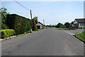
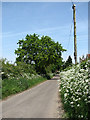
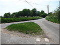
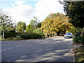
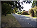
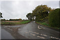
Photos of NR12 9QJ

Area Information
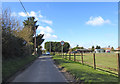
NR12 9QJ represents a specific residential cluster covering 14.7 hectares. This postcode area forms a small, defined community within wider Norfolk. The population totals 1,703 residents, creating a relatively quiet neighbourhood compared to larger urban centres. You will find a settled population where daily life moves at a measured pace. The area feels intimate yet connected to the surrounding transport network. Living in NR12 9QJ offers a clear separation between rural tranquillity and access to town facilities. The density of 214 people per square kilometre suggests a spacious environment without the pressure of high-density living. This postcode serves as a gateway for those seeking homes in a low-density setting. The layout supports a typical suburban or semi-rural lifestyle where streets are well-spaced. You do not find the chaos of a city centre here. Instead, the layout prioritises residential space and local convenience. This area functions as a stable residential zone. The small footprint of 14.7 hectares means you can walk to many local points of interest. It is a distinct pocket of countryside living close to key infrastructure.
- Area Type
- Postcode
- Area Size
- 14.7 hectares
- Population
- 1703
- Population Density
- 214 people/km²
The property market in NR12 9QJ is defined by a strong owner-occupier base. You will find that 77% of households own their homes. This percentage leaves a lower proportion of rented accommodation. The market operates primarily for existing owners rather than transient tenants. Houses dominate the housing stock in this specific postcode. You will see very few flats or purpose-built apartment complexes. The area is built on traditional residential planning rather than modern urban housing. This structure means supply for sale is often limited to owner transitions or estate sales. Buyers looking for new-build developments may struggle to find options here. The high ownership rate suggests houses in this area hold value for long-term residents. You will find character homes rather than mass-produced housing units. The 14.7 hectare footprint limits the volume of available properties. When considering homes in NR12 9QJ, you are entering a localised market. Demand often competes with local owners rather than high-volume agency sales. The lack of rental pressure means properties stay in family hands longer. This environment suits buyers seeking permanence. The market reflects the demographic reality of an area dominated by established families. Price volatility is generally lower than in high-turnover rental zones.
House Prices in NR12 9QJ
Showing 4 properties
| Address | Type | Beds | Baths | Last Sale Price | Last Sale Date | |
|---|---|---|---|---|---|---|
| Greenfields, Rectory Road, Sutton, NR12 9QJ | Bungalow | 3 | 1 | £440,000 | Dec 2022 | |
| The Haven, Rectory Road, Sutton, NR12 9QJ | Bungalow | 2 | - | £82,000 | Nov 2001 | |
| High Cottage, Rectory Road, Sutton, NR12 9QJ | Detached | - | - | £84,000 | Apr 1998 | |
| Home Barn, Rectory Road, Sutton, NR12 9QJ | house | - | - | - | - |
Energy Efficiency in NR12 9QJ
Amenities within practical reach of NR12 9QJ form the backbone of daily convenience. You have access to four key retail venues nearby. Morrisons Daily, Tesco Norwich, and the East of England Co-operative Co offer essential shopping needs. These three supermarkets and one daily store ensure you can buy groceries without driving far. You will find one railway station in the vicinity, specifically Worstead Railway Station. This transport hub links the residential area to the wider rail network. The combination of local food retailers and a train link supports a balanced lifestyle. You do not need to travel long distances for weekly shopping or commuting. The neighbourhood allows you to manage most errands locally before using the rail link for longer trips. These amenities create a self-sufficient loop for household management. Dining options are limited to the basics provided by these supermarkets. You will find practical facilities rather than luxury entertainment venues. The presence of Co-op and Tesco indicates a standard high-street availability. This setup works well for families prioritising utility over nightlife. The area remains quiet during evenings, respecting the residential nature of the postcode. Daily life here relies on the efficiency of these four retail points and one rail station.
Amenities
Schools
Families living in NR12 9QJ are served by two nearby primary institutions. Sutton CofE VC Infant School operates as a primary school catering to younger children. Sutton Church of England Infant Academy functions as an academy with a similar target age group. Both schools focus on the early years of education. You will find these institutions provide foundational learning before secondary education. The mix includes a Voluntary Controlled establishment and an Academy. This diversity allows families to choose between different governance models for their children. Both schools are located close enough to be practical for daily commuting. There are no secondary schools listed in the immediate data for this postcode. You must plan transportation for older children based on the nearest secondary provision outside this specific list. The presence of infants schools indicates a catchment area for younger dependents. Families will likely need to look beyond NR12 9QJ for secondary options. The character of these schools suggests a faith-based or church-linked educational tradition. The proximity to two infant academies means you have local options for early education. Transport links to wider school networks depend on standard road access.
| Rank | School | Type | Entry gender | Ages |
|---|
Explore more schools in this area
Go to Schools tabDemographics
The community in NR12 9QJ reflects a mature and stable resident base. The median age stands at 47 years, indicating an older demographic profile. Most residents fall within the 30-64 years age range. This age distribution shapes the local culture and demand for services. Home ownership is highly prevalent at 77%, revealing a neighbourhood where families have long-term roots. The majority of people here own their properties outright or with a mortgage. The predominant residence type consists of houses rather than apartments or flats. This housing stock supports family life and established households. The community is largely White, reflecting a traditionally settled demographic pattern. You will encounter a neighbourly environment where many residents have lived in the area for decades. The high ownership rate suggests financial stability among residents. There is little transient population within this postcode. The data indicates a cohesive group of people who know each other. This stability often translates to lower vacancy rates and consistent community engagement. The age profile aligns with families in later stages of life or empty nesters. The area does not skew towards young students or temporary workers. This demographic consistency provides a predictable social environment for anyone considering moving here.
Household Size
Accommodation Type
Tenure
Ethnic Group
Religion
Household Composition
Age
Household Deprivation
NS-SEC
Explore more demographic insights in this area
Go to Demographics tabPlanning
Planning Constraints
- Flood RiskPremium
- Ramsar Wetland SitesPremium
- Area of Outstanding Natural BeautyPremium
- Protected Nature ReservePremium
- Protected WoodlandPremium