Area Overview for NR12 9HB
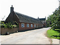
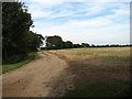
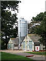
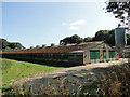
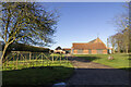
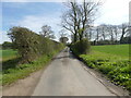
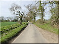
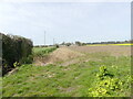
Photos of NR12 9HB
Area Information
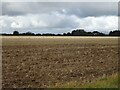
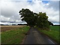
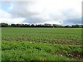
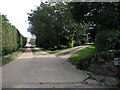
Living in NR12 9HB offers a distinct experience characterised by a sparse residential cluster set within a 40.3 hectare footprint. This specific postcode covers a neighbourhood where the population stands at 2,020 people, resulting in a remarkably low density of 44 individuals per square kilometre. The setting feels quiet and uncluttered, placing residents in a discernible demographic shift away from high-density urban living. You are in an area where space between homes is significant, creating a lifestyle that prioritises tranquillity over proximity to immediate crowds. Daily life revolves around this specific small cluster, yet you remain connected to the broader Norfolk landscape. The 2,020 residents form the entire community within this boundary, fostering a sense of familiarity despite the low street density. This area does not offer the buzz of a city centre or a town core within its immediate limits. Instead, it provides a backdrop of openness where the quality of life is defined by space and pace rather than volume of interaction. For those considering homes in NR12 9HB, the environment is defined by this specific demographic concentration. The area supports a total population of 2,020 across its 40.3 hectares. You can expect a community that does not overwhelm. This postcode acts as a small, defined chapter in the wider North Norfolk property market. It is a place where the rhythm of life is set by its own small numbers, creating a specific type of secluded yet accessible living situation for buyers who have done their research on this exact cluster.
- Area Type
- Postcode
- Area Size
- 40.3 hectares
- Population
- 2020
- Population Density
- 44 people/km²
The property market in NR12 9HB is defined by a strong preference for ownership and traditional housing types. Data confirms that 74% of the housing stock is owner-occupied, meaning the vast majority of households purchase homes rather than rent. This high rate of ownership creates a market where price fluctuations often reflect long-term investment decisions rather than immediate tenancy turnover. If you are looking to buy, you are entering a segment where sellers are likely established owners who have stayed in the area for years. Accommodation types in this postcode are predominantly houses. This aligns perfectly with the demographic profile of adults aged 30 to 64 years who prioritize family space or garden areas found in detached or semi-detached homes. The 40.3 hectares available to support 2,020 residents ensures that houses are not packed tightly together. You can expect the homes in NR12 9HB to sit back from the road, consistent with the low density figure of 44 people per square kilometre. This is not a typical student rental market or a transient housing zone. The 74% ownership figure is the critical metric for buyers here. It signals a stable, less volatile market for those seeking a permanent base. Since the primary accommodation is houses, floors and amenities are typically suited for family living rather than partitioned studio flats. The area accommodates the needs of the 30-to-64-year-old demographic, who often seek the larger footprints of a house over an apartment. When evaluating homes in this postcode, the high ownership rate suggests you will compete with other serious buyers, but also find a community that values the stability of owning a property in this specific rural cluster.
House Prices in NR12 9HB
Showing 4 properties
| Address | Type | Beds | Baths | Last Sale Price | Last Sale Date | |
|---|---|---|---|---|---|---|
| Brunstead Grange, Brunstead Grange Farm, Ingham Road, Brumstead, NR12 9HB | Farm | 6 | - | - | - | |
| 2 Grange Bungalows, Ingham Road, Brumstead, NR12 9HB | Detached | - | - | - | - | |
| The Bungalow, Brunstead Grange Farm, Ingham Road, Brumstead, NR12 9HB | Bungalow | - | - | - | - | |
| Grange Bungalow, Ingham Road, Brumstead, NR12 9HB | Detached | - | - | - | - |
Energy Efficiency in NR12 9HB
The lifestyle in NR12 9HB is defined by practical convenience and regional accessibility rather than immediate, high-density retail. Residents rely on a specific set of amenities located within practical reach, necessitating short drives or walks to the nearest towns. For essential shopping, there are five retail venues within easy access, including Tesco Norwich, Morrisons Daily, and Lidl North. These supermarkets provide full-range grocery shopping, ensuring you do not need to survive on a very limited range of fresh produce. Transport links are managed through two key railway stations: Worstead Railway Station and North Walsham Railway Station. These stations are the primary points for rail travel from this postcode area. While not located inside the 40.3 hectares, they offer the necessary infrastructure for getting out for leisure, work, or family visits without a car. This reliance on external amenities means your daily lifestyle involves a structured routine where planned trips to shops or stations are part of the week. There are no large parks, cinemas, or leisure centres listed within the immediate practical reach of this specific cluster. Your leisure activities will depend on the surrounding towns served by the local stations. The character of daily life here is one of self-sufficiency, supported by the nearby supermarkets and the promise of rail travel. When you imagine living in NR12 9HB, you are committing to a routine built around these five key retail outlets and the two railway hubs. It is a lifestyle that values access to major chains nearby over having everything immediately on your doorstep.
Amenities
Schools
Families considering NR12 9HB have several educational institutions within reach, though the options include a mix of local and special needs provision. East Ruston Infant School and Nursery operates as an academy and holds a good Ofsted rating. This is a primary-level institution capable of serving younger children in the area. Nearby, East Ruston Area Infant School also serves the primary education requirements for younger pupils. For those seeking specialized educational pathways, two notable options exist with a top-tier rating. All Saints School holds a good Ofsted rating and is of the special type. Similarly, The Stables Independent School is also graded good and is classified as a special school. While East Ruston Infant School is a standard academy, the presence of all-saints and the stables indicates a commitment to specialized learning outcomes in the vicinity. You will need to consider transport arrangements, as these schools are nearest to the postcode but may not be located inside it. The Upper Key Stage education is not explicitly detailed in the immediate list, but the primary options provide a strong foundation. If you are planning your route for schools near NR12 9HB, the good rating of All Saints and The Stables is a significant advantage for those seeking specialized curricula. For standard primary education, East Ruston Area Infant School offers a government-accredited setting. This mix means you have access to both maintained priorities and private/independent specialized choices close to the 40.3 hectare residential zone.
| Rank | School | Type | Entry gender | Ages |
|---|
Explore more schools in this area
Go to Schools tabDemographics
The community in NR12 9HB has a clear demographic profile defined by age and stability. The median age here is 47, which positions this area as a stronghold for adults aged between 30 and 64 years. This age range forms the bulk of the population, suggesting a neighbourhood where families have established roots and residents are likely working or retired well into their mature years. You will find that the social fabric is dominated by these middle-aged adults, creating a stable environment that tends to resist rapid demographic turnover. Home ownership is exceptionally high in this zone, with 74% of properties owned outright or with a mortgage. This figure indicates a settled population that has chosen to invest in this specific postcode. Because 74% of residents own their homes, the area functions largely as an owner-occupied market rather than a rental hub. The predominant accommodation type consists of houses, reinforcing the status of this location as a family-oriented residential zone. The ethnic makeup is primarily White, reflecting the traditional character of many coastal and rural areas in Norfolk. With a population density of 44 people per square kilometre, the sense of community is intimate. This low density aids the high home ownership rate, as residents are more likely to settle for the long term. The 47 median age is a key indicator of this stability. When you look at homes in NR12 9HB, you are entering a territory where the majority of occupants are part of this established, longer-term demographic cohort.
Household Size
Accommodation Type
Tenure
Ethnic Group
Religion
Household Composition
Age
Household Deprivation
NS-SEC
Explore more demographic insights in this area
Go to Demographics tabPlanning
Planning Constraints
- Flood RiskPremium
- Ramsar Wetland SitesPremium
- Area of Outstanding Natural BeautyPremium
- Protected Nature ReservePremium
- Protected WoodlandPremium